MGIST Graduates Team With Community Partner IntraHealth International To Develop Critical Spatial Decision Support Tools
Three recent graduates of the MGIST program received special invitations from community partner IntraHealth International, based in Chapel Hill, NC, to present their geospatial applications to agency representatives. Jared Berger, Ricky Sabhikhi and Justin Bridwell worked closely with members of the IntraHealth team during Spring 2015 semester on two different projects as part of their Master’s work and capstone course (GIS 590). The invited presentations and open discussion were part of the agencies May “Tech Tuesday” meeting, held May 5, 2015, and included several representatives joining remotely from the agency’s Washington, DC office. The range of applications developed by the MGIST students provided IntraHealth a comparison of geospatial methods and tools to evaluate as they move forward to implement critical spatial decision support systems into their workflow.
IntraHealth’s Mission is to empower health workers to better serve communities in need around the world. They foster local solutions to health care challenges by improving health worker performance, strengthening health systems, harnessing technology, and leveraging partnerships. Partnering with NC State’s MGIST students has enabled them to add geospatial tools and analyses to the important work they are doing globally.
Charlynne Smith, PhD Candidate and Lead Faculty for the capstone course, joined the session and provided an overview of the Center, GIS educational programs at NC State, and further explained the course educational framework. Learn more about the MGIST Capstone Course at go.ncsu.edu/gispartner.
Student Project Information:
IntraHealth leads the communication aspect of Safeguarding Health in Conflict coalition. The Coalition promotes respect for international humanitarian and human rights laws for the safety of health facilities, health workers, ambulances and patients during conflict.
- Justin Bridwell worked on the Safeguarding Health project with the goal to structure a database of documented attacks against health workers or systems, then develop an interactive map outlining the location of attacks in an open source environment. Justin established the infrastructure for employees to view locations, add new data and edit existing information as media report incidents of attacks. The ultimate research goals is to visualize the kind, distribution and frequency of published attacks on health workers over a specified time period.
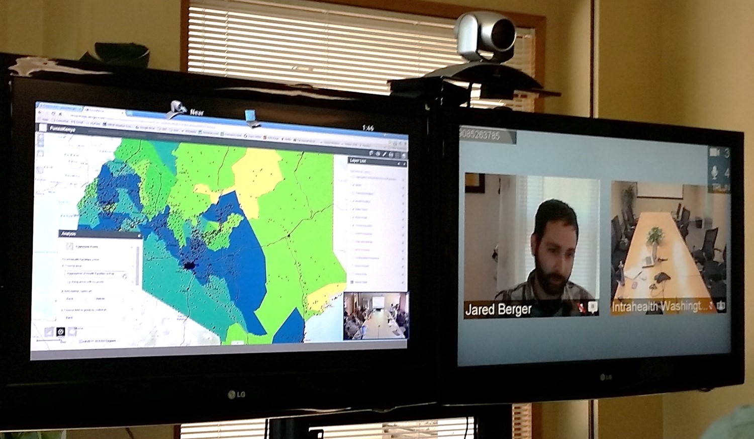
FUNZOKenya is supporting the Government of Kenya’s efforts to make dramatic changes to its health worker education and training systems. “Funzo” means training in Kiswahili, and the project aims to work across the public and private sectors to strengthen pre-service education of health workers, improve access to training for existing health workers, and link professional licensure to ongoing professional development. These linkages are critical to ensuring quality health care.
- Jared Berger and Ricky Sabhikhi worked on the FUNZOKenya project each developing a separate web mapping application pointing to the same enterprise geodatabase developed as a team. The first application, using ArcGIS Online WebApp Builder, showcased the newest HTML /JavaScript app format that will run on any device. The second application used ArcGIS Viewer for Flex to showcase tried and tested widgets to allow IntraHealth staff to easily query, compare and view data. Both applications permit visual display, query and analysis of health worker data related to training, licensure and professional development in Kenya.


