Professional Master’s Student Helps with NC Disaster Recovery
Editor’s note: The following is a guest post by James McCarter, a teaching associate professor at the Center for Geospatial Analytics.
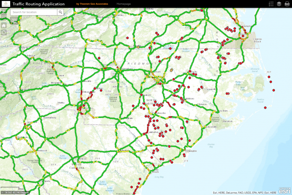
Because of Hurricane Matthew, North Carolina was hit with one of the worst utility outage events in their history. In a storm meeting at a local utility, Master of Geospatial Information & Technology (MGIST) student William Reckling heard a need for a real-time road closure and traffic routing application to help crews navigate the storm’s aftermath.
Using what he recently learned in GIS 550 (Geospatial Data Structures and Web Services), he was able to stand up a traffic routing web app in about an hour with a paid Esri routing and traffic service. Within seven hours of launching, Reckling’s online app was accessed over 175 times. Hundreds more field workers are expected to use it throughout the week. Anyone can use the app on any device.
“Every class has had a practical aspect,” Reckling says of his experience so far in the MGIST program, which helps GIS professionals from a range of fields apply new skills to solving real-world problems. “The whole program’s been amazing.”
- Categories:


