“I Use Geospatial Analytics To…” Part II
In Fall 2019, the Center for Geospatial Analytics welcomed its second cohort of Geospatial Analytics Ph.D. students. Geospatial analytics is a branch of data science that spans a myriad of disciplines, and our students’ research interests are just as varied!
Curious about what our newest students will work on for their dissertations? Check out how they will use geospatial analytics for research, as they join our first cohort of students on their academic journeys.
“I use geospatial analytics to…”
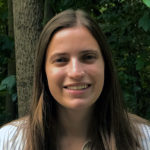
“…forecast the spatial redistribution of people and infrastructure following sea level rise.”
Elyssa Collins
Advisor: Ross Meentemeyer
“…examine surface water connectivity and how it may change with forecasted changes in climate and land use.”
Mollie Gaines
Advisor: Mirela Tulbure
Our newest students are funded by a mix of program support and external grants from NASA, NSF and more. And all of our Geospatial Analytics Ph.D. students are fully funded for four years.
“I use geospatial analytics to…”

“…study the environmental impacts of global warming, with aims to understand human-nature interactions and global climate change.”
Xiaojie Gao
Advisor: Josh Gray
“…integrate geospatial technologies with ecological modeling to understand forest disturbance and climate adaptation.”
Kate Jones
Advisor: Rob Scheller
The Faculty Fellows advising our students have academic homes in the Departments of Civil, Construction and Environmental Engineering; Parks, Recreation and Tourism Management; Forestry and Environmental Resources; Computer Science; Marine, Earth and Atmospheric Sciences; and more! In total, the Center for Geospatial Analytics’ Faculty Fellows program unites experts from a dozen academic departments and five colleges across NC State.
“I use geospatial analytics to…”

“…understand forest productivity, with the goal of applying this to ecological forecasts and species conservation.”
Ian McGregor
Advisor: Josh Gray
“…investigate how the distribution and ecosystem function of forests and vegetation protect and sustain water resources for people and biodiversity now and into the future.”
Katie McQuillan
Advisor: Katie Martin
Although they have varied research interests, all new Geospatial Analytics Ph.D. students share a core set of six courses that unite them in their academic journey, beginning with GIS 710: Geospatial Analytics for Grand Challenges.
“I use geospatial analytics to…”
“…apply high-resolution satellite imagery to evaluate small water bodies close to agricultural lands.”
Vinicius Perin
Advisor: Mirela Tulbure
“…study snow bands and winter storm dynamics in the Northeast United States.”
Laura Tomkins
Advisor: Sandra Yuter
As they move through their program, Geospatial Analytics Ph.D. students also engage with experts in industry, government and other organizations through an off-campus externship, enhancing their experiential learning and expanding their professional network.
“I use geospatial analytics to…”
“…examine human-driven changes in landscapes and forecast ecological change in a growing world.”
Thom Worm
Advisor: Ross Meentemeyer

“…investigate how best to make energy and transportation systems more equitable, sustainable, efficient and resilient.”
Alexander Yoshizumi
Advisor: Jelena Vukomanovic
Interested in joining this talented group? The application deadline for our Ph.D. program in Geospatial Analytics is February 1! Contact our Graduate Services Coordinator, Rachel Kasten, with any questions or to connect with a potential advisor.
- Categories: