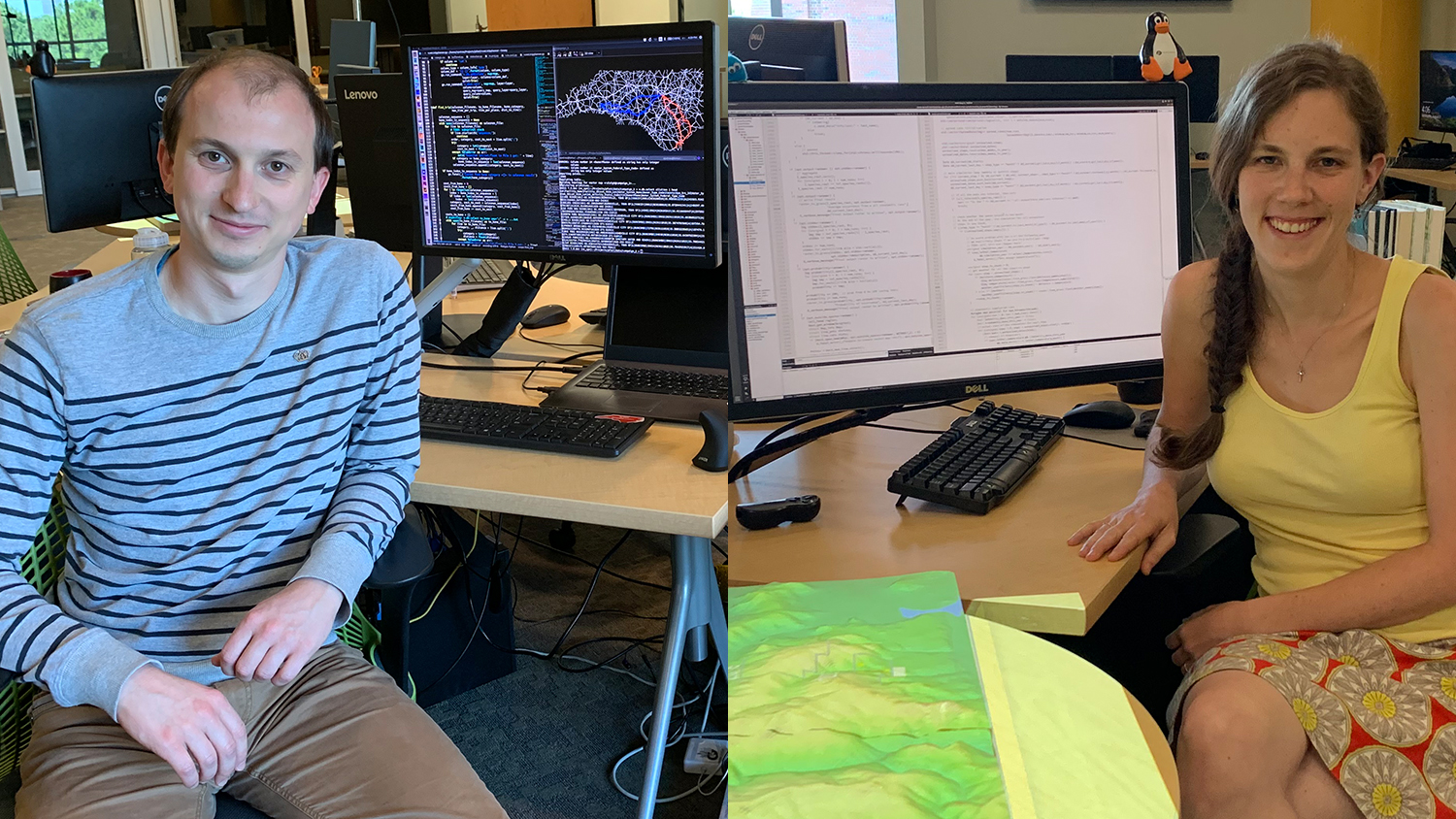
Meet Anna Petrasova and Vaclav Petras, Geospatial Research Software Engineers
For six years, a data science power couple has been essential to the success of numerous projects at the Center for Geospatial Analytics. From developing powerful simulations to advancing the practices of open science, Anna Petrasova and Vaclav Petras have led many innovations at the frontiers of geospatial analytics and have been core members of many center research teams.
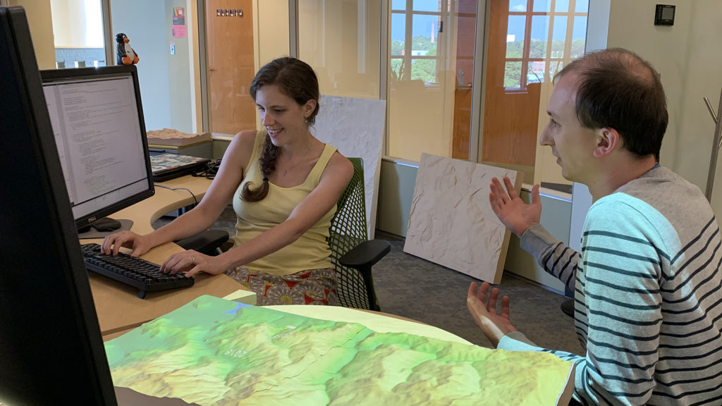
A sample of their many roles? They are key developers of Tangible Landscape and the FUTURES urban growth simulation; they are core members of the center’s Biological Invasions team forecasting the spread of invasive pests and pathogens; and they sit on the international GRASS GIS project steering committee. The pair have been married for seven years, and together they have blazed a remarkable research path.
Petrasova and Petras first joined the Center for Geospatial Analytics as Ph.D. students, then continued their work as postdoctoral scholars after graduation. Recently, in recognition of their exceptional talents and expertise––both individually and combined––the dynamic duo were hired to join the center’s research staff as full-time geospatial research software engineers.
We caught up with them to find out more about their extraordinary work and what the future has in store.
Congratulations on joining the center as full-time researchers! Tell us, what does it mean to be a geospatial research software engineer? What are the main things that you do?
Anna: Thank you! “Geospatial research software engineer” is a long title, but I think it captures well this emerging need for a certain combination of skills and expertise in current research. Using and developing software is becoming essential not just for conducting research, but also for disseminating results and accelerating further research. Not many researchers are, however, comfortable with publishing their code, because––for example––the code works only for their data, can be slow to run and lacks documentation. As research software engineers, we use our background in software development and research to develop scientific models that feature high-quality code, and in the spirit of open science, that code can be reused by other researchers internationally. Given that geospatial models bring many special challenges, our background in geospatial analytics makes our work possible.
Vaclav: We also try to ensure that the software we are developing, such as Tangible Landscape, will be reusable later in future research projects and that we will be able to continue to benefit from GRASS GIS and other open source software in years to come.
What has it been like to transition from Ph.D. student to postdoc to research staff? How has your research focus shifted?
Anna: As a Ph.D. student you are trying to define your research focus, trying to balance things you enjoy doing with things that are possibly strategic for your career, which is exciting and frustrating at times. Going through this experience helped me to better understand my research priorities but of course, it’s an ongoing process.
Vaclav: Although as a student you are part of a lab or a team, you are expected to carry most of your research project yourself. Now, my role in the team helps me to focus on what I do best. This also reflects a shift at the center towards team science, which involves combining strengths of researchers with diverse backgrounds to tackle greater challenges.
Congrats too on winning a Beacon Award at the center’s recent awards banquet. One of your nominators mentioned that you were part of over 30 demonstrations of Tangible Landscape in the past year alone. How has the number and variety of demos grown over time? Are there any that have been especially memorable or particularly rewarding for you?
Vaclav: The number of demos grew pretty fast right at the beginning. Our initial audience were often colleagues from NC State and their visitors. Regardless of the audience, we were usually showing just a specific set of applications such as water flow. Then we added a couple of applications showing the potential of Tangible Landscape––what it could do. Now we have a variety of applications which we can further tweak towards a specific audience, but we usually show applications we developed for a specific project, event or purpose, e.g., teaching high schoolers about topography. The most specialized example is currently the connection with PoPS, the pest forecasting tool.
Anna: There have been several memorable demos, for good and bad reasons… A lot of the demos we did outside of the center really pushed us to improve Tangible Landscape to speed up and optimize the setup––or even improvise if a part didn’t show up at a venue!––and develop new applications. The most rewarding moments were when we used Tangible Landscape during our SOD workshop but also when we learn about other groups applying Tangible Landscape in their research.
What innovations in your current work are you most excited about?
Anna: It’s great to see the synergies of several projects that I and many other colleagues at the center have been working on, specifically the PoPS forecasting framework, which brings together Tangible Landscape, web technologies, my work on steering stochastic geosimulations, engaging stakeholders through participatory modeling and others. In the future, I hope our urban growth modeling efforts will directly benefit from this development as well.
Vaclav: These are the really big ones, but I’m also excited about several smaller projects. One of them is finding an optimal sampling plan for the NC PFAS Testing Network, which is already in use helping researchers plan trips to take samples across North Carolina. I’m also quite excited when somebody else solves a problem I’ve encountered. For example, Binder enables people to run open source code online without installing anything, so it is now easy to run tutorials and share my computational research experiments.
What else would you like folks at our center, across NC State, or in the wider geospatial community to know about you and your work?
Anna: What I would like to highlight is that the projects we at the center are working on, such as Tangible Landscape, PoPS, FUTURES and others are open source. Sometimes researchers consider following open science principles as not practical or irrelevant to their work, but we have seen a lot of benefits during the past couple years in our work, specifically in the area of teamwork, collaboration and sustainability of the projects.
Vaclav: That’s right. Most researchers know all the reasons why doing open science or using open source is the right thing to do, but they often underestimate the benefits this would bring them. In fact, my ongoing research is about creating mechanisms for open science and understanding the role of geospatial software platforms such as R or GRASS GIS.
- Categories: