OpenPlains: Geospatial Participatory Modeling in the Clouds
Editor’s note: Each semester, students in the Geospatial Analytics Ph.D. program can apply for a Geospatial Analytics Travel Award that supports research travel or presentations at conferences. The following is a guest post by travel award winner Corey White as part of the Student Travel series.
The decision to travel to an international conference is not always easy. After considering the costs of flights and lodging, deciding whether you have enough time and if what you have to present is ready to share is a daunting process. However, some conferences are easier to convince yourself to attend than others. That was the case for me when deciding to present OpenPlains at FOSS4G in Florence, Italy in August 2022. The international FOSS4G conference is an amazing community of communities filled with open-source developers, companies, enthusiasts, evangelists, researchers and students. The software these communities develop and maintain are both the bedrock of the geospatial industry and pushing the threshold of what is coming next.
My community at FOSS4G is GRASS GIS. GRASS GIS has deep roots in the GIS world with its first official release in 1985. The GRASS community is a hardworking group of volunteers who have a reputation for being the first to show up to and last to leave a community code sprint. The group consists of members from all over the world who share the same mission to continue to maintain and improve GRASS GIS. At the Center for Geospatial Analytics we are lucky enough to have three core members of the GRASS GIS community: Anna Petrasova, Vaclav Petras and Helena Mitasova.
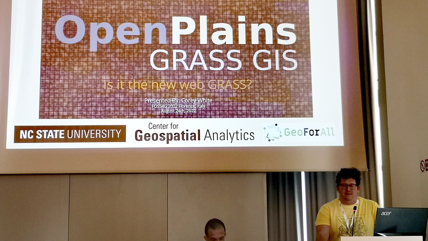
Through the work of GRASS’s amazing community, GRASS has continued to grow with changes in technology and methods. This also happens to be where I fit into the GRASS equation. I attended FOSS4G to present OpenPlains, an open-source geospatial participatory modeling platform which allows users to use GRASS GIS on the web and develop interactive participatory modeling applications. I created OpenPlains in order to develop TomorrowNow, a serious game co-designed with stakeholders with expertise in stormwater management, urban planning and community engagement from around the Research Triangle, NC. With TomorrowNow users can play with urban development scenarios and evaluate their impact on future flooding events.
As extreme weather events continue to impact communities worldwide, tools to address complex socio-environmental issues such as flooding, fires, droughts and water quality degradation are needed to aid in the decision-making process. OpenPlains aims to provide a service to communities to improve the quality of decision-making by enabling equitable community engagement in the decision-making process.
However, in order to see this vision come to fruition a new branch of the FOSS4G community family tree must sprout from GRASS. OpenPlains, like most young things, needs support to survive long enough to form its own roots and community, a community not only of maintainers, developers and practitioners, but a community of engagement. My hope is that other members of FOSS4G––that might be you––will join me in the new OpenPlains community, to help co-design a brighter, more sustainable future.
Join the community:
- TomorrowNow on GitHub: https://github.com/tomorrownow
- Join the development: https://gitter.im/tomorrownow/community
- Join the conversation: https://tomorrownow.slack.com
- GRASS GIS Community: https://gitter.im/grassgis/community
- Categories: