Spring 2023 Geospatial Forum Rewind
Revisit the Center for Geospatial Analytics' Spring 2023 Geospatial Forum series.
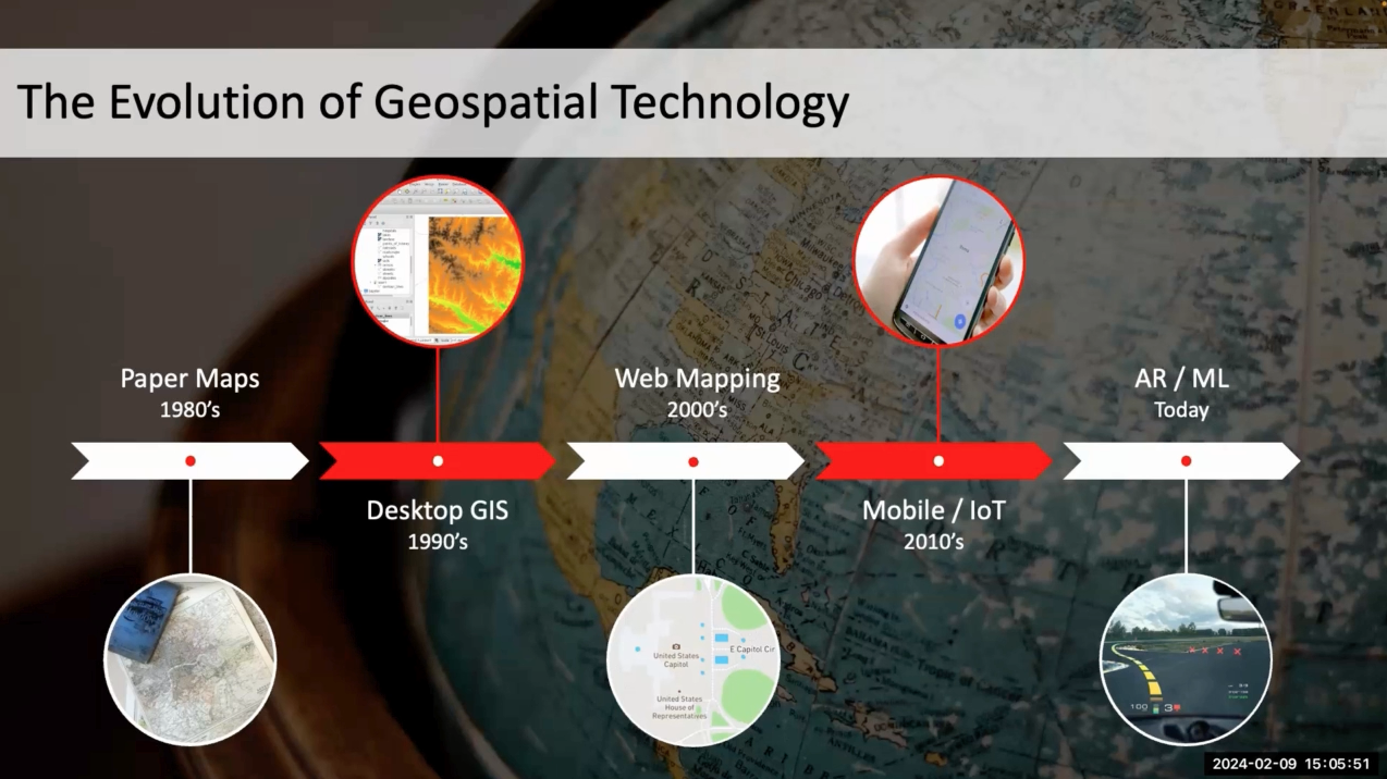
Each semester, our Geospatial Forum event series brings together researchers, educators, practitioners and students in the geospatial data sciences for lectures, interactive studios and panel discussions focused on important topics and cutting-edge techniques.
This spring, Geospatial Analytics Ph.D. students presented their doctoral research and guest speakers discussed topics ranging from disease spread to justice in the participatory sciences; a special three-hour studio also taught our community about species distribution modeling using GRASS GIS and R. Expand each title below to learn more and click the play button to revisit each recorded discussion.
Remember you can watch the recordings from past semesters anytime on our YouTube channel. All videos are closed captioned, with transcripts checked by Center staff.
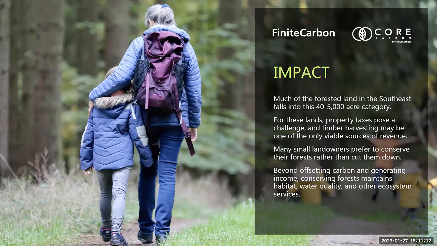
JAN 27 – Including Family-Owned Forests in the Fight Against Climate Change
Lecture
Speaker: Dr. Donal O’Leary (Finite Carbon)
Hosted by: Felipe Sanchez, Geospatial Analytics Ph.D. Student
Summary: While the economic forecast for 2023 might be gloomy, the demand for carbon offsets continues to grow. As North America’s leading developer of forest carbon offsets, Finite Carbon is pioneering technological advancements that leverage geospatial information to automate the carbon project development process. These innovations reduce transaction costs, creating new opportunities for family-owned forests to join the carbon marketplace, increasing substantially the total forest area eligible for high-quality carbon offset projects, particularly in the Southeastern United States. Please join Donal as he shares examples of how Finite Carbon applies geographical sciences to preserve forests for generations to come.
About the speaker: Donal O’Leary is an Applied Remote Sensing Scientist, building solutions for Finite Carbon’s remote sensing, GIS, and cloud-native compute pipelines. Combining his years of on-the-ground conservation experience with his technical training, Donal uses Earth observation data to create robust, precise, and meaningful data products. Donal’s first act was as a trail crew leader for the National Park Service and a wilderness guide across the western USA. Seeking a greater impact, Donal earned his Ph.D. from the University of Maryland where he studied and published alongside NASA scientists as an NSF Graduate Research Fellow. Outside of work hours, Donal is probably eating well, collecting memories and experiences with his partner, or exploring the mountains near his home in Estes Park, Colorado.
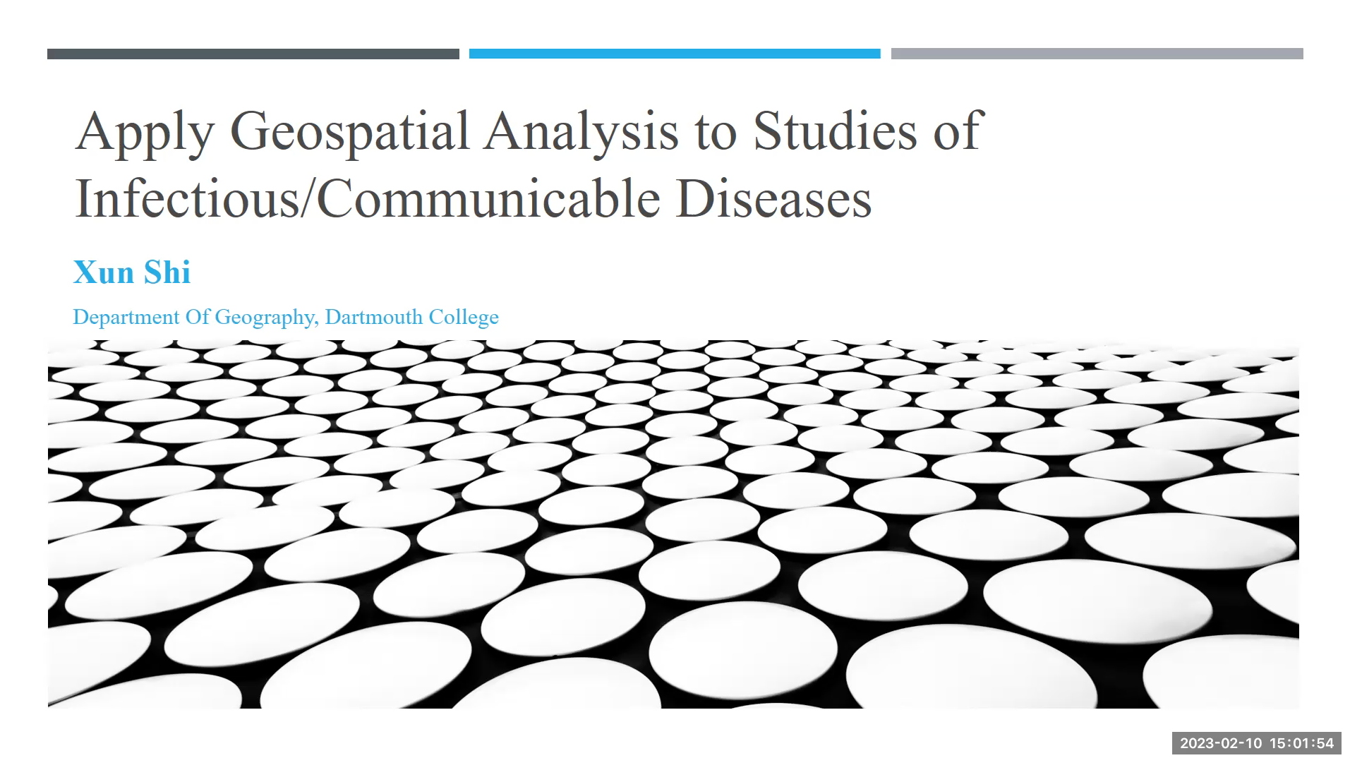
FEB 10 – Applying Geospatial Analysis to Studies of Communicable Diseases
Lecture
Speaker: Dr. Xun Shi (Dartmouth College)
Hosted by: Dr. Aaron Hipp, Associate Director of Social and Behavioral Science Applications and Faculty Fellow, Center for Geospatial Analytics; Associate Professor of Community Health and Sustainability in the Department of Parks, Recreation, and Tourism Management
Summary: Infectious/communicable diseases have (re)emerged at local, regional, and global scales within the context of contemporary global environmental change, globalization, urbanization, and environmental problems. Geospatial analysis can play a major role in analyzing, modeling, and predicting epidemics and pandemics. In this forum presentation, Dr. Shi will use examples from his own research, ranging from modeling dengue fever and COVID-19 to detecting environmental risks of Lyme disease, to demonstrate some important trends in this area, including the integration of spatialization and individualization, the bottom-up approach, the integration of small, medium, and big data, and the computational methodology.
About the speaker: Xun Shi, Ph.D., is a Professor of Geography at Dartmouth College. His main research interest is in developing and applying quantitative geospatial methodologies to health issues. Dr. Shi has published over 90 journal articles, covering spatiotemporal epidemic modeling of infectious/communicable diseases, spatial environmental health, assessment and optimization of access to healthcare services, and geospatial data infrastructure issues in epidemiology and public health. He earned a B.S. in geography from Beijing University, a M.S. in geography from the Chinese Academy of Science, a M.Phil. from the University of Hong Kong, and a Ph.D. in geography from the University of Wisconsin-Madison.
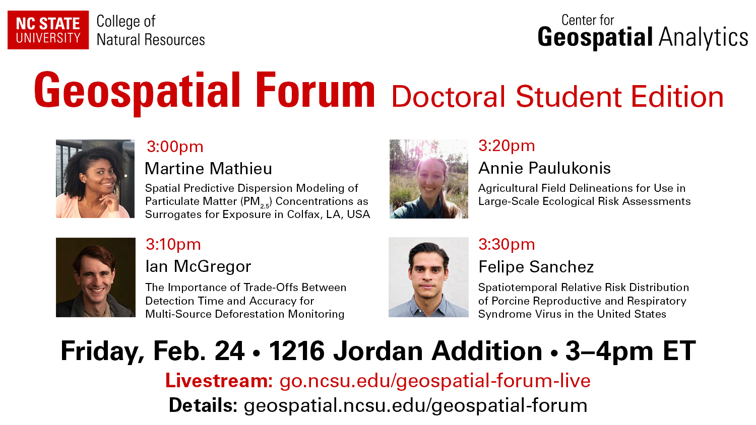
FEB 24 – 3rd Doctoral Student Forum
Lecture
Join us for a series of lightning talks by four of the CGA’s Geospatial Analytics Ph.D. students.
Hosted by: Rachel Kasten, University Program Specialist, Center for Geospatial Analytics
Speakers, Titles and Abstracts:
> Martine Mathieu: Spatial Predictive Dispersion Modeling of PM2.5 Concentrations as Surrogates for Exposure in Colfax, Louisiana, USA (advised by Jennifer Richmond-Bryant, CNR)
Abstract: In Colfax, LA, several residents have experienced adverse health effects in an area surrounding an open burn/open detonation hazardous waste thermal treatment facility that accepts waste including soils from Superfund sites, fireworks, military ordnances, and munitions, resulting in emission of fine particulate matter (PM). To predict the spatial distribution of PM2.5 concentrations as surrogates for exposures and help Colfax residents understand their health risks from exposure to the facility emissions, we used AERMOD to model dispersion in Colfax. Our preliminary results showed that PM2.5 dispersion occurred over two communities adjacent to the facility: Colfax and The Rock. The average concentrations exceeded the EPA’s annual ambient PM2.5 standard of 12 mg/m3.
> Ian McGregor: The Importance of Trade-Offs between Detection Time and Accuracy for Multi-Source Deforestation Monitoring (advised by Josh Gray, FER)
Abstract: Detecting deforestation as quickly and accurately as possible is important for near real-time monitoring (NRTm) of forests, especially via remote sensing. Recently, multi-source approaches have improved our detection capability, but some studies have hinted at the lack of an optimal solution. To explore this accuracy-latency trade-off and determine if it’s limited to optical sensors, we developed a novel approach combining data from Landsat-8, Sentinel-2, and Sentinel-1 in northern Myanmar. We found three main results: 1) we quantified the full spectrum of trade-offs; 2) including Sentinel-1 did not improve results; and 3) our approach returned fast detections with high accuracy.
> Annie Paulukonis: Agricultural Field Delineations for Use in Large-Scale Ecological Risk Assessments (advised by Helena Mitasova (MEAS) and Tom Purucker (EPA))
Abstract: The U.S. EPA uses spatially explicit agricultural information from the USDA Cropland Data Layer (CDL) to quantify potential pesticide exposures of non-target species, but the CDL lacks well-defined field boundaries necessary for higher tier modeling efforts. This work describes a methodology that uses unique pixel histories and basic geostatistical approaches to define field boundaries for use in ecological risk assessment efforts. The approach captures field edges while closely matching both original CDL crop patterns and reported crop metrics for areas of high proportional agriculture use and can be altered to reflect trends in county-level field size/use for delineation.
> Felipe Sanchez: Spatiotemporal Relative Risk Distribution of Porcine Reproductive and Respiratory Syndrome Virus in the United States (advised by Gustavo Machado, Population Health and Pathobiology, CVM)
Abstract: Identifying areas and farms at greater risk for porcine reproductive and respiratory syndrome virus (PRRSV) transmission is pivotal for targeted surveillance and disease control strategies. In this study, we used an adaptive kernel density approach to define the spatial distance at which the risk of PRRSV transmission between farms is high, and describe how risk is distributed across different farm types. We then used a Bayesian spatiotemporal model to identify variables associated with PRRSV outbreaks. Information gathered from this study addresses an important gap in the understanding related to the spatial range of PRRSV local transmission, and can be used to calibrate future PRRSV transmission models.
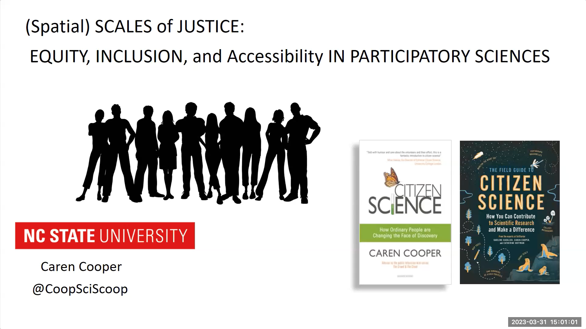
MAR 31 – (Spatial) Scales of Justice: Equity, Inclusion, and Accessibility in Participatory Sciences
Lecture
Speakers: Dr. Caren Cooper (NC State)
Summary: The participatory sciences manage public engagement to create bridges between science and society, taking different forms in different disciplines. The discoveries and advances through these large collective efforts are unique and not possible by people working alone. With innovations in geospatial and data sciences, the spatial scale of public engagement in science can include millions and span continents. Yet, with increasing scale, projects become less spatially and socially representative of human populations: the overwhelming majority of participants are White, highly educated, and wealthy. The Diverse, Inclusive, Equitable, Accessible, Large-scale (IDEAL) participatory science program supports professional development of practitioners to produce changes needed for inclusion of groups historically excluded and underrepresented in participatory science.
About the speaker: Caren Cooper is an interdisciplinary scholar with research programs in avian ecology, human dimensions, and the participatory sciences. Dr. Cooper is an associate professor in the Department of Forestry and Environmental Resources and part of the Chancellor’s program in Leadership in Public Science.
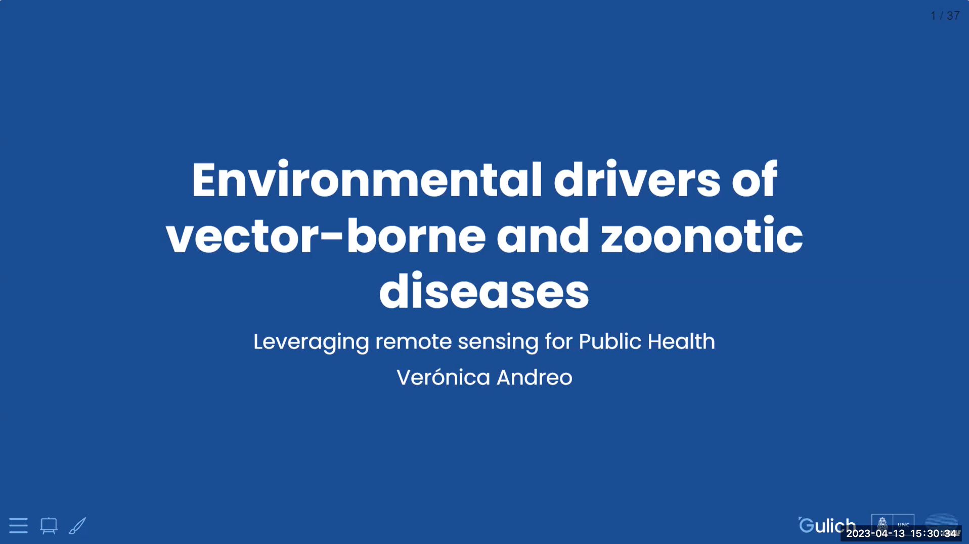
*APR 13 – Environmental Drivers of Vector-borne and Zoonotic Diseases: Leveraging Remote Sensing in Public Health
Lecture: NOTE this event is on a Thursday at 3:30pm in 5103 Jordan Hall.
Speaker: Dr. Verónica Andreo (CONICET and the Gulich Institute, Argentina)
Hosted by: Dr. Vaclav Petras, Research Software Engineer, Center for Geospatial Analytics
Summary: Vector-borne and zoonotic diseases are responsible for one-sixth of disease and disability worldwide. Their distribution and spread is highly dependent on the environment. In the face of the environmental changes brought about by the Earth-system crisis, remote sensing has gained renewed relevance for public health applications. For example, time series of remotely sensed variables can be used to understand the spatio-temporal conditions that favor mosquito populations and may pose a high risk of West Nile Fever outbreaks. In this talk, Dr. Andreo will show how she use remote sensing data of different spatial and temporal resolutions to predict the risk of diseases such as hantavirus, dengue and leishmaniasis, to allocate sensors for mosquito sampling, and to quantify access to health care, among others. She will also discuss various limitations, challenges, and future directions in the use of remote sensing for operational early warning systems and applications to support timely decision making in the field of Public Health. Spoiler alert! GRASS GIS is one of the main characters in this journey.
About the speaker: Dr. Verónica Andreo is a biologist and holds a PhD in Biological Sciences and an MSc in Remote Sensing and GIS applications. She is a researcher for CONICET and a lecturer at Gulich Institute – Argentinian Space Agency (CONAE) in Córdoba, Argentina. Her research focuses on uncovering environmental drivers of vector-borne disease outbreaks. She is most interested in those environmental features that can be derived by means of satellite image analysis, remote sensing time series and GIS-based techniques.
Dr. Andreo is part of the GRASS GIS Development team and is chair of the GRASS GIS Project Steering Committee. She is a strong advocate for OSGeo and free and open source software for geo-spatial (FOSS4G). Among other things, she has served as Program Committee chair for FOSS4G 2021 and volunteered as a mentor for GRASS GIS in the Google Code-In contest introducing high school students into the Open Source world.
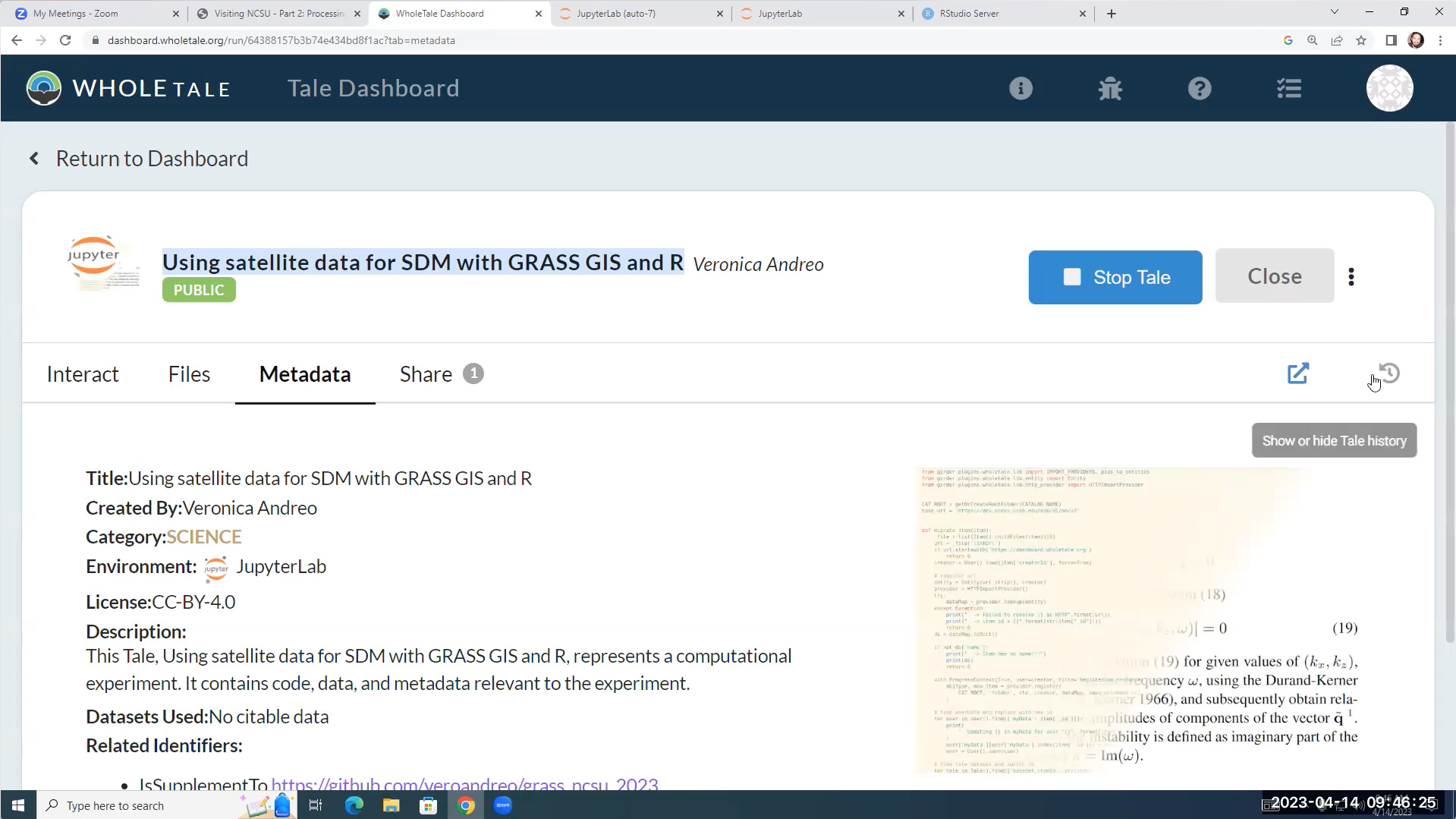
*APR 14 – Using Satellite Data for Species Distribution Modeling with GRASS GIS and R
Studio: NOTE this event is from 9am – Noon.
Speaker: Dr. Verónica Andreo (CONICET and the Gulich Institute, Argentina)
Follow along with the recording:
- Getting Started:
https://veroandreo.github.io/grass_ncsu_2023/studio_index.html - Part 1, Intro to GRASS GIS: https://veroandreo.github.io/grass_ncsu_2023/notebook_intro.html
- Part 2, Processing Data in GRASS: https://veroandreo.github.io/grass_ncsu_2023/notebook_ex_rs_grass.html
Summary: Species distribution models (SDM) have traditionally used climatic data as predictors of habitat suitability for the target species. In this hands-on studio, we will explore the use of satellite data to derive relevant predictors. We will perform satellite data processing, from download to analysis, using GRASS GIS software functionality. Then, we’ll read our predictors within R and perform SDM, visualize and analyze results. Finally, we will write the output distribution maps back into GRASS.
About the speaker: Dr. Verónica Andreo is a biologist and holds a PhD in Biological Sciences and an MSc in Remote Sensing and GIS applications. She is a researcher for CONICET and a lecturer at Gulich Institute – Argentinian Space Agency (CONAE) in Córdoba, Argentina. Her research focuses on uncovering environmental drivers of vector-borne disease outbreaks. She is most interested in those environmental features that can be derived by means of satellite image analysis, remote sensing time series and GIS-based techniques.
Dr. Andreo is part of the GRASS GIS Development team and is chair of the GRASS GIS Project Steering Committee. She is a strong advocate for OSGeo and free and open source software for geo-spatial (FOSS4G). Among other things, she has served as Program Committee chair for FOSS4G 2021 and volunteered as a mentor for GRASS GIS in the Google Code-In contest introducing high school students into the Open Source world.
- Categories: