
Before graduating, each student in the Center for Geospatial Analytics’ professional master’s program in Geospatial Information Science and Technology (MGIST) applies their knowledge and skills to a client-supplied problem in a service-learning capstone project.
Industry, academic, government and nonprofit partners work closely with our students to find a customized solution using GIS applications and geospatial analysis. This semester, our professional master’s students developed solutions for improving railways, tracking access to public trails, meeting infrastructure needs, assessing quality of life and more!
Improving How Freight Rides the Rails

Each year, the North Carolina Department of Transportation (NCDOT) offers grants aimed at improving freight railroad lines in the state, but keeping track of funded projects can be cumbersome. MGIST student Summer Faircloth partnered with the NCDOT Rail Division to help them better analyze these investments across the state. “Railroads are commonly referred to as the ‘first and last mile’” for transporting goods, Faircloth explains. “They play a critical role in North Carolina’s economy by ensuring the efficient and safe transport of freight.” Thanks to Faircloth’s efforts, “the Rail Division will be able to see exactly what these [grant] programs have accomplished. Being able to see the historical submissions also gives insight into the impact of the programs on carloads, jobs created and other metrics of economic development on a larger scale.”
Keeping Track of Public Trails
Public trails through greenspaces offer many opportunities for recreation. Three MGIST students worked this semester to help community partners monitor or site public trails.
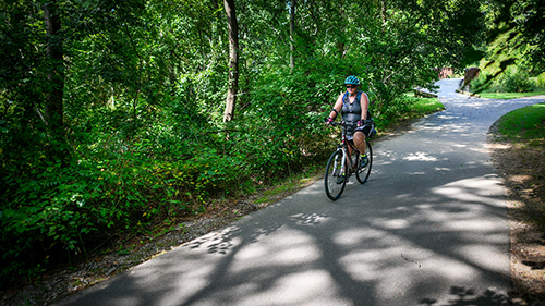
Roderick Flannery worked with the National Park Service’s (NPS’s) Continental Divide Research and Learning Center to track trail usage in Rocky Mountain National Park in Colorado. Because much of the park is designated Wilderness Area, NPS staff “have to make sure they have a pretty strong management program,” Flannery explains, “making sure they’re abiding by the stipulations of the Wilderness Act, and making sure the land isn’t being overused.” The web mapping application Flannery developed integrates data from motion-activated trail counters in the park to display high-use vs. low-use trails, the popularity of trails across different times of the day or week, and even predictions about future trail use.
In North Carolina, 2023 is the Year of the Trail, but the state doesn’t have a comprehensive map that provides information about all of its trails. So Natalie Luftman partnered with researchers from NC State University’s Department of Parks, Recreation and Tourism Management to start building one. The web app she created not only consolidates information about the state’s many trails but is also intended “to help gauge the equity of trails within each county,” Luftman explains, by comparing trail density and county populations and economies.
NC State University’s Centennial Campus currently features several public trails along Lake Raleigh, and plans are underway to join them into a loop trail. For the loop to become a reality, however, “two suitable locations must be found to create bridges to cross Walnut Creek,” explains Kyle Noel, and “parcel boundaries and wetlands are major challenges.” Working with NC State University Real Estate and Development, Noel created a way to visualize with GIS the most ideal path between two points on either side of the creek, depending on a variety of factors. To support decision-makers at the university, the web mapping application he developed will “host the tool and allow for users to determine the best optimal paths across two water crossings for themselves.”
Meeting Infrastructure Needs
From local municipalities to public schools, organizations have pressing needs to maintain aging infrastructure and monitor development changes in their communities. This semester, three MGIST students worked to make tracking infrastructure easier.
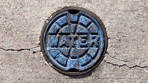
David Kist partnered with the City of Oxford, NC to help it keep ahead of utility problems like water main breaks. “There’s a limited amount of resources to work with,” Kist explains. “As great as it would be to replace those pipes every few years…there just aren’t enough resources to go around…So the goal of this project was to prioritize.” The web mapping application Kist developed calculates and spatially displays the risk of water and sewer pipe failures, helping city staff establish priorities for inspections, repairs and replacements.
Aging infrastructure is also a concern for public school systems. Working with Cabarrus County Schools, Colby Traynor developed “a streamlined method for collecting, visualizing and sharing data about the infrastructure and facilities on their school sites.” Ultimately, these data can be used for capital improvement planning. “Our hope is that with a geospatial approach, we can help speed the maintenance, repair and replacement efforts across these schools,” Traynor explains.
Impervious surface like roofing and pavement increases the amount of stormwater runoff that can cause flooding and water quality problems downstream––and rapid development across North Carolina means rapidly changing amounts of impervious surface. To fund efforts like flood control and water quality monitoring, Durham County relies on a stormwater utility fee charged to property owners based on the amount of impervious surface on their property. To make sure stormwater utility fees are accurately assessed, Andrew Freeland partnered with Durham County Stormwater to improve methods of identifying properties with new construction from remotely sensed imagery, and help with calculating square footage of impervious surface.
Assessing Community Quality of Life

In 2022, Geospatial Analytics Ph.D. student and Thriving Earth Exchange Community Science Fellow Shannon McAvoy partnered with the city of Montevallo, AL to help organize a Quality of Life Assessment project that will guide future citywide decision-making. This semester, MGIST student Jessica Hackman joined the project with a goal “to compile all of Montevallo’s community assets, map the city’s quality of life and show the results in a public-facing mapping application.” The website that Hackman created pools data about public safety, infrastructure, education, greenspaces and more, and even features a community events locator. “This project produced results that can be used by many different groups for many different purposes,” Hackman explains. “Montevallo community members can use it to explore events and resources that they may not have known existed.” Furthermore, analysis tools allow seeing where quality of life indicators are low vs. high, identifying areas of need.
And More!
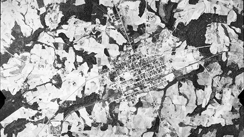
Purdeep Dhanoa created a method to help the North Carolina State Historic Preservation Office georeference and display its vast collection of historic aerial imagery from the 1930s and 1940s.
Scott Ellis worked with RTI International to relate soil properties in California’s agriculturally vital Central Valley to the yields of seven different crops.
Dallas Hoffman collaborated with the North Carolina State Climate Office and NC State University Department of Biological and Agricultural Engineering to develop an open source workflow and training materials that can help extension agents assist growers with precision agriculture. Hoffman is the winner of this semester’s MGIST poster competition.
Yale Kodwo-Nyameazea partnered with researchers at the University of North Carolina at Charlotte to examine which communities in North Carolina may be at risk of gentrification.
Alexander Mann collaborated with civil engineering consulting company VHB to develop a deep learning model that can identify crosswalks in satellite imagery to support transportation planning projects.
Ben Masters helped the JC Raulston Arboretum update their information technology infrastructure so that they can continue to maintain and expand the garden database that keeps tabs on over 10,000 living plants across its 10 acres.
Macy Sawtelle worked with multinational insurance company Manulife to update the way it monitors reforestation efforts as part of the timber Plantation Assessment Program.
Greyson Smith partnered with Crown Castle to support its drone operations.
Derek Stanley collaborated with the Army Geospatial Center to develop a user-friendly workflow that will allow military geospatial professionals to quickly and easily leverage OpenStreetMap data for creating useful visualizations.
James Webber created a multi-functional web mapping application leveraging Child Opportunity Index data to help researchers at Duke University School of Medicine better understand the environmental factors associated with childhood obesity.
Devin Whitney worked with Buncombe County Election Services to create a centralized method of tracking information about its voting precincts and a way for members of the public to suggest new polling places in the county.
Caroline Wood helped NC State University Facilities Division and the university’s Office of Sustainability by developing mobile friendly forms and a web mapping application to track the maintenance and health of campus pollinator gardens.
Hubert Yun partnered with the Center for Geospatial Analytics’ Associate Director of Educational Innovation to track and highlight the history and diversity of MGIST capstone partnerships over time.
Several MGIST students even collaborated with partner organizations from the Fall 2022 semester, expanding on projects begun by past students. William Turner partnered with the National Park Service at Petersburg National Battlefield in Virginia to identify the likely locations of artillery artifacts and help NPS staff stay a step ahead of looters. Robert Lawson worked with the Hickory Fire Department to develop a Fire Accreditation Analysis viewer application to visualize and assess the department’s response capabilities.
Thank you to all of our capstone partners, and congratulations to all of our graduating MGIST students on their success!


