A Passion for Teaching and the Future of GIS

For the past eight semesters, Geospatial Analytics Ph.D. candidate Jason Matney has taught hundreds of students as a graduate teaching assistant and course instructor at NC State. As he now prepares to defend his dissertation in May, he credits this experience with solidifying his passion for teaching and honing his approach as an educator.
Matney’s first teaching experience at NC State was nearly four years ago, when he was assigned to GIS 510 (Fundamentals of Geospatial Information Science and Technology), taught by Center for Geospatial Analytics teaching assistant professor Stacy Supak. “He was there from day one when I took over the class in Fall 2015,” Supak says. Besides helping to shape the curriculum, Matney also ran the course discussion board, a key place to interact with students one-on-one. GIS 510 enrolls about 150 students a semester, all online, and after seven semesters, “over 1,000 students have benefited from his informative and empathetic responses on class discussion boards,” Supak says. “Overall, this was one of the defining features of my time at NC State,” Matney says. “It developed my passion for teaching.”
Matney also served as a teaching assistant for Center for Geospatial Analytics research associate Bill Slocumb for two semesters. This course (GIS 535, Web and Mobile GIS Protocols) serves graduate students enrolled in the center’s professional master’s degree in Geospatial Information Science and Technology (MGIST), and Matney provided helpful perspectives as students built web mapping applications and used virtual computing technology.
Now, Matney is instructing the capstone course ES 400 (Analysis of Environmental Issues), mentoring about 25 NC State seniors in their last semester. “I am keenly aware that they are looking past the coursework and trying to land their first job,” Matney says. His focus in the course has been on professionalization and providing the students with practical skills. To that end, he has run a GIS workshop, organized lessons on the statistical software R and offered a resume workshop. “It is fun to work with these students,” he says, helping them to navigate working with a community partner to gain real-world problem-solving experience. This semester’s partner is the Chatham County Climate Change Advisory Committee, which is engaging with students on projects to advance its Chatham County Climate Action Plan. Matney sees the collaborative approach as a win-win, as the community partner can “tap these up-and-coming environmental scientists” for their expertise, and students can apply all they have learned in their last four years.
Lessons learned
What has it been like to teach both undergrads and graduate students? “I feel like I’ve learned from each group of students,” Matney says, noting that his teaching style has evolved over time as he’s discovered how to tailor his approach to what different students need. GIS courses tend to be very technology-heavy, and so Matney teaches undergraduates to be patient with themselves if and when they become frustrated by technical glitches. It’s important, he says, to let students find the answers themselves, rather than be “an automatic answer machine.”
“Athletes want to be coached,” Matney says, and students do too. “Students are excited to learn, and you have to provide the space and boundaries to help them do that.” In all of his teaching experiences, he says, “I am motivated by helping young people succeed.”
Mentors can also make all the difference. “I want to emphasize how great of a mentor Stacy Supak has been and how much I have learned from her,” Matney says. He recalls how he was struck by her teaching style from the start. Rather than simply teaching the surface-level basics of how to use GIS software, Supak introduces her students to GIS through complex problems, Matney explains, and wants them to “understand it from the ground up,” so that they grasp what the software is doing behind-the-scenes.
“She has been an inspiration and a model for how I approached the work,” Matney says.
Looking to the future
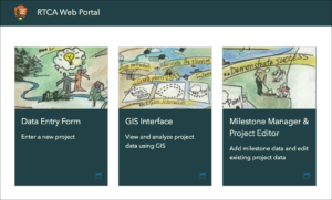
Matney’s interest in the spatial sciences began with geography, but he quickly became drawn to “applications that could be used by people every day.” For his dissertation research, he built decision support tools for protected areas and land managers, focusing on the Rivers, Trails and Conservation Assistance (RTCA) program of the National Park Service (NPS). The RTCA is an intermediary for community groups who seek NPS funds for projects such as trail building or developing programs to get more kids into nature. Managing all of these projects, though, can be complex––a task that Matney saw could be simplified through spatial techniques.
A forthcoming publication in the Journal of Park and Recreation Administration catalogs his entire process of creating “a suite of web apps for a workflow they desired,” he explains, “from needs assessment to implementation to surveying the client.” RTCA can now simply use a web browser to access and manage a multi-user, editable database to track project data and progress, and the workflow Matney developed can be duplicated by other organizations looking for a similar solution.
This work demonstrates the utility of GIS for a wide range of applications. “You can dream big, have big ideas, and then implement these ideas with GIS in different areas,” Matney says. “GIS tools are inclusive tools that anyone can learn how to use.”
“GIS serves as a jumping off point to learn about different fields,” Matney continues. Over the course of his master’s and doctoral programs, he has gained expertise in areas as diverse as computer science and spatial statistics, which all “orbit around this center, which is GIS.”
He is also interested in the history and future of GIS, including machine learning, the use of geotagged data from social media to understand park use and the Internet of Things. He predicts that applications in this area will play a large role in the future of GIS. “Spatial intelligence is more intuitive to younger people,” he says. “Everything on a phone is geolocated. Young people use this technology every day.”
As Matney pursues a career in university teaching, innumerable more young people will likely be inspired to learn GIS from his instruction. At NC State, a large number already have.
Matney’s doctoral advisory committee is co-chaired at the Center for Geospatial Analytics by Stacy Supak and faculty fellow Stacy Nelson.
This post was originally published in Center for Geospatial Analytics.
- Categories: