GIS at Your Fingertips: Tangible Landscape Webinar Showcases Open-source Solutions

On August 31st, the GeoForAll Laboratory at the Center for Geospatial Analytics presented a live multi-media webinar to a broad audience of online viewers, showcasing Tangible Landscape and describing how researchers around the world can adopt and adapt its flexible technology.
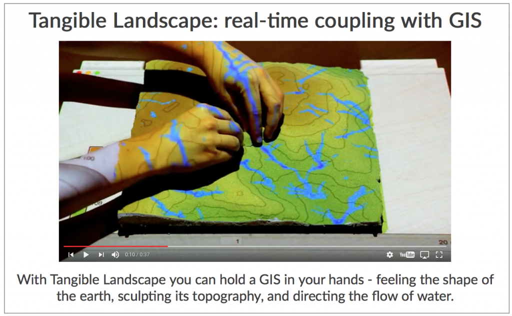
While traditional use of Geographic Information Systems (GIS) requires specialized training and software, Tangible Landscape creates an intuitive, collaborative environment by bringing geospatial models out of the computer and into three-dimensional physical space. The technology relies on low-cost hardware and free, open-source software to project sophisticated computer models onto physical models; computer analyses can then respond to a user’s sculpting hands, to markers placed on the 3D surface, and even to lines drawn with a laser pointer, all to change the landscape and visualize its new configuration.
In this way, someone with little to no training in GIS can still interact with, and learn from, a geospatial modeling process in real time.
The GeoForAll Lab’s webinar presentation – entitled Tangible Landscape: open source environment for geospatial learning, science, and community – was supported by multiple geospatial groups as part of the GeoBytes webinar series: GeoForAll (an initiative by the Open Source Geospatial Foundation), the American Association for Geodetic Surveying (AAGS), the American Society of Photogrammetry and Remote Sensing (ASPRS), the Cartography and Geographic Information Society (CaGIS), and the University Consortium for Geographic Information Science (UCGIS).
Congratulations to the presentation authors – Dr. Helena Mitasova, Anna Petrasova, Brendan Harmon, Vaclav Petras, Payam Tabrizian, and Dr. Ross Meentemeyer – for their informative and impactful work!
If you missed the live webinar, its content is available for free online:
- View a recording of the webinar
- Scroll through the presentation slides (without sound), using your keyboard’s space bar or side arrows
If you would like to learn more about Tangible Landscape:
- Visit the project website where updates are posted
- Watch videos of example applications on the GeoForAll Lab’s YouTube channel
- Visit the project Wiki to share information with other users
- Check out the book, Tangible Modeling with Open Source GIS, which contains background information and GRASS workflows for different applications
To develop your own version of the Tangible Landscape setup:
- Access the Tangible Landscape plugin
- Download the GRASS GIS module for importing data from Kinect v2
- Visit the Tangible Landscape repository on Open Science Framework


