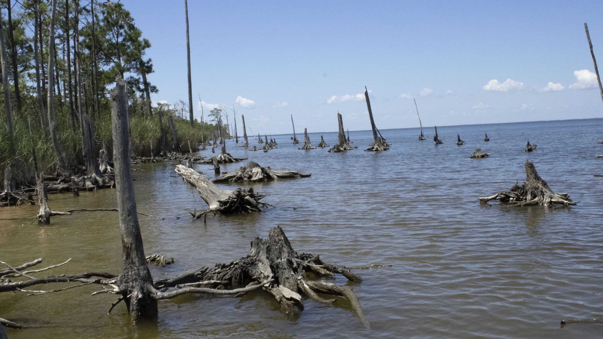
People Perceive Coastal Change Processes As More Severe When Processes Visualized In Aerial Photographs
New research by Rosemary Keane (PRTM PhD Student) and Jordan W. Smith (CGA Faculty Fellow) explores the ability of different geovisualization mediums such as digital elevation models (DEM) and aerial photography to convey information about beach erosion and shoreline change. The research, which was recently accepted for publication in Coastal Management suggests individuals perceive coastal change processes as more severe when those processes are presented through photographs, particularly aerial photographs, relative to DEMs and graphic illustrations.
Reference:
Keane, R., & Smith, J. W. (in press). Information presentation and perceived severity of climate change driven coastal morphological change. Coastal Management.
Abstract:
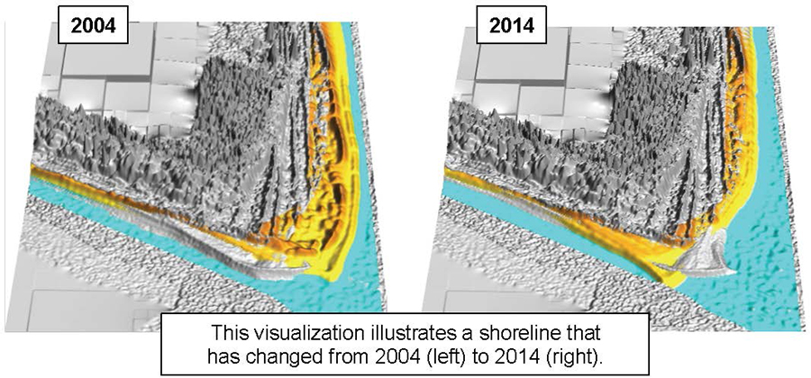
The visual presentation of information is valuable for coastal climate change planning given the difficulties of conveying environmental changes that vary in scale and complexity. The use of visual imagery alone, however, is not sufficient to illustrate complex geophysical processes; imagery must be accompanied by supporting information that makes it understandable. The influence of supporting information on perceptions of coastal morphological change processes are explored through an experiment delivered to coastal recreationists. The study examined two types of supporting information (graphs and numeric values) that can be used to inform individuals about either beach erosion or shoreline movement. Supporting information was presented alongside four imagery types: human perspective digital elevation models (DEMs), human perspective digital photographs, aerial views of DEMs and aerial photography. The analysis suggests neither the use of graphs nor numeric values influenced respondents’ perceptions of coastal environmental change. However, perceptions varied significantly across imagery type; human perspective digital photographs and aerial photographs yielded higher ratings compared to human perspective DEMs and aerial views of DEMs. The results suggest supporting information representing increasingly severe rates of beach erosion and shoreline movement does not translate into perceptions of increasingly dramatic geophysical processes; this is consistent with previous empirical findings. The results also suggest individuals perceive coastal change processes as more severe when those processes are presented through photographs, particularly aerial photographs. Scientists, educators and coastal land use managers struggling to communicate the magnitude and severity associated with coastal geophysical processes are advised to use comparative aerial photography when possible.
- Categories: