
geovisualization

an orange snow shovel cuts through a pile of snow

Nov 15, 2022

New Visualization Tool Helps Weather Forecasters and Researchers More Easily Identify and Study Bands of Heavy Snow

Geospatial Analytics Ph.D. candidate Laura Tomkins developed a new way for meteorologists and atmospheric scientists to quickly and easily distinguish heavy snow from mixed precipitation in weather radar imagery, to improve understanding of snowfall during winter storms.

Screenshot of the virtual tour of Geospatial Analytics Geoviz Lab 5111 Jordan Hall.

Jul 29, 2022

DELTA Produced Virtual Tours Promote Exploration

Thanks to a Virtual Tours Express Grant from DELTA, our flagship Geovisualization Lab can now be explored in 3-D by anyone online.

Tangible Landscape

Oct 29, 2019

First Official Stable Version of Tangible Landscape Software Released

Developers at the Center for Geospatial Analytics have announced the first stable release of Tangible Landscape, the center’s signature open source system for hands-on geospatial modeling: Tangible Landscape 1.0.0.

tangible landscape workshop - Center for Geospatial Analytics at NC State University

May 20, 2019

Can a Hands-on Model Help Forest Stakeholders Fight Tree Disease?

Participants don't need coding or software expertise to use Tangible Landscape, a 3D model that allows them to try out different approaches for stopping sudden oak death, which has killed millions of trees.

Tangible Landscape system with 3-D imagery

Jul 17, 2018

Second Edition of Tangible Modeling Book Released

Newly released this summer, the second edition of Tangible Modeling with Open Source GIS provides new tools for running powerful geospatial simulations with physical models and 3-D imagery.

A photo of Payam Tabrizian as he looks on while Joan Iverson Nassauer experiments with designing a landscape using colored felt.

Apr 28, 2017

Getting in Touch with the Designer in All of Us

Payam Tabrizian is a landscape architect and Ph.D. student in Design, but he firmly believes that designing landscapes shouldn’t be limited to the professionals. His research bridges disciplinary gaps between design and the geospatial and cognitive sciences.

A user in an immersive virtual environment resembling a city

Mar 28, 2017

Revealing the Research Possibilities of Virtual Reality

Imagine you are standing in a downtown city plaza, surrounded by tall buildings, steel sculptures, and storefronts. Perhaps it’s your lunch break, and you’ve come to the plaza to take…

A screenshot from a Tangible Landscape webinar

Sep 8, 2016

GIS at Your Fingertips: Tangible Landscape Webinar Showcases Open-source Solutions

On August 31st, the GeoForAll Laboratory at the Center for Geospatial Analytics presented a live multi-media webinar to a broad audience of online viewers, showcasing Tangible Landscape and describing how researchers around…

A photo showing a live demonstration of the Tangible Landscape at the North Carolina State University Center for Geospatial Analytics

Jul 6, 2016

Tours of Geovisualization Lab Spark Discovery and New Partnerships

When you step into the Geovisualization Lab at the Center for Geospatial Analytics at NC State, maps leap off computer screens onto touchable, interactive displays. Virtual reality headsets let you enter landscapes…

Two images of the Tangible Landscape at the North Carolina State University Center for Geospatial Analytics

Jan 4, 2016

First-Of-Its-Kind Book on Tangible Modeling Puts the Power of Open Source GIS in Your Hands

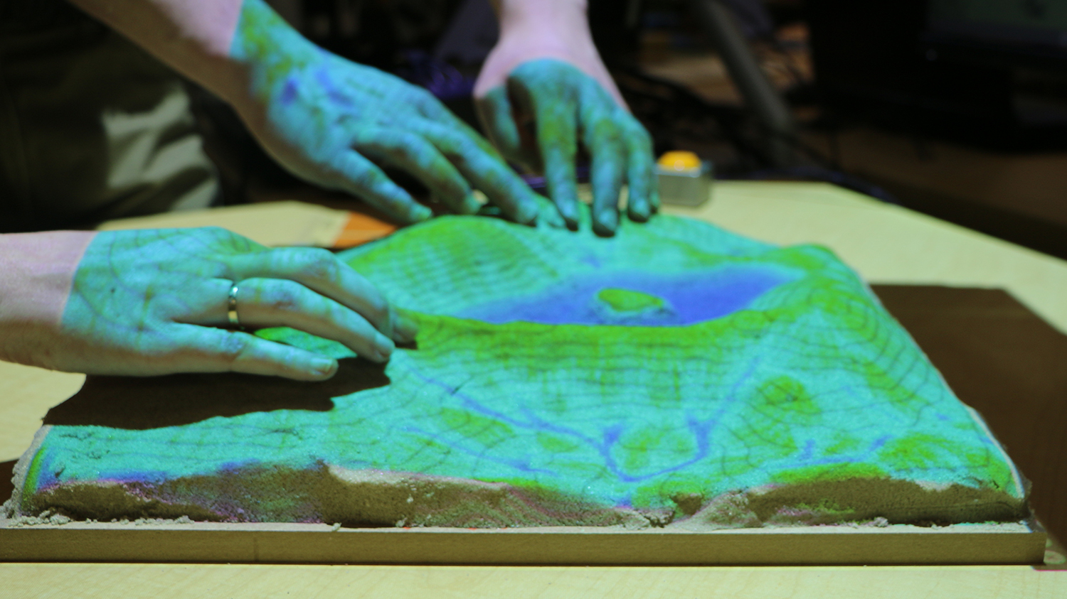
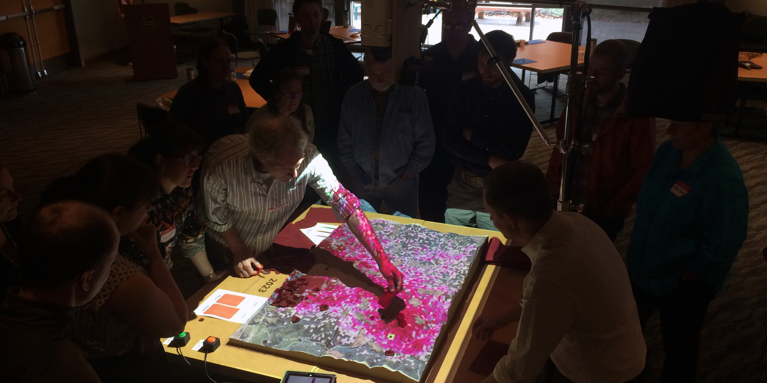
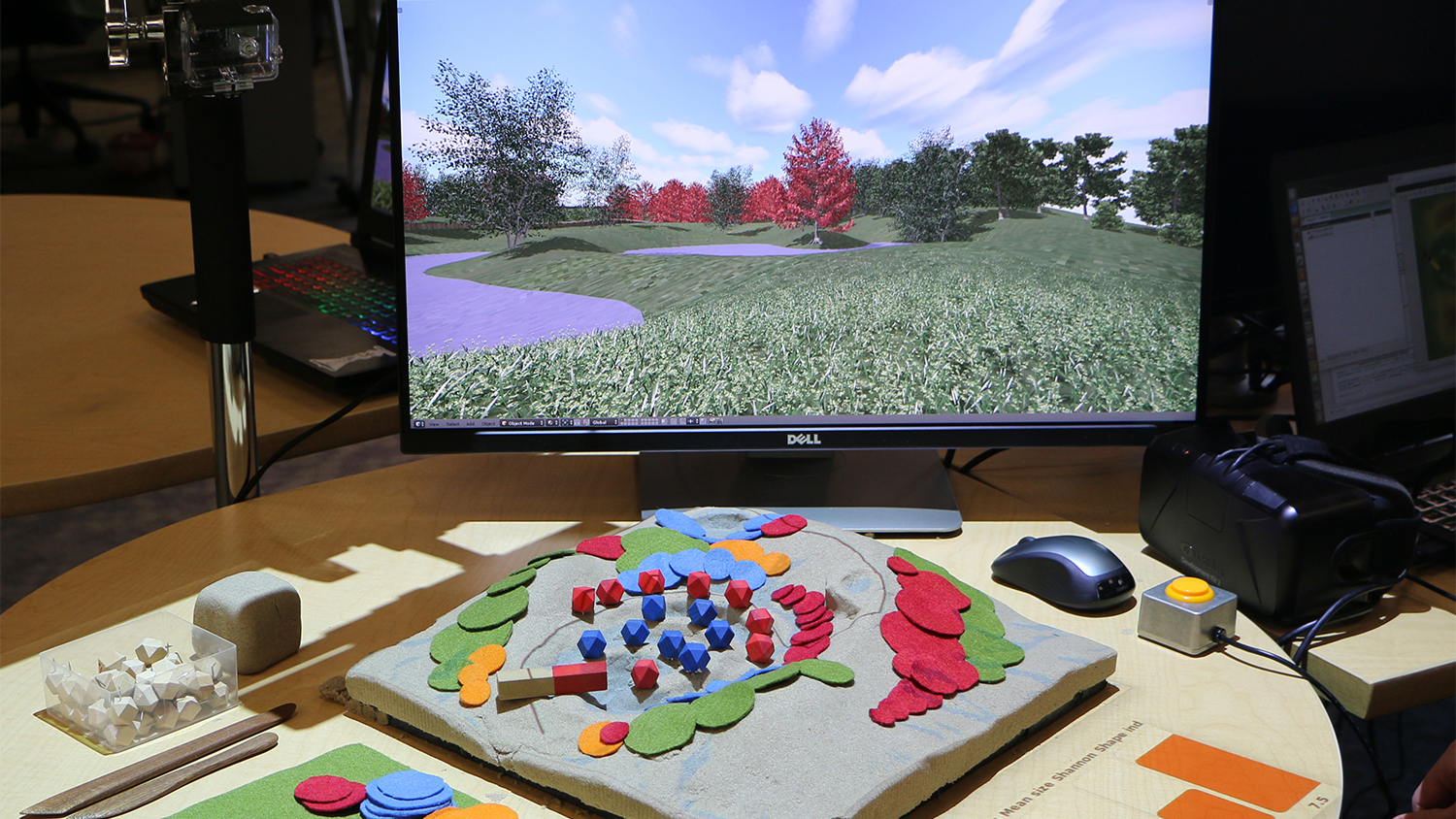
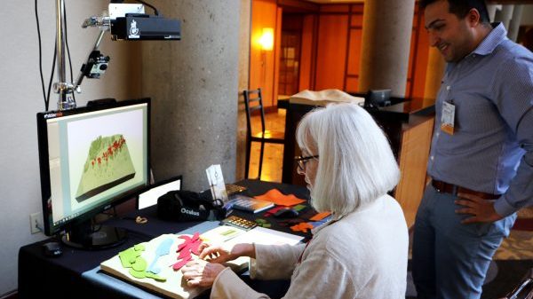
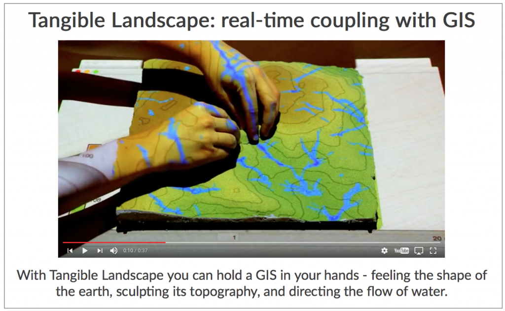
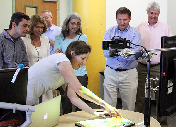
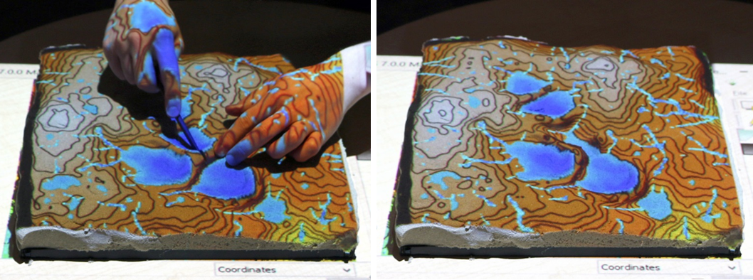
Center researchers and co-authors Anna Petrasova, Brendan Harmon, Vaclav Petras, and Helena Mitasova have published “Tangible Modeling with Open Source GIS,” a groundbreaking new book on the Tangible Landscape, an innovative tangible geospatial…