This article is part of the Not Your Average Summer series highlighting the internship experiences of both undergraduate and graduate students from the NC State College of Natural Resources.
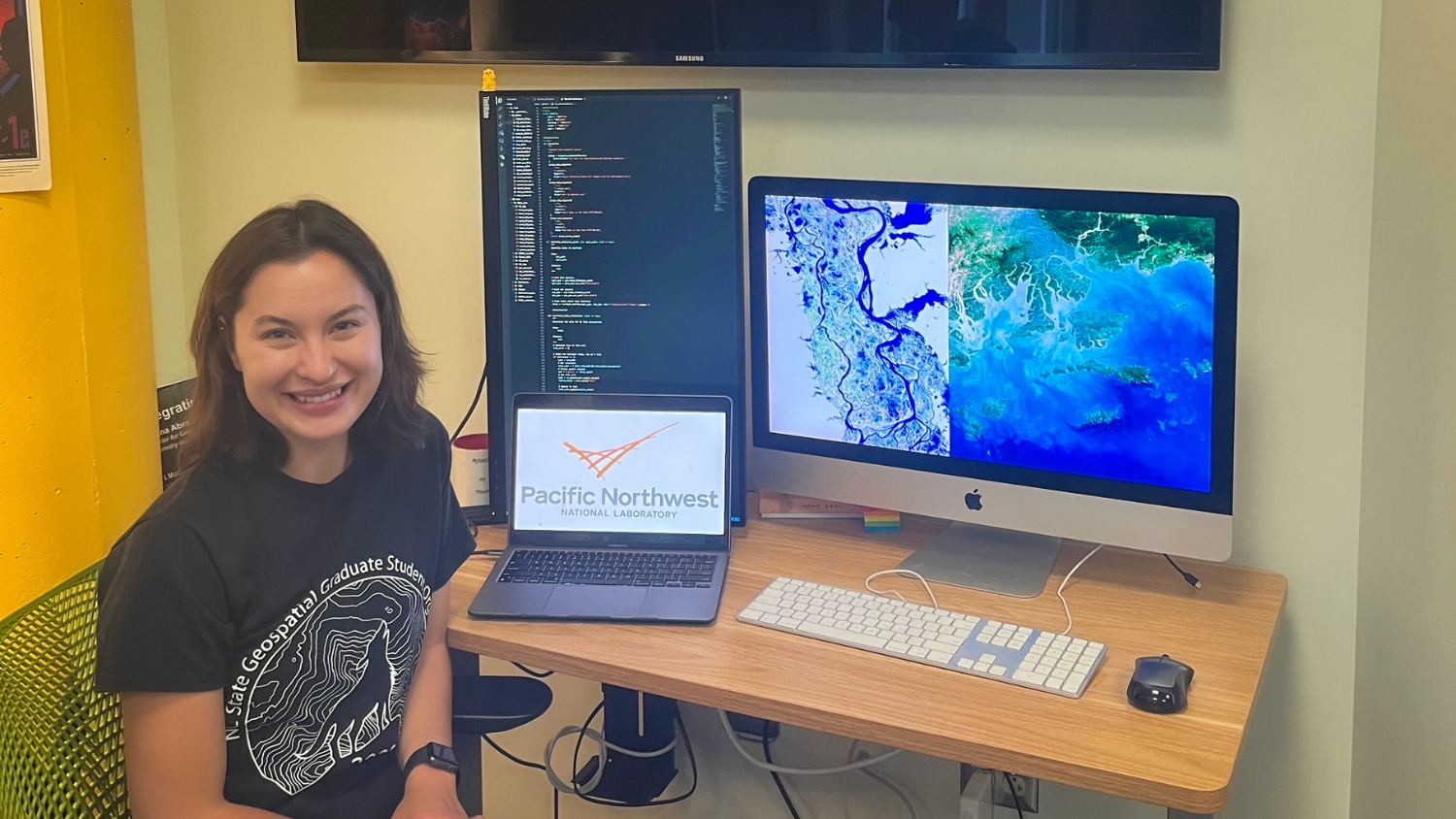
Jenna Abrahamson is a Ph.D. student in the Center for Geospatial Analytics. She received her bachelor’s from the University of St. Thomas – Minnesota in 2019 with a degree in environmental science and a concentration in geology. She is a recipient of the National Science Foundation Graduate Research Fellowship and NC State University Graduate Research Fellowship.
This summer, Abrahamson is working remotely for the Pacific Northwest National Lab (PNNL) as a Ph.D. intern on its terrestrial and aquatic integration team under the Earth and Biological Sciences Directorate. She is part of a large interdisciplinary group that is focused on studying a variety of earth system processes in ecosystems that experience seasonal to daily flooding.
Check out the Q&A below to learn more about Abrahamson’s experience with the Pacific Northwest National Lab and the role of the College of Natural Resources in helping to prepare her for the internship.
What kinds of things are you doing during your internship?
My key role in this internship has been developing remote sensing methods to predict and characterize flooding and inundation across these different ecosystems to better understand how changes in surface water impact biogeochemical processes in a changing climate. To this end, I have spent the summer using satellites to explore areas such as coastal wetlands, tidal zones and non-perennial streams across the United States to develop methods to better monitor short-term flooding events using machine learning and time series techniques. This has involved creating a code pipeline that efficiently synthesizes satellite data from multiple sources and produces time series of inundated areas at a variety of spatial scales.
How did you find out about this internship and why were you interested in it?
For my dissertation, I have been exploring the impact of short-term flooding events on biogeochemical cycles using a variety of interdisciplinary methods. I presented my initial research into this topic at the American Geophysical Union (AGU) Annual Conference in Chicago this past December, where I networked with a scientist from PNNL who was conducting similar research. This interaction and our shared interest in the same science questions led to my internship at PNNL. I was interested in this opportunity not only because the science was directly in line with what I am interested in, but because I had a desire to experience life at a national lab and to see if it was a career path I would be interested in pursuing after graduation.
In what ways did the College of Natural Resources prepare you for this internship?
The College of Natural Resources, and more specifically my time in the Center for Geospatial Analytics, prepared me for this internship by giving me a solid foundation in remote sensing, coding, and spatial data science. For this internship, I have been the primary geospatial and remote sensing scientist on a team of interdisciplinary earth and biological scientists. I would not have been able to take on this role without the preparation and training my lab and the center have given me over the past two years.
One of the many skills I have grown more proficient in during my time in the College of Natural Resources is how to conduct large scale spatial analyses using languages such as R and Python. I have also gained a tool belt of data mining and statistical methods that I feel comfortable applying to various science questions and problems. These skills have been crucial to me during my internship and are tools that I find myself regularly using and improving on every single day. During my internship thus far, I’ve had the opportunity to learn from other scientists about what data and insights are most useful for applications in biogeochemistry, how the commercial satellite industry may impact scientific studies and how artificial intelligence can help guide entire sampling designs.
What are your long-term goals and how does this internship factor in?
My long-term career goal is to finish my Ph.D. and continue working with big data and data science methods in remote sensing and earth science applications. Through this internship, I have had the opportunity to experience how science projects are conducted at a National Laboratory, and more broadly, how science is conducted at the federal level under the U.S. Department of Energy. Not only that, but I have gotten to meet and interact with prominent scientists in my field and talk with them about what techniques and methods they consider state of the art and what they think the future of this field holds, especially considering advances in artificial intelligence and computing. Overall, this internship has been fundamental in helping me gain firsthand experience in how science is conducted at the government level and taught me what the day to day looks like as a scientist at a national lab.
What’s the most important thing you’ve learned while at NC State?
The most important thing I have learned while at NC State, beyond the technical skills, is how to navigate interdisciplinary teams of scientists and effectively communicate to and learn from a variety of audiences. Being a part of an interdisciplinary team means that the people I work with often have backgrounds and expertise across different disciplines. However, being a geospatial/remote sensing data scientist means knowing how to collaborate and learn from others in different fields. Whether its scientists that specialize in biogeochemistry, hydrology, or ecology, their knowledge and expertise directly influence my work and informs how I approach my own research and science questions. This multifaceted approach to science is something that has been instilled in me as a student in the center for Geospatial Analytics and is one of the most important things I think I have learned how to embrace while at NC State.
- Categories: