Partnerships in GIS Service Learning

The Center for Geospatial Analytics is celebrating the Fall 2017 graduation of 12 professional master’s students in Geospatial Information Science and Technology (MGIST)! During their final semester, each student in the MGIST program completes a service-learning capstone project, working directly with a community or industry partner to apply their knowledge and skills to a real-world problem. Service learning differs from community service, explains Charlynne Smith, instructor of the capstone course, in that students work collaboratively with their external partner to solve a problem together. In the process, everyone learns.
This semester, capstone topics ranged from optimizing wildfire response time to tracing coastal inlets, discovering illegal marijuana plots and archeological sites, protecting property from wildfire, supporting affordable housing and more. Read on for a glimpse into the exciting work of our professional master’s students!
Reducing response time to wildfire hazards
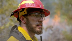
When managing wildfires, response time matters. MGIST student Eric Carlton worked with the Arkansas Forestry Commission to create a web mapping application that can help the commission decide where best to locate work centers that can respond quickly to fires. Using data about internet availability across the state of Arkansas, wildfire density over the past four years, and past fire intensity, Eric developed a system that synthesizes information for future planning and can calculate service areas for proposed and current work centers. With the application, decision-makers can quickly see what forested areas would be accessible by road within 15, 30, 45, or 60 minutes from a work center.
Tracing the shifting sands of coastal inlets
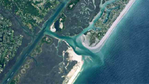
The North Carolina coast is home to over twenty dynamic inlets, where ocean waters rush through breaks in barrier islands to connect the sea to scenic bays. These inlets by nature are highly variable; their channels shift over time as sand erodes in some areas and builds in others. MGIST student Matt Ayres partnered with NC Sea Grant to create a web mapping application that serves not only as an 80-year visual history of Mason Inlet in Wilmington but also as a planning tool can help predict how the inlet may change in the future.
Matt manually scanned into a computer, and standardized to the same spatial coordinates, scores of aerial photographs taken by the US Army Corps of Engineers between 2017 and 1938. He then created an online interactive map that allows users to turn layers of imagery on and off to easily compare years; drag a time slider to watch migration of the inlet across all years; or generate a highly accurate footprint of the inlet in one year (a geoprocessing tool creates a polygon showing where the inlet was) and use that footprint to measure how far the channel migrated over time.
“Having this imagery,” Matt says, “allows us to create long-range planning initiatives and help mitigate issues like we had at Shell Island,” where encroachment of the channel years ago threatened buildings including the Shell Island Resort. “Tidal inlets through the barrier islands create our most volatile shoreline changes,” says Spencer Rogers, Coastal Construction and Erosion Specialist for NC SeaGrant and Matt’s contact for the project. “Matt’s work serves a pilot study to help property owners, communities and coastal managers better visualize and accurately measure these rapid changes.”
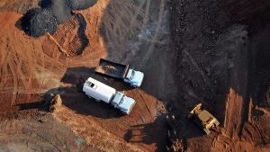
Finding illegal marijuana growing sites from the air

Searching for something small on the ground from an aircraft can be an immense challenge, and so being able to narrow the search area with guiding information can be a real time-saver. MGIST student Mike Dixon partnered with the NC Department of Public Safety to develop a method that will help the aviation units of the Drug Enforcement Agency, National Guard and NC State Highway Patrol search for and report illegal marijuana operations. To help these teams plan their flyovers, he pulled together data on land cover, road and trail networks and previously identified growing operations to generate a suitability index for marijuana growing sites across the state of North Carolina.
“We now have a measurable, repeatable decision-support analysis tool,” Mike explains. “So, for any operation you wish to conduct, you can point directly back to the data and say, ‘This is why we think this is a potential grow area.’” He also developed a mobile application for the project, so that personnel aboard surveilling aircraft can mark suspected locations with a digital pin and share notes with headquarters. The goal is to increase operational efficiency, Mike says, by reducing focus areas for the flights. In one section of the state, for example, his suitability analysis was able to reduce the possible search area by two-thirds.
Avoiding archeological sites during road projects
Honoring the cultural history of North Carolina includes making sure that new road projects do not encroach on sites of archeological significance. Yet, how can project managers efficiently reduce the risk of building in areas with as-yet-undiscovered artifacts? MGIST student Will Reckling partnered with the Durham-based archeology firm Legacy Research Associates to develop a geospatial tool that can help the NC Department of Transportation determine whether potential road corridors include probable archeological sites. The reusable tool considers land cover, slope, soil type, roads, and water bodies, as well as uses the results of on-the-ground “shovel tests” searching for artifacts in sample plots.
Predicting wildfire risk to property and resources near national parks

Wildfire-prone areas occur all over the US, including in and around national parks. When urban development increases alongside parks that practice wildfire suppression, the risk of fire at the border, and associated losses of property, can increase. To evaluate risks to resources at this so-called “wildland-urban interface,” MGIST student Megan Culler partnered with Center for Geospatial Analytics faculty fellow Jelena Vukomanvic and research associate Justin Shedd on a project for the National Park Service.
Megan used a variety of datasets, including one that tracks how often fires occur in an area and the amount of time elapsed since the last fire, to develop a web mapping application that allows examination of risk across a landscape. “Tools let the user buffer an area of interest [for example, around a park] and identify features within the buffer that are at risk,” Megan explains. “The web application can be used to estimate the potential impacts of a wildfire on surrounding communities, threatened and endangered species habitat and cultural resources.”
Mapping the need for affordable housing

According to the NC Housing Coalition, about 500 thousand households across the state spend more than 50% of their income on housing. Even more spend greater than 30%, the threshold for being considered cost-burdened. To reveal whether cost-burdening varies spatially, MGIST student Donta’ Fairey partnered with the coalition to develop a Housing Insecurity Ranking that evaluates the number of cost burdened households facing eviction or foreclosure per county. He then created a web mapping application to “visualize areas of high affordable housing need and explore how evictions and foreclosures influence housing security.” The map also overlays congressional districts, with the names and contact information of representatives and senators who influence those counties. The NC Housing Coalition’s mission is to ensure that “every North Carolinian has a home in which to live with dignity and opportunity.” Says Donta’ of the outcome of his project, “This information can be used by the public, housing advocates and policy influencers to help facilitate positive change.”
And more!

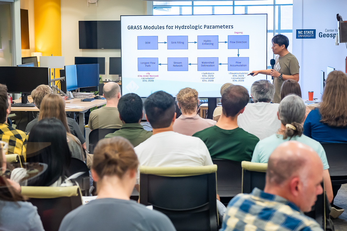
Many MGIST students this semester engaged with experts from NC State University, including the Center of Geospatial Analytics, to develop their capstone projects. Jacob Mouw partnered with center research associate Okan Pala to create a web mapping application that allows users to visualize patterns of energy consumption and energy sources in the nation’s power grid under different potential future scenarios. Zeke Krautwurst worked with Geospatial Analytics Ph.D. students Anna Petrasova and Vaclav Petras to develop a new method that will help students in the GIS/MEA 582 Geospatial Modeling course use Jupyter Notebook training modules while learning GRASS GIS software. Dan Wade helped the JC Raulston Arboretum move their data collection workflows to ArcGIS from the older software they previously used; his project included a web mapping application that will allow arboretum staff to visualize and keep track of all of their garden beds and plants. And Emily McNamar worked with NC State assistant professor of history Frederico Freitas on the NCSU Visual Narrative Initiative, creating a story map that details the historical patterns of colonization and reforestation in two national parks on the border of Brazil and Argentina.
Two students also worked with the North Carolina State Parks Grants Program. Eric Nutter and Vladimir Rusinovich mapped the locations of park improvement and recreation projects funded by NC State Parks across North Carolina and developed ways to calculate the walkability of areas surrounding those projects. Using this walkability analysis, they could identify neighborhoods where community members could walk to, for example, new playgrounds and water sports facilities.
Congratulations to all of our graduating MGIST students on their success!