Feb 3, 2020
Tracking Tiny Organisms Using Big Data
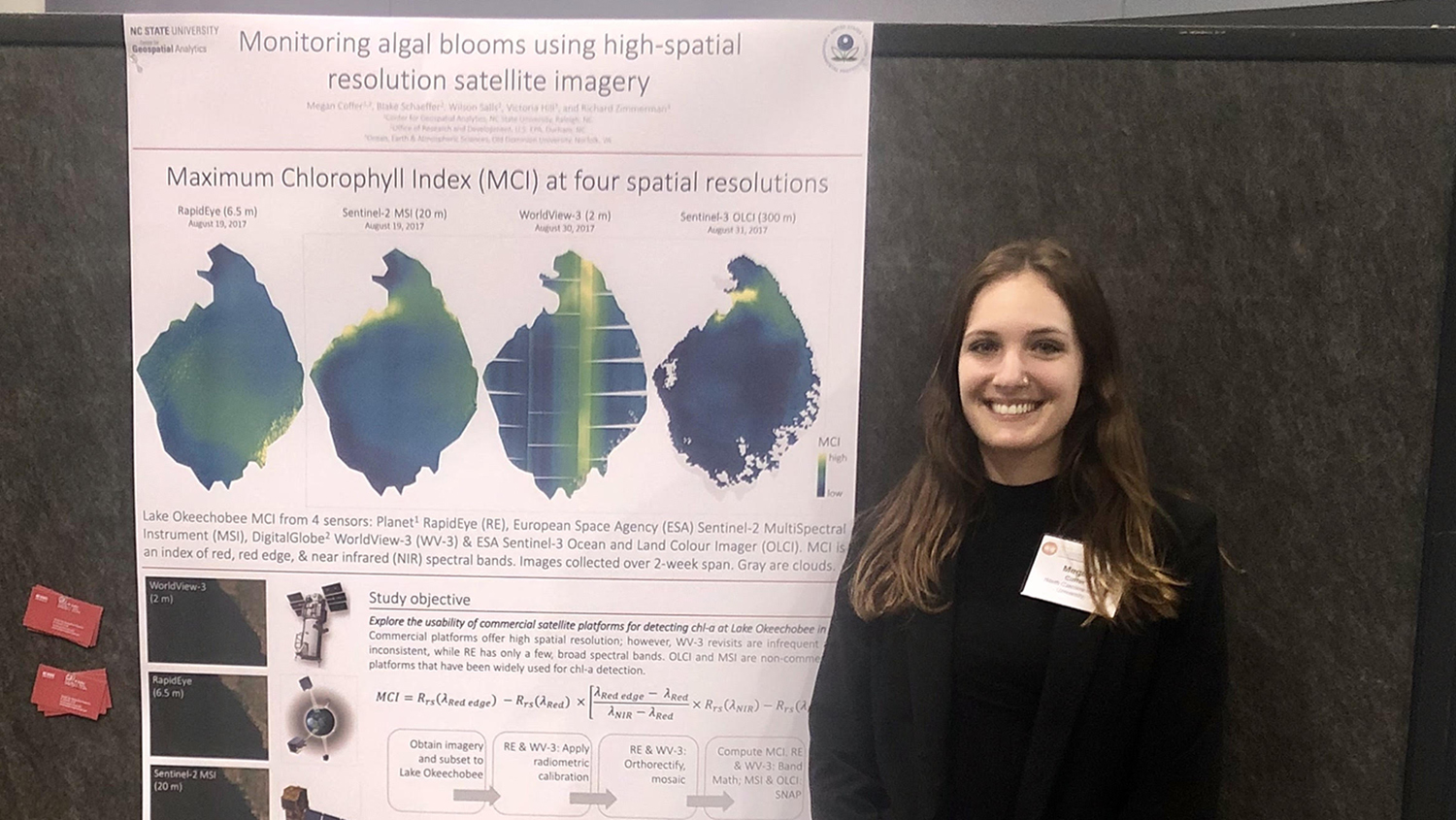
Geospatial Analytics Ph.D. student Megan Coffer has developed a first-of-its-kind workflow for processing data from commercial satellites, which will advance understanding of large-scale cyanobacterial blooms.