Untangling the Complexity of Stormwater Problems
Editor’s note: The following is a guest post by Geospatial Analytics Ph.D. student Corey White.
Rapid urban development and the increasing frequency of severe precipitation events are leaving the Triangle Region of North Carolina vulnerable to increased flooding and water quality degradation. As the Triangle continues to grow in population and development increases, so does the total volume of stormwater runoff city planners and regulators need to manage. News headlines from around the globe (Germany and China, July 2021) exemplify how previously benign stormwater issues can result in catastrophic damages and loss of life.
In the Triangle, NC, planning and policy professionals from around the region are addressing these issues together to co-design an innovative serious game called TomorrowNow. TomorrowNow aims to increase the level of public engagement in stormwater management by bringing big data and advanced geospatial models to the fingertips of planners, policymakers and community members. The goal of TomorrowNow is to facilitate the co-creation of knowledge and democratize decision-making through the process of geospatial participatory modeling.
As part of the co-development process, two workshops were held with stakeholders at the Center for Geospatial Analytics in 2018 and 2019 to develop goals, research questions and mental models surrounding stormwater management and the co-development of TomorrowNow.
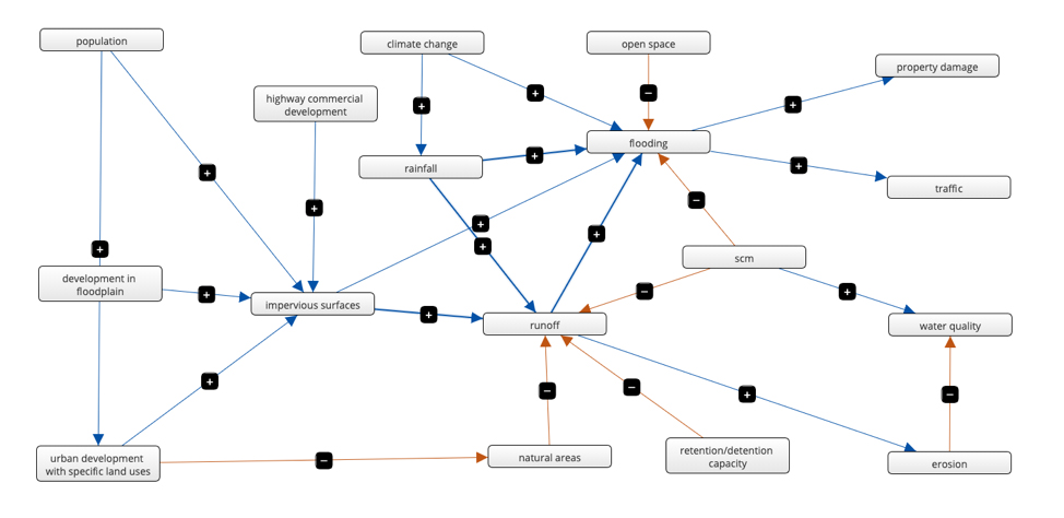
During the workshops, researchers identified that stakeholders used a wide range of language to describe stormwater management. TomorrowNow will aim to untangle this complexity to remove language differences as a potential barrier to collaboration. For example, data suggest that focusing on impervious surfaces rather than urban development to manage stormwater runoff could increase the acceptance of a proposed idea.
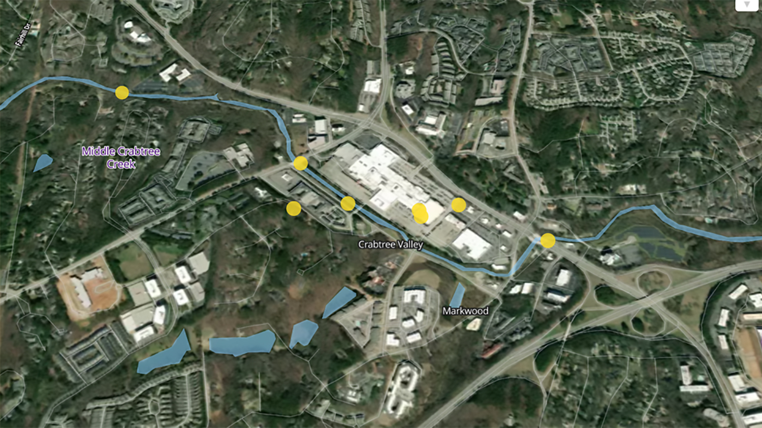
Stakeholders also created mental models to represent their perceptions of what influences stormwater issues in the Triangle and identified the locations of stormwater problem areas. Analysis of these models and problem areas revealed that management decisions are influenced both by the size of the area of interest and the level of detail considered when addressing stormwater problems (spatial framing). For example, impacts on regional water quality were often not considered in the context of localized flooding issues. Conversely, stormwater control measures were generally considered for regional stormwater management without regard to specific flood-prone locations.
TomorrowNow aims to play with the concept of spatially framing problems by encouraging the collaboration of bottom-up (grassroots) and top-down (policy) players. For example, in the game players will face problems at different spatial scales with a limited set of actions filtered by the spatial scale. Each player can develop their own solutions to various problems and understand the wider impacts of their choices.
TomorrowNow represents a new way of thinking about traditional city/county planning meetings (public engagement) by allowing community members to participate on their own time and focus on the locations that are important to them. To learn more about the results of the workshops, read the full (open access) publication “Spatially Explicit Fuzzy Cognitive Mapping for Participatory Modeling of Stormwater Management” recently published in the MDPI journal Land special issue Towards Sustainable Land-Water Interactions in the Anthropocene: The Role of Stakeholder Engagement and Participatory Modelling.