
jbvogler

A visualization of shoreline change from 2004 to 2014

Mar 20, 2015

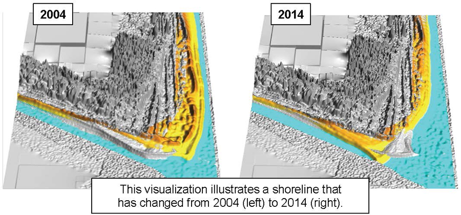
People Perceive Coastal Change Processes As More Severe When Processes Visualized In Aerial Photographs

New research by Rosemary Keane (PRTM PhD Student) and Jordan W. Smith (CGA Faculty Fellow) explores the ability of different geovisualization mediums such as digital elevation models (DEM) and aerial…

A photo of Georgina Sanchez

Mar 17, 2015

Georgina Sanchez Selected As Southeast Climate Science Center Global Change Fellow for 2015-2016

Georgina Sanchez, PhD student in the Center for Geospatial Analytics and the Dept. of Forestry and Environmental Resources, has been selected as a Southeast Climate Science Center Global Change Fellow…

A photo of Hugh Devine using the Tangible Landscape at the North Carolina State University Center for Geospatial Analytics

Mar 10, 2015

Hugh Devine Receives NC State’s Alexander Quarles Holladay Medal for Excellence

Dr. Hugh Devine has been selected to receive the 2015 Alexander Quarles Holladay Medal for Excellence. This award recognizes NC State faculty members who have made outstanding contributions to the University through…

A photo of six NC GIS conference attendees taken in 2015

Mar 5, 2015

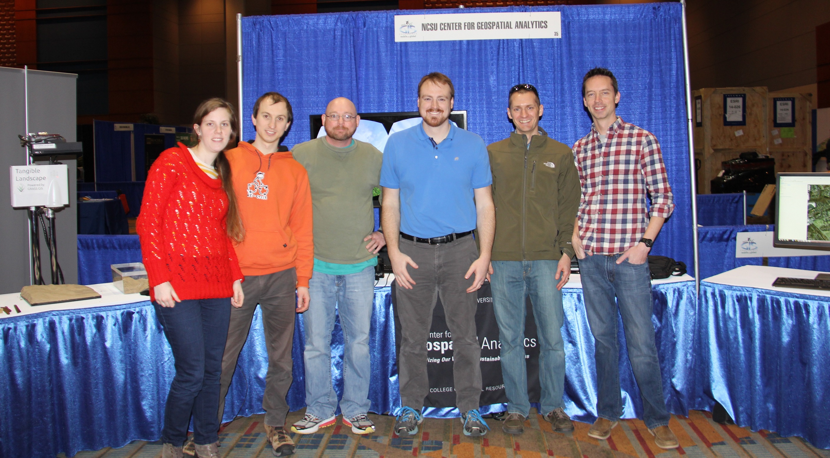
NC State And The Center Shine At The 2015 NC GIS Conference

NC State and the Center for Geospatial Analytics were well-represented at the recent NCGIS Conference 2015 held at the Raleigh Convention Center.  Center students, faculty and associates participated in the conference, including…

A headshot of Francesco Tonini

Feb 20, 2015

Postdoc Francesco Tonini Wins 2014 Outstanding Doctoral Dissertation In The School of Forest Resources and Conservation At The University of Florida

Just announced, Center postdoctoral scholar Francesco Tonini‘s doctoral dissertation entitled, “Modeling the Spread and Geographic Distribution of Invasive Termites in Florida,” has been selected as the 2014 Outstanding Dissertation in…

A map of proposed fire management zones in the Southeastern United States

Feb 19, 2015

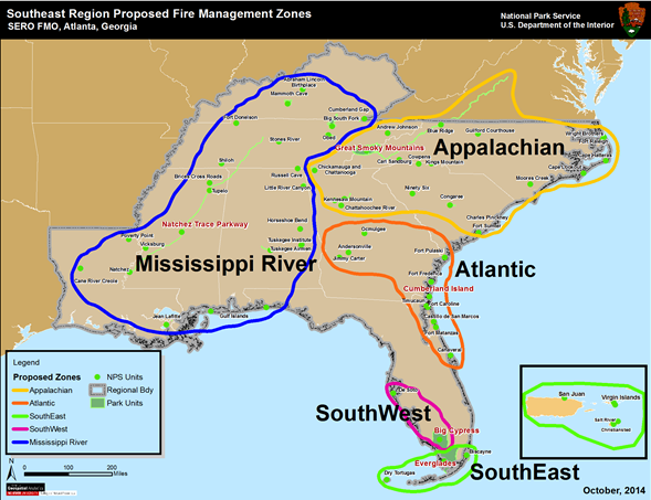
National Park Service Fire Management Office Adopts New Wildland Fire Management Zones For Southeast US

The Southeast Region of the National Park Service Fire Management Office recently adopted new wildland fire management zones (see map) that were developed in collaboration with Center researcher, Justin Shedd.…

Three images of users trying an Oculus Rift virtual reality headset during a UniSA workshop

Feb 13, 2015

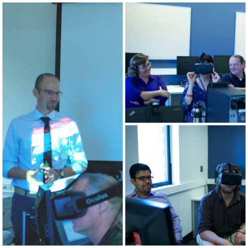
Center Fellow Leads International Training On Immersive Virtual Environment Technology

Center Faculty Fellow Jordan Smith led a series of training sessions on the use of immersive virtual environment technology at the University of South Australia in Adelaide. The week-long training event (February 9-13)…

A chart showing the predicted biomass categorized by LiDAR point density reduction with red horizontal line indicating the median of observed biomass.

Feb 6, 2015

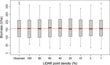
As Little As 1 Percent Of LiDAR Can Be Used To Effectively Map And Estimate Urban Tree Biomass

Light Detection and Ranging (LiDAR) data is being increasingly used as an effective alternative to conventional optical remote sensing to accurately estimate aboveground forest biomass ranging from individual tree to…

A chart showing annual operating expenditures

Jan 7, 2015

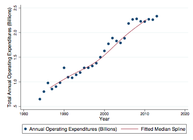
Nation’s State Park Systems Likely to Experience Reduced Operating Budgets With U.S. Adoption of Climate Change Mitigation Policy

Recent research from Jordan W. Smith (CGA Faculty Fellow), Yu-Fai Leung, Erin Seekamp (Dept. of Parks, Recreation and Tourism Management) as well as Chelsey Walden-Schreiner and Anna Miller (PhD students…

A poster for the film Shored Up

Dec 12, 2014

New NC State Chapter of the International Association of Society and Natural Resources Receives Competitive Science Communication Award

The newly formed NC State chapter of the International Association of Society and Natural Resources (IASNR) was awarded a competitive science communication grant to host a film screening and panel discussion on…