
Megan Skrip

Ashwin Shashidharan

Sep 8, 2017

Where a Great Idea Can Take You

Ph.D. student Ashwin Shashidharan interned with the world’s top GIS software company this summer and continues to gain recognition for his award-winning research in computer science.

Downtown Raleigh

Aug 30, 2017

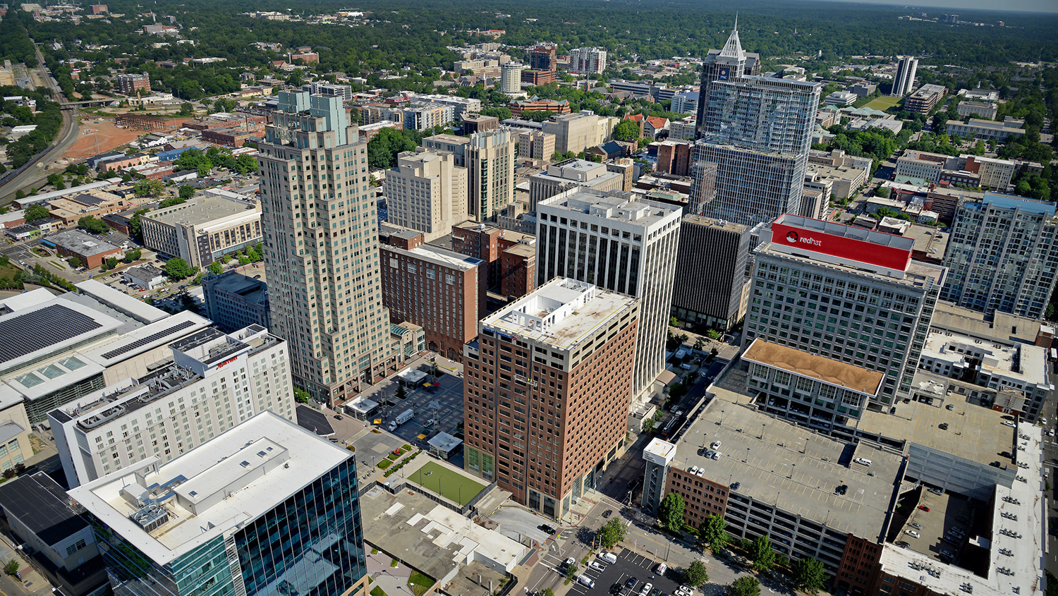
InVision Raleigh Lets Urban Planners See the Future

Center researchers led by faculty fellow Perver Baran partnered with a team from the City of Raleigh to create a revolutionary 3-D tool on the web for visualizing development alternatives.

MGIST students at orientation

Aug 14, 2017

New Enrollment in Online Master’s Degree Breaks Previous Record

This Fall, the center welcomes its largest group of new students to the professional master's program in Geospatial Information Science and Technology. Thirty-nine students are newly enrolled, breaking last Fall's record of 32.

An image of a map of North Carolina

May 19, 2017

Service Learning in Action

During their final semester, each master's student in Geospatial Information Science and Technology completes a service-learning capstone project.

A photo of Payam Tabrizian as he looks on while Joan Iverson Nassauer experiments with designing a landscape using colored felt.

Apr 28, 2017

Getting in Touch with the Designer in All of Us

Payam Tabrizian is a landscape architect and Ph.D. student in Design, but he firmly believes that designing landscapes shouldn’t be limited to the professionals. His research bridges disciplinary gaps between design and the geospatial and cognitive sciences.

The Memorial Belltower at North Carolina State University on a spring day

Apr 12, 2017

Center Graduate Students Inducted into Forestry Honor Society

Four students from the Center for Geospatial Analytics were recently inducted into Xi Sigma Pi, the Forestry Honor Society, during the local chapter’s 77th annual banquet held at the NC State…

Megan Amanatides and Christiana Ades before going out for fieldwork in the Sacramento San-Joaquin Delta in California.

Apr 12, 2017

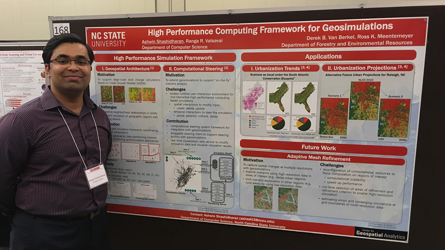
Center Master’s Students Recognized for Their Work in Remote Sensing

Two center graduate students were recently awarded valuable scholarships recognizing their research and academic excellence. Megan Amanatides has won the 2017 Scholarship Award from the North Carolina Association for Environmental Professionals…

Okan Pala looks on as students collaborate during a simulated drill in a disaster management class at the North Carolina State University Center for Geospatial Analytics

Apr 10, 2017

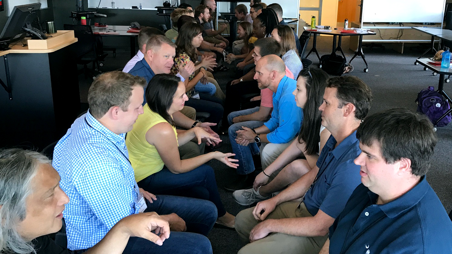
Disaster Response Drill Trains Next Generation of GIS Professionals

When disasters strike, it’s important to be prepared. Responses can hinge on the ability of skilled, agile GIS teams to swiftly map and communicate the locations of impacts, for decision-makers…

A user in an immersive virtual environment resembling a city

Mar 28, 2017

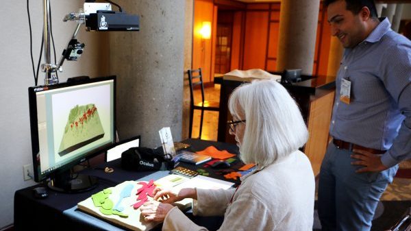
Revealing the Research Possibilities of Virtual Reality

Imagine you are standing in a downtown city plaza, surrounded by tall buildings, steel sculptures, and storefronts. Perhaps it’s your lunch break, and you’ve come to the plaza to take…

A photo of Jason Matney

Mar 22, 2017

Ph.D. Student Jason Matney Accepted to 2017 UCGIS Summer School

Center Ph.D. student Jason Matney (Dept. of Forestry and Environmental Resources) has been accepted to attend a select training program in CyberGIS held at the University of Illinois at Urbana-Champaign…