Forecasting Landscape and Environmental Change
Researchers Design Simulation Tool to Predict Disease, Pest Spread
A team led by Research Scholar Chris Jones developed a computer simulation tool called PoPS to predict pest and disease attacks on crops or forests, and to test when and where to apply pesticides or other management strategies to contain them.
Where There’s Smoke: Reducing Downwind Impacts of Prescribed Burns
New research by Geospatial Analytics Ph.D. student Kate Jones will use geospatial modeling and interactive data visualization to help fire managers consider the vulnerability of communities downwind of prescribed burns.
Multi-Model Approach Could Help Farmers Prepare for, Contain PEDV Outbreaks
New research co-authored by Research Scholar Chris Jones and Faculty Fellow Gustavo Machado shows that a three-model approach could help farmers prevent the spread of PEDV in pigs. One of these models is the Center's signature PoPS (Pest or Pathogen Spread) model.
Ecologist: People Should Prepare for Landscapes to Change
In a new book, Faculty Fellow Rob Scheller describes how land managers and communities should expect landscape change and plan for it.
First Official Version of PoPS (Pest or Pathogen Spread) Model Released
Developers at the Center for Geospatial Analytics have announced the first stable release of the Pest or Pathogen Spread model (PoPS 1.0), the Center’s signature open source system for forecasting the spread of insect pests and disease and for testing control strategies.
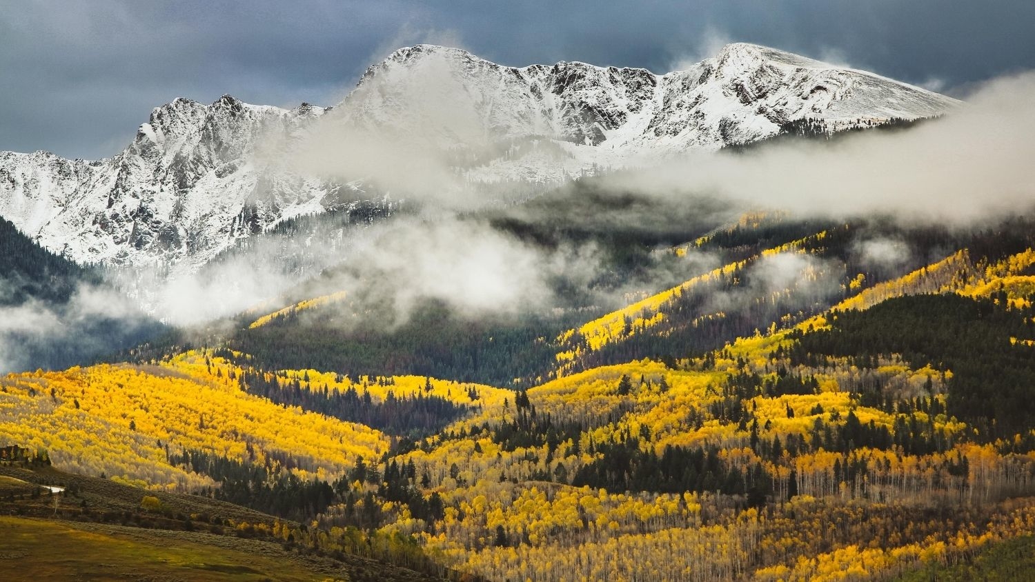
Colorado’s Famous Aspens Expected to Decline Due to Climate Change
Recent research by Geospatial Analytics Ph.D. student Nikki Inglis and Faculty Fellow Jelena Vukomanovic predicts quaking aspen trees, known for their brilliant foliage in fall, will visibly decline along three scenic drives in Colorado.
Faculty Focus: Nelson to Help USDA Guide Agricultural Innovation
Faculty Fellow Natalie Nelson was selected by the US Department of Agriculture to serve as one of 11 subject matter experts for the USDA’s Agriculture Innovation Agenda. Her expertise in machine learning and data science will inform proactive strategies to prevent crop loss.
Undergrad Position Available for Urban Systems Research
The Landscape Dynamics group at the Center for Geospatial Analytics is recruiting an NC State University undergraduate to assist with ongoing urban systems research. Applications are due July 31, 2020.
Urban Growth Model FUTURES 2.0.0 Released
Developers at the Center for Geospatial Analytics have released the newest official version of the center’s signature open source software for modeling urban growth: FUTURES 2.0.0.
In the Battle Against a Spreading Forest Disease, Strategy Matters
Predicting and controlling the spread of disease requires the right geospatial tools. At a recent gathering of the Oregon Sudden Oak Death Task Force, over thirty representatives of government, academia, nonprofit groups and the timber industry experimented with two Center for Geospatial Analytics technologies that can help them do just that.