Tangible Landscape Research Honored by International Computer-Human Interaction Conference
Next April, a team from the Center for Geospatial Analytics led by doctoral student Garrett Millar will present their latest research with Tangible Landscape at the ACM SIGCHI Conference on Human Factors in Computing Systems, the premier international conference for Human-Computer Interaction. Their paper, “Tangible Landscape: A Hands-on Method for Teaching Terrain Analysis,” was recently awarded an Honorable Mention Award for CHI 2018, ranking their paper among the top 5% of all submissions to the conference.
According to the CHI 2018 Awards Chair, the conference received over 2500 submissions. Garrett and his team’s paper was chosen for inclusion in the conference through a competitive selection process, and 25 were chosen for Best Paper; 101 were chosen for Honorable Mention.
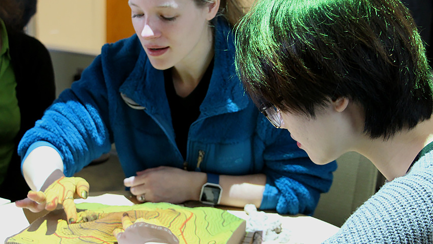
In their paper, Garrett and his co-authors experimented with using Tangible Landscape—a hands-on interface for geospatial modeling developed at the center––to teach Landscape Architecture graduate students key concepts in their field, specifically grading, geomorphology and hydrology. They found that physically interacting with the tangible model helped participants effectively work together and learn, with implications for advancing education about spatial concepts though tangible user interfaces. The full paper is available on ResearchGate. A 30-second video the group was asked to prepare for the conference demonstrates their methods:
Garrett is one of the first students accepted into the center’s new cutting-edge doctoral program in Geospatial Analytics. His co-authors include doctoral students Payam Tabrizian (Geospatial Analytics and Design), Anna Petrasova (Geospatial Analytics) and Vaclav Petras (Geospatial Analytics), center alumnus Brendan Harmon (now assistant professor of Landscape Architecture at Louisiana State University), center associate director of geovisualization Helena Mitasova (Department of Marine, Earth and Atmospheric Sciences), and center director Ross Meentemeyer (Department of Forestry and Environmental Resources).
Congratulations to Garrett and his co-researchers on their success!