Meet Vaishnavi Thakar, Our Center’s Newest Assistant Teaching Professor
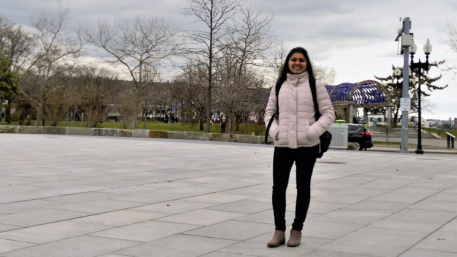
In Fall 2019, the Center for Geospatial Analytics welcomed Vaishnavi Thakar as our new assistant teaching professor of Geospatial Information Science and Technology. Thakar performs research applying spatial analysis to a range of pressing problems––from tracking the spread of COVID-19 to wildfire mitigation––and teaches a core course in the Center’s professional master’s (MGIST) program, GIS 550: Geospatial Data Structures and Web Services. She is also helping to shape the Center’s growing undergraduate offerings as a member of its Education Committee and was recently awarded a DELTA Rapid Design Grant.
We caught up with her to tell us more about her role at the Center, her recent research and the new class she has created.
We’re so glad to have you here at the Center! What has been the best part of your experience so far? What are you most excited about for the future?
Thank you! It’s been a wonderful experience to be a part of the Center for Geospatial Analytics. I started my journey with the Center in September 2019 and I am glad I’ve had a chance to be a part of teaching, research and service activities.
So far, I’ve updated GIS 550 to include the latest approaches for web mapping applications. I also developed a new graduate course, “Geospatial Data Science and Analysis,” and am working to create a version of that course for undergraduates as well. The aim is to help students understand the connections between theory and technology. Geospatial technology is always changing, so it’s essential for students to understand core concepts and what the software is doing; they can then keep up no matter how the technology changes.
To support this course development, I applied for and received a DELTA Rapid Design Grant. The title of my proposal was “Teaching Geospatial Data Analysis in a Distance Education Format,” and I’m looking forward to working with DELTA staff to design a new online course that will be offered sometime next year.
I’m also interested in collaborating on research and applied for a Research and Innovation Seed Funding (RISF) grant through NC State in Spring 2020. My aim is to launch a new research project developing spatial optimization models for mitigating forest disease spread. My proposal wasn’t funded during the last grant cycle, but I plan to apply again, and I encourage other teaching faculty to apply for this kind of funding as well!
NC State offers excellent opportunities for faculty to contribute and grow, by offering teaching and research grants as well as service opportunities. This experience motivates me and I am hopeful about the future. I look forward to continuing to contribute towards the Center’s MGIST program. I am excited to help shape the undergraduate GIS minor and develop new courses for this program as well. Besides, I look forward to working on different geospatial research projects that I have in line and hope to initiate new collaborations.
Your recently published research about the spread of COVID-19 during the initial outbreak in Washington used online news articles to analyze location information about new cases over time at a fine spatial scale. How did you develop this unique approach, and what is the biggest take-home message? Have you continued to study the geospatial aspects of COVID-19 spread?
I was receiving COVID-19 related news alerts on my phone since the first week of March 2020, and I was following those constantly. Every new COVID-19 positive case was reported by online news. As a GIS scientist, I was thinking about how I could use GIS to study the spread in both space and time. Non-availability of data is a big concern when working with geospatial applications. And when it comes to health-related data, privacy is a larger concern. But, unless you have data, you cannot do any analyses. I realized that this publicly available news was very valuable and, more importantly, spatial in nature! I was confident this could actually be used to perform spatial analysis and to understand where and when COVID-19 spread during the initial stage.
It was interesting to find a space-time pattern––wide community spread was observed in March. For a month, newer cases of COVID-19 appeared in closer locations, depicting Tobler’s first law of geography, while clustering together on a map. It was after a month that COVID-19 diffused from the center of the outbreak to locations further away. Interestingly, there were a few locations further away from the outbreak location, defying Tobler’s first law of geography. Detailed analysis showed that these cases had either come in close contact with already infected locations or had travelled internationally. If cases were found close to each other or far away from each other, the data told us why! It took some time for COVID-19 to spread from the first case’s location in Washington state to locations further away. This indicates that implementing mitigation strategies such as strict social distancing measures during the initial stage of the outbreak could have helped curb the spread to distant locations. Delays in mitigation will worsen the COVID-19 infection scenario.
This motivated me to submit an animation for the NC State Envisioning Research Image contest in the video and interactive category for faculty and staff. I created a video animation of COVID-19 spread in North Carolina, and received honorable mention in the faculty and staff category.
Yes, I am currently in the process of implementing geospatial sciences for understanding the spread of COVID-19. This work is ongoing; I hope to complete this soon and share the findings.
Your new special topics course debuted last semester––GIS 595: Analysis Methods for Geospatial Data Science. What does that course involve? What skills do students learn?
Yes, GIS 595 was first offered in Spring 2020 as a special topics course. We are offering it again this Fall as an eight-week course. We have also now made it a permanent course, titled GIS 532: Geospatial Data Science and Analysis. This information is for students, so that they don’t get confused when they see this course next semester with a different number and title!
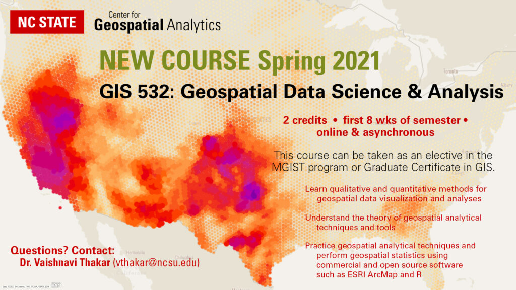
This course will provide the background and foundation necessary for geospatial analysis, with emphasis on spatial statistics. The focus of this course is application and interpretation of analytical methods, rather than derivation of techniques. Students will learn the nature of and challenges associated with geospatial data, implementation of various qualitative and quantitative methods for geospatial data, visualization and analyses, theory of geospatial analytical techniques along with hands-on assignments.
The Center is currently exploring developing an undergraduate minor that can be paired with practically any major at NC State. What is your vision for that new program?
The Center currently offers two undergrad courses––GIS 205: Spatial Thinking with GIS, and GIS 280: Introduction to GIS––and these enroll about 300 students per year. The minor would build on these courses to provide even more advanced training in GIS.
With geospatial data, it is important to learn geospatial theories and concepts and understand what makes geospatial data spatial and special, so that it makes more sense when GIS software produces a map or some results for you. It is also essential to be knowledgeable about the latest technology, and software and tools. Balancing both is what I envision focusing on. The idea is to develop a program focusing on theory and concepts in GIS and implementing those using cutting-edge tools and technology. I would like to develop and offer courses relating to geospatial data analytics, geospatial web applications and spatial databases. These courses will equip students with valuable skills needed for internships, full time positions in GIS as well as research in GIS. Students from any major at NC State will certainly find useful GIS applications for their area of interest.
What else would you like folks at our Center, across NC State, or in the wider geospatial community to know about you and your work?
Apart from developing and teaching graduate and undergraduate courses at the Center, I also engage in research activities. I am open to research collaborations in the areas of spatial optimization, spatial statistics, geocomputation, citizen science, and volunteered geographic information, spatial analyses of COVID-19 spread, resource management and disaster mitigation strategies. If you find any of my activities interesting, feel free to reach out!
And lastly, I would like to thank all my colleagues at the Center for their constant support and encouragement.
- Categories: