Postdoctoral Positions Available for Modeling the Spread of Invasive Species
The Center for Geospatial Analytics (https://geospatial.ncsu.edu) at North Carolina State University is seeking two Postdoctoral Research Associates in spatial data science and modeling the spread of invasive species. These new positions will join the Biological Invasions group of the Landscape Dynamics Lab led by Drs. Ross Meentemeyer and Chris Jones.
The Landscape Dynamics Lab specializes in forecasting landscape and environmental change with an emphasis on collaborating with stakeholders to explore what may happen in the future under different scenarios. We turn complex models and simulations into user-friendly discovery tools by developing sophisticated back-end algorithms and interactive front-end dashboards that visualize location data clearly and quickly. Our Biological Invasions team is coupling landscape forecasts of invasion dynamics with interactive decision analytics to help practitioners compare strategies to control spread. We cultivate an open-source community of users and developers who advance our methods and models and find new applications.
Multiple current projects involve partnering with the USDA Animal and Plant Health Inspection Service (APHIS) to build tools to quantify at-risk areas and inform their decisions regarding invasive pest and pathogen management. These and other research collaborations adopt a participatory modeling approach, wherein we work closely with individuals who both affect and are affected by invasive species to co-create data, forecasts, and visualizations that support real-world action.
This position is funded by a USDA NIFA grant titled “Leveraging Multi-scale, Multi-purpose Open Big Data and Machine Learning to Improve Forecasts of and Decision Support for Emerging Pest Threats” and an NSF Ecology of Emerging Infectious diseases grant.
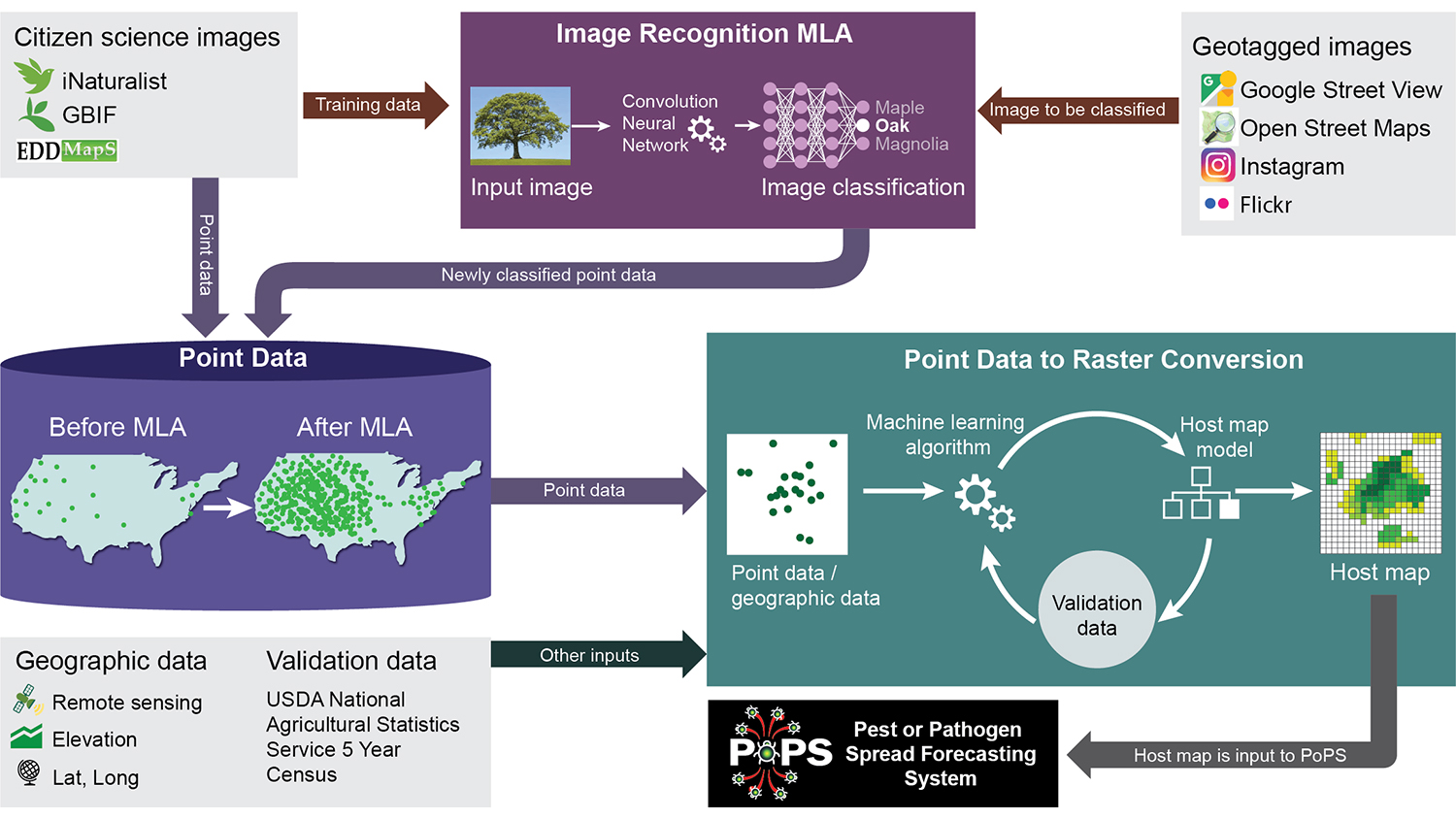
Primary tasks will include:
- Building machine learning algorithms for individual species predictions
- Automation of data collection and processing for near real-time applications
- Analysis of uncertainty related to data inputs for machine learning models
- Working with machine learning algorithms, and Google Street View
- Playing a leadership and contributing role in writing articles for submission to peer-reviewed journals.
There will also be opportunities to seek grant funding to develop related, independent research.
This position will focus on using environmental and satellite data coupled with machine learning algorithms to better understand where tree and crop species are located at large spatial scales. These forecasts feed into our PoPS forecasting platform (https://popsmodel.org/) to improve our ability to forecast pest and pathogen spread into the future and provide better management optimization to our stakeholders.
The ideal candidate will have a strong background in machine learning, geospatial programming skills in Python and R, remote sensing to predict individual species, excellent scientific writing skills, and familiarity and willingness to learn git and GitHub, and other open source/science tools.
The anticipated hiring range is $60,000 – $70,000 for one year with renewal based on satisfactory performance. For a full job description and to apply, visit https://jobs.ncsu.edu/postings/176627.
Questions about the position may be directed to Dr. Chris Jones (cmjone25@ncsu.edu).
Applications will be reviewed every two weeks until the positions are filled.