Modeling Water in Earth’s Rivers
Editor’s note: Each semester, students in the Geospatial Analytics Ph.D. program can apply for a Geospatial Analytics Travel Award that supports research travel or presentations at conferences. The following is a guest post by travel award winner Elyssa Collins as part of the Student Travel series.
River discharge, which is the amount of water flowing through rivers, is the most renewable and most accessible form of freshwater on Earth and therefore the most sustainable. However, it is highly variable in space and time, a characteristic which has vast influences on water security (e.g., flooding, drought, water quality). Therefore, understanding how much water is flowing in Earth’s rivers through space and time is imperative for a range of environmental and economic issues related to water security.
Currently, stream gauges located in rivers measure river discharge. While they are very accurate, they are limited to a single point in space and are sparsely distributed, with higher concentrations in developed countries. Consequently, they don’t provide a comprehensive understanding of the amount of water flowing through rivers globally.
To overcome the limitations of stream gauges, researchers use computer models, which take runoff as input, to estimate river discharge in ungauged locations. However, the river discharge outputs from these models are greatly influenced by uncertainties present in the input runoff data. Therefore, uncertainties that are present in the input runoff data need to be accounted for and constrained to reduce uncertainties in the river discharge outputs from the models.
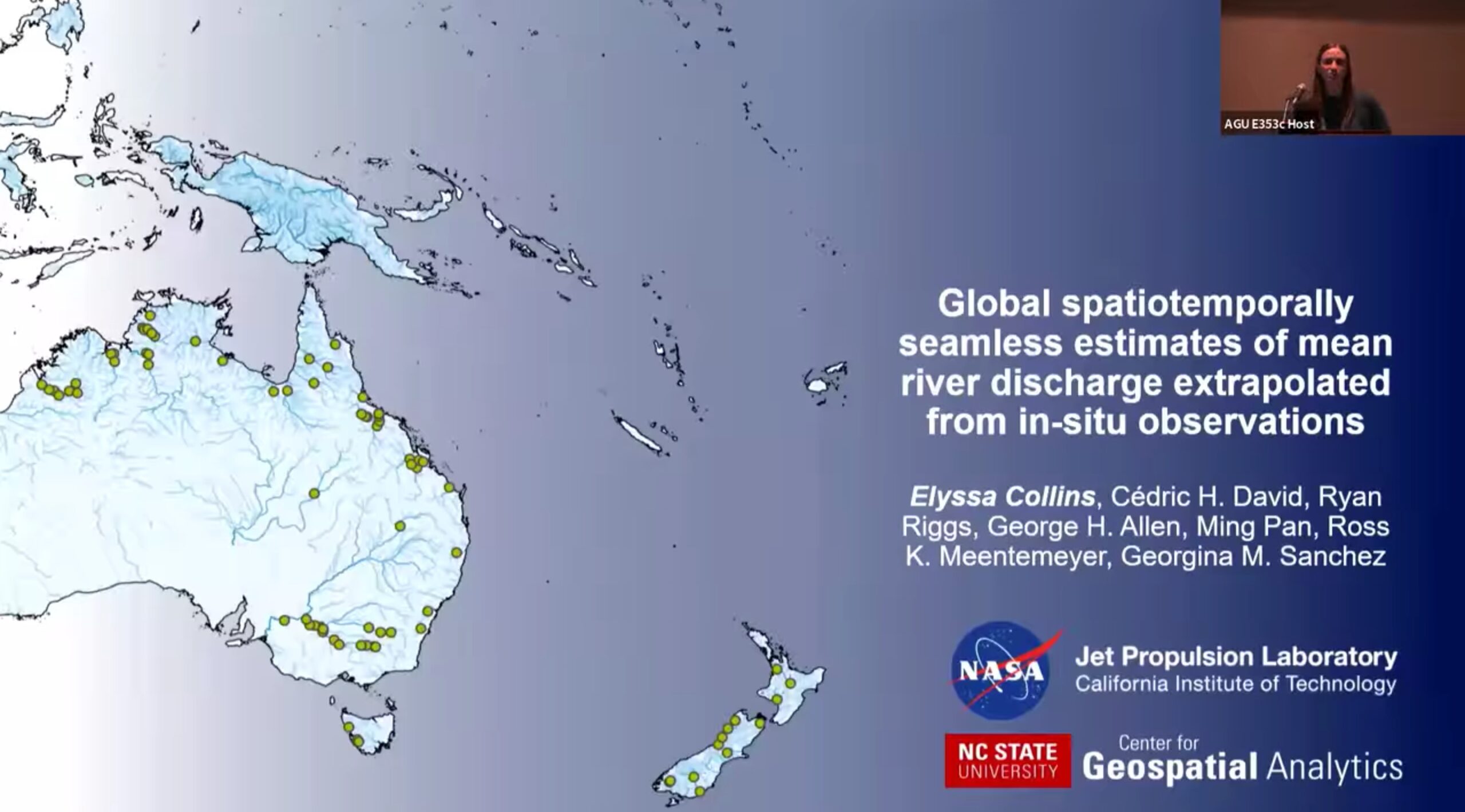
To improve model estimates of river discharge, I developed a novel bias correction algorithm and applied it at the global scale to generate 30 years of river discharge data at a monthly temporal resolution. The approach involved using 30 years of runoff data, a high spatial resolution river network, and observations of river discharge to complete the correction and subsequently develop global estimates. Thanks to the Center for Geospatial Analytics travel award, I was able to attend the American Geophysical Union (AGU) Fall 2022 meeting in Chicago and give an oral presentation on this work, in addition to connecting with researchers working on similar projects.
At AGU, I presented on the key methods and results of this study. By constraining estimates of river discharge with our algorithm, we found that bias was reduced globally, in addition to improvements in other model validation metrics. Our constrained estimates of river discharge highlighted areas across the world that have experienced considerable human influences on the water cycle (e.g., water withdrawals, damming), such as the Murray-Darling basin in southeast Australia. We also highlighted locations where observations drastically differ from our model estimates without correction. Our work has vast implications for Earth system science and water resources management.
- Categories: