Why the Turkey-Syria Earthquakes Were So Destructive
NC State professor Ashly Cabas explains how the two earthquakes that struck Turkey and Syria earlier this month resulted in so much death and destruction.

Key Takeaways:
- Turkey is one of the world’s most active earthquake zones because it is located in an area where three tectonic plates interact.
- A variety of factors, both human and natural, are likely to blame for the casualties and damage caused by the two earthquakes.
- Large, destructive earthquakes can occur in the United States.
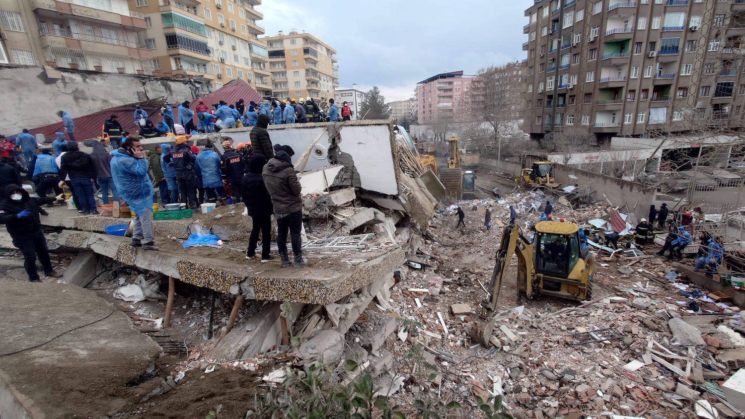
On Monday, February 6, at 4:17 a.m. local time, a 7.8 magnitude earthquake struck southern Turkey, near the border of northern Syria, releasing an amount of energy equivalent to roughly 8 million tons of TNT. Nine hours later, a 7.5 magnitude earthquake struck the same region.
The earthquakes claimed the lives of more than 46,000 people and collapsed hundreds of thousands of buildings throughout the region, leaving at least 2 million survivors without a home and in need of humanitarian aid.
Ashly Cabas, an assistant professor of civil, construction and environmental engineering and a fellow at the Center for Geospatial Analytics, said the sheer power of the recent earthquakes created the “perfect recipe for strong ground motions to take place.”
Cabas uses geospatial analytics to characterize earthquake ground motions and the effects of the spatial variability of sedimentary deposits on the intensity of ground shaking and deformation. More specifically, her research team develops predictive models of the response of soils and foundation systems to seismic loading.
“Because these shallow, large magnitude earthquakes had epicenters located nearby densely populated cities, along with a fault rupture spanning approximately 186 miles, many communities and civil infrastructure systems were exposed to strong ground shaking,” Cabas said.
She added, “I think the observations and analyses from reconnaissance teams in the field will provide much needed information to fully understand the compounding effects that led to the devastation the whole world is sadly witnessing in Turkey.”
Turkey is one of the world’s most active earthquake zones because it is located on the Anatolian plate, which is being squeezed westward by the northward collision of two tectonic plates — the Arabian and Eurasian.
As these plates move past each other, they get stuck at their edges due to friction and pressure builds up. When the pressure is finally released, an earthquake occurs, triggering waves of energy that cause the ground to shake.
Earthquake shaking causes horizontal and vertical motion that can lead to deformations in beams, columns and other structural elements in buildings. The degradation of the integrity of these structural elements can ultimately lead to collapse.
Cabas said modern building codes in many countries provide the necessary guidance to design earthquake-resistant structures, from appropriately representing the seismic hazard to designing protocols that ensure ductility of the structures.
While the design of many structures in Turkey and Syria are based on modern building codes, some experts have cited local infrastructure and recent development policies as potential contributors to earthquake destruction across the region.
“More information is required to fully understand the role of the quality of the building stock on the damage observed in Turkey and Syria; for example, old structures lacking the necessary retrofit measures to comply with current building codes, or new buildings lacking the appropriate construction practices or compliance with the building code,” Cabas said.
But it’s not just a structure’s design that plays a role in its ability to withstand the shaking of earthquakes ― the ground on which it’s built matters, too. For example, the softness and thickness of sedimentary deposits located below structures can influence the amplitude of seismic waves and change their frequency content and duration.
If saturated, granular soils are subjected to strong ground shaking, they can lose all their shear strength and behave as a liquid, according to Cabas. This process is called “liquefaction” and can lead to large deformations in the ground that can result in damage to structures, including collapse.
“Thus, a moderate-magnitude earthquake nearby can cause damage to certain types of structures, whereas a large-magnitude earthquake, far away, can damage other types of structures. If such structures are founded on soft soils or on rock, the intensity of ground shaking can be further modified,” Cabas said.
Cabas added that the Turkey earthquakes were produced by tectonic settings that can also be found in the United States, especially in California where the San Andreas fault forms the boundary between the Pacific Plate and the North American Plate.
A report published by the U.S. Geological Survey (USGS) found that a hypothetical 7.8 magnitude earthquake on the San Andreas fault could kill 1,800 people and injure nearly 50,000 people across southern California.
The occurrence of earthquakes in central and eastern U.S. is different, however, because they’re located within the North American plate, which means that earthquakes throughout these regions don’t result from the relative movement between two or more plates.
While earthquakes in North Carolina and other states throughout these regions are less frequent, they can still occur. In August 2020, for example, a 5.1 magnitude earthquake struck Sparta, North Carolina. According to the USGS, earthquakes in the eastern U.S. “tend to cause higher-frequency shaking” compared to those in the western U.S.
“The damage resulting from future seismic events will be a function not only of the intensity of the ground shaking, but also the performance of infrastructure systems and the level of preparedness of the communities they serve,” Cabas said.
Meet the Expert
This post was originally published in College of Natural Resources News.
- Categories:


