Collaboration, Innovation Address Food Security Needs in Bangladesh with New Rice Mapping Method
Sometimes, an impactful research project emerges from simply listening…and following up on what you heard.
Four years ago, Varun Tiwari was working as a remote sensing and geoinformation analyst with the International Centre for Integrated Mountain Development, an intergovernmental organization based in Nepal. In this role, he collaborated closely with multiple governments, including that of Bangladesh, whose officials told him about a need they had: To help them identify potential rice surpluses and deficits before they happened, officials needed accurate estimates of the country’s rice crop at the peak of the growing season, because post-harvest reports came too late to support import-export decisions that affect food security and the country’s economy.
Fast-forward to 2024, and Tiwari, now a doctoral student at North Carolina State University’s Center for Geospatial Analytics, has just published the first chapter of his dissertation in the Journal of Environmental Management, reporting his development of an innovative method for mapping rice before harvest in Bangladesh using satellite imagery.
“Whatever you are doing in your research, you should have some initial ideas of who’s going to use it,” Tiwari says, “and then try to involve people from those government agencies so that the work can be translated into policy.” When he began his graduate research, Tiwari thought back to the needs he’d heard as an analyst and reached out to potential collaborators. “We identified people who contribute to the annual rice statistics in Bangladesh, who know what the research gaps are, and we had a back-and-forth process to develop the methodology,” he says. Tiwari’s collaborators ultimately became co-authors on the publication reporting the work.
“Bangladesh is among the countries most severely impacted by climate change, particularly vulnerable to flooding,” says Mirela Tulbure, Tiwari’s advisor, a faculty fellow at the Center for Geospatial Analytics and associate professor in NC State’s Department of Forestry and Environmental Resources. “Approximately 80% of its population relies on agriculture, with [the rice variety Tiwari studied] being one of the main crops cultivated.” Mapping the extent of rice cultivation in the country, she explains, “is essential for subsequently assessing flooding impacts on these agricultural zones.”
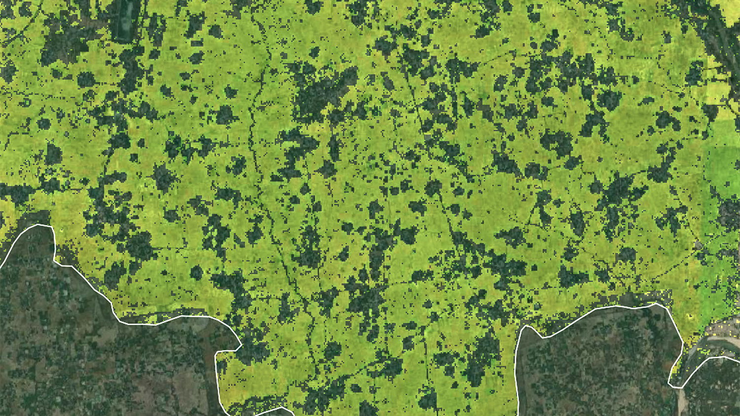
Tiwari’s newly published method addresses the difficulty of collecting field data in remote regions, avoiding the data-hungry machine learning models typically used to classify satellite data. “We designed the method while keeping in mind limitations in Bangladesh,” Tiwari says. His approach uses a computer vision technique and a threshold-based algorithm to automatically identify rice fields in Sentinel-1 and Sentinel-2 time series data. Unlike other crops, rice is intentionally flooded during the growing season, and Tiwari was able to use this unique characteristic to identify inundated areas of rice cultivation with high accuracy across the country.
Now, he is discussing how to facilitate training with his collaborators so that end-users in Bangladesh can run the algorithm and analyze the results, an important next step for the continuation and sustainability of the work. “That’s how to bridge the gap between science and policy,” Tiwari says––having the people who can use the work involved in the research itself. “Co-developing it, people will have more confidence in it and be more keen to use and apply it.”
Tiwari’s main advice for other student researchers working with stakeholders is to be patient.
“It’s not about rushing things,” Tiwari says. “We can design and develop a method in a few days. But it doesn’t make sense to do if people aren’t going to use it.” While working with a team of Bangladesh-based professionals, Tiwari developed skills in consensus-building and adaptability, as he waited for and incorporated feedback into his approach. By co-developing methods with eventual end-users, “the research will be more solid,” Tiwari says, “and you will build skills in convincing people. And you’ll get a lot of feedback that will strengthen the resulting paper.”
Tiwari’s co-authors included collaborators affiliated with the International Maize and Wheat Improvement Center (CIMMYT), the Bangladesh Rice Research Institute (BRRI) and the Bangladesh Agricultural Research Council (BARC) as well as his advisor, Mirela Tulbure, Geospatial Analytics doctoral students Mollie Gaines and Vinicius Perin, and postdoctoral research scholar Julio Caineta.