Megan Skrip
![Paul Schrum holding his newly granted patent at the North Carolina State University Center for Geospatial Analytics](https://cnr.ncsu.edu/geospatial/wp-content/uploads/sites/22/2017/03/Paul_Schrum-patent-e1489085735708.jpg)
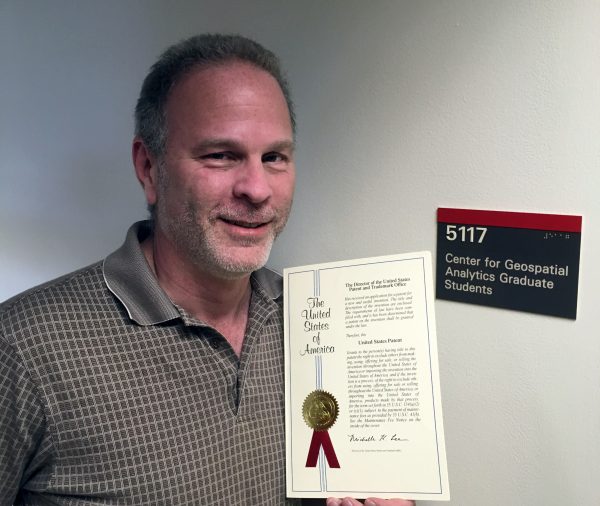
MGIST Student Paul Schrum Awarded Patent to Improve Roadway Design
![A photo of Prague](https://cnr.ncsu.edu/geospatial/wp-content/uploads/sites/22/2017/02/Prague-825x464-e1488304382395.jpg)
Growing Globally: Eric Money to Scout Collaboration Potential in Prague
![A photo of a man holding a CFL lightbulb](https://cnr.ncsu.edu/geospatial/wp-content/uploads/sites/22/2017/01/ENG.Baliga-cropped-e1485282452155.jpg)
Helping North Carolinians Save Money on Energy
![A photo pastures and the Beef Unit barn at North Carolina State University with downtown Raleigh in background](https://cnr.ncsu.edu/geospatial/wp-content/uploads/sites/22/2017/01/AERIAL2016.1645-e1484070189306.jpg)
Can Forests Slow Urban Sprawl?
![A photo of a student helping construct a new home for Habitat for Humanity.](https://cnr.ncsu.edu/geospatial/wp-content/uploads/sites/22/2017/06/WEB.BuildABlock.8360-1024x684.jpg)
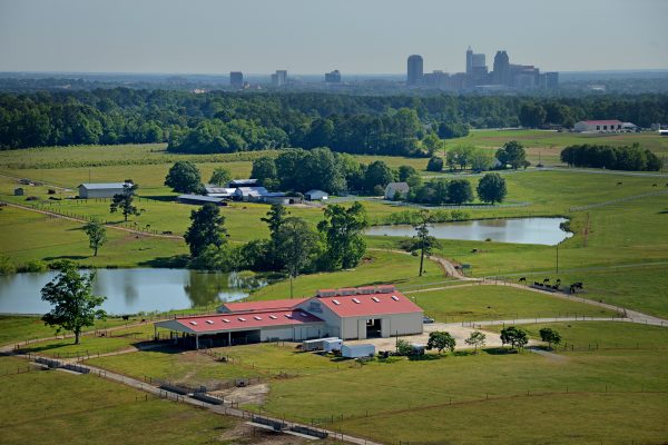
NC State Caldwell Fellows Use GIS to Help Habitat for Humanity
![A photo of an NC State University student holding sweet potatoes](https://cnr.ncsu.edu/geospatial/wp-content/uploads/sites/22/2016/12/CALS.SweetPotatoes.2543-small-e1482174184459.jpg)
Solving Problems around the World, One Map at a Time
![A photo of Ashwin Shashidharan standing with his advisors, Ross Meentemeyer and Raju Vatsavai, and holding an award at the ACM SIGSPATIAL Conference](https://cnr.ncsu.edu/geospatial/wp-content/uploads/sites/22/2016/11/Ashwin-SIGSPATIAL_award-e1478554018887.jpg)
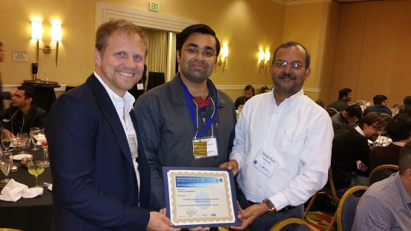
Ph.D. Student Ashwin Shashidharan Wins Student Research Competition at International Conference
![A photo of Justin Shedd leading a classroom discussion using ArcGIS Online at the North Carolina State University Center for Geospatial Analytics](https://cnr.ncsu.edu/geospatial/wp-content/uploads/sites/22/2016/11/Justin_Shedd-Thales-e1478292014713.jpg)
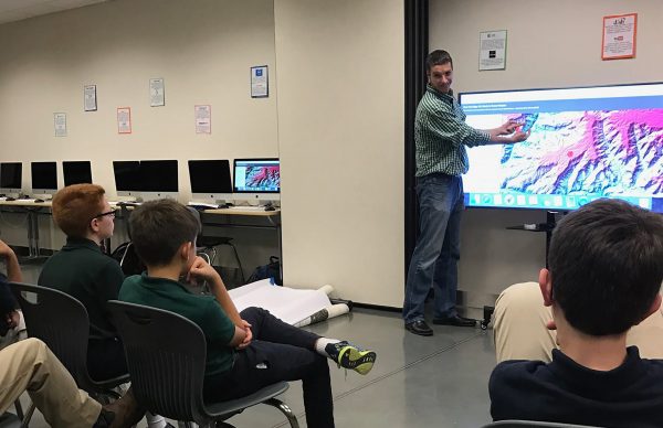
GeoMentor Justin Shedd Leads Local Classroom to Explore Mapmaking with ArcGIS Online
![A photo of a Wolfline bus stopped at the West Parking Deck while students cross Varsity Drive at North Carolina State University](https://cnr.ncsu.edu/geospatial/wp-content/uploads/sites/22/2016/10/TRANS14.bus_.5820-e1502900212731.jpg)
Webcams as Data Sources about Healthy Living and Urban Design
![A photo of a woman kayaking on a lake in a park](https://cnr.ncsu.edu/geospatial/wp-content/uploads/sites/22/2016/10/photo-1440993443326-9e9f5aea703a-Mark_Bosky-e1476986928640.jpeg)