
Megan Skrip

Two men talk in the background with a video camera on a tripod in the foreground

Nov 30, 2022

New Multimedia Story Map Shares Experiences of Veterans in Fire Management

A new interactive story map produced by researchers at North Carolina State University’s Center for Geospatial Analytics highlights the experience of five Army and Marine Corps veterans who worked as part of the Veterans Fire Corps to protect landmarks with the National Park Service.

Nov 28, 2022

Fall 2022 Geospatial Forum Rewind

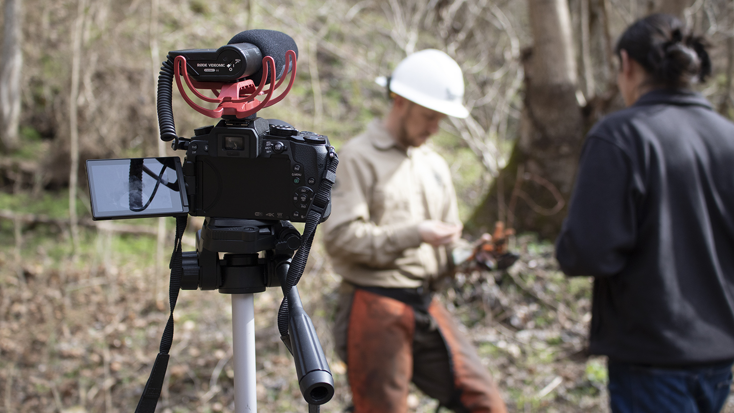
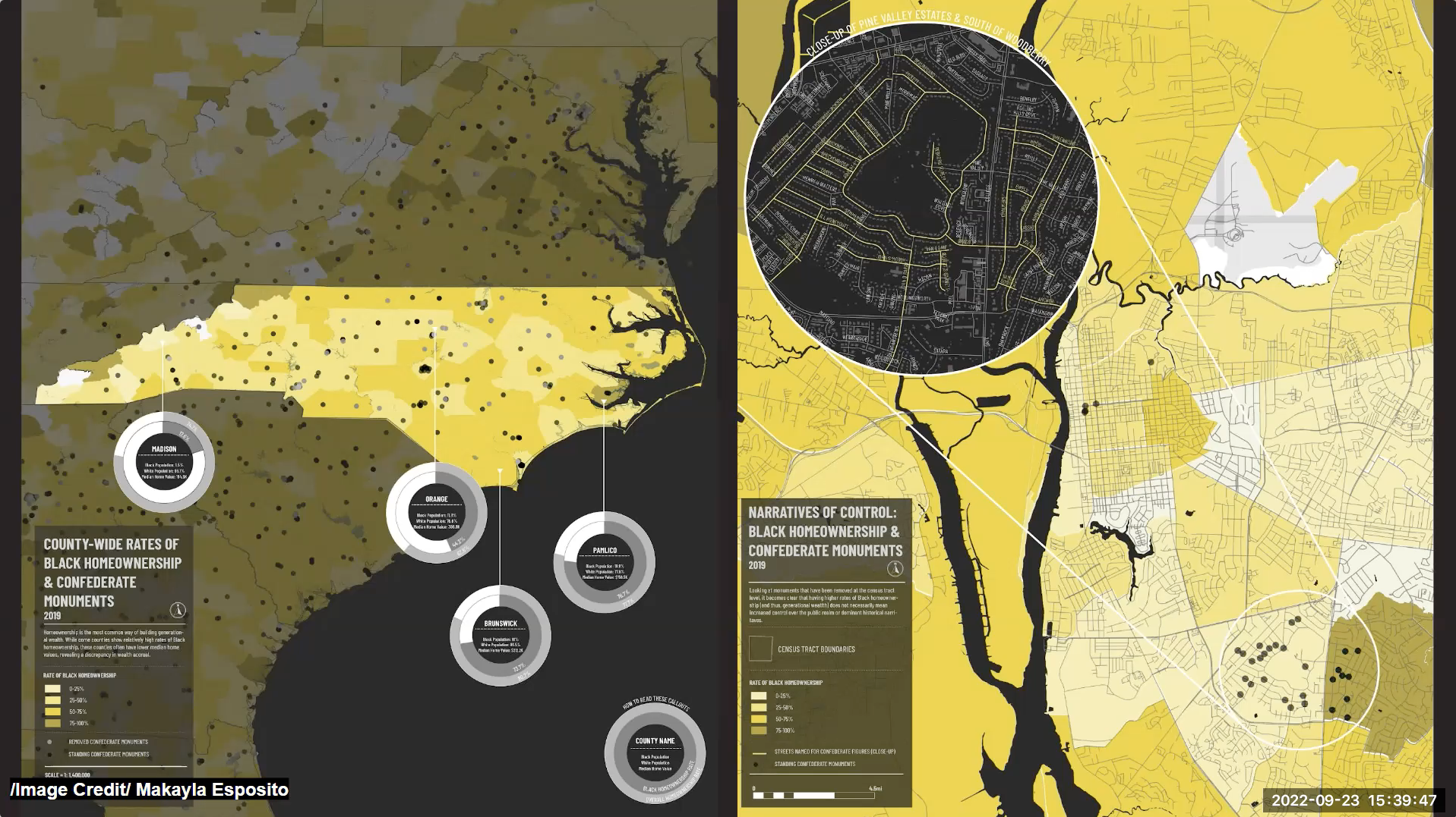
During the Fall 2022 Geospatial Forum series, guest speakers discussed Indigenous property rights, mapping racism in the built environment, Planet Labs, NC State's Data Science Academy and using geospatial outputs to drive outcomes.

an orange snow shovel cuts through a pile of snow

Nov 15, 2022

New Visualization Tool Helps Weather Forecasters and Researchers More Easily Identify and Study Bands of Heavy Snow

Geospatial Analytics Ph.D. candidate Laura Tomkins developed a new way for meteorologists and atmospheric scientists to quickly and easily distinguish heavy snow from mixed precipitation in weather radar imagery, to improve understanding of snowfall during winter storms.

view of mountains against a blue sky with trees in the foreground

Nov 4, 2022

Linking Forests and Freshwater

With remote sensing, Ph.D. student Katie McQuillan is uncovering how climate change is affecting the water budget in mountain forests.

aerial view of flooded homes in Florida after Hurricane Ian

Nov 4, 2022

Many Americans Lack Flood Insurance Despite Rising Risks — Here’s Why

As climate change and urbanization increase the risk of flooding across the US, millions remain unprotected. Center for Geospatial Analytics researchers are working to solve that problem.

Corey White standing at a podium with a presentation on a screen behind him

Oct 27, 2022

OpenPlains: Geospatial Participatory Modeling in the Clouds

Ph.D. student Corey White developed an open-source geospatial participatory modeling platform that allows users to use GRASS GIS on the web.

Oct 19, 2022

Center for Geospatial Analytics Seeking Business Officer

The Center for Geospatial Analytics is seeking its next Business Officer II to serve as the primary point of contact for finance and research administration.

Felipe Sanchez stands next to a podium and a large screen displaying the title slide of his presentation

Oct 17, 2022

Spatial Veterinary Epidemiology to Support Disease Surveillance and Biosecurity

Ph.D. student Felipe Sanchez applies geospatial analytics to characterize the risk of disease transmission between swine farms and identify the variables that affect outbreak occurrence.

Four people give the Wolfpack hand sign with a cityscape of Florence, Italy behind them

Oct 4, 2022

Unleashing the Power of GRASS GIS with Jupyter Notebooks at FOSS4G 2022

Our software developers created a new way to integrate open source geospatial software with interactive documents, and presented their work at a recent international meeting. Geospatial Analytics Ph.D. student Caitlin Haedrich explains.

Kate Jones presents at the 2022 SECASC Symposium

Oct 3, 2022

Connecting Southeast Scientists, Managers, Educators and Students

Geospatial Analytics Ph.D. candidate Kate Jones recounts her experience at the 2022 Southeast Climate Adaptation Science Center Symposium and how being a Global Change Fellow shaped her dissertation research.