Solving Problems around the World, One Map at a Time

Master’s Capstone Projects Pair Service Learning and Geospatial Science
The Center for Geospatial Analytics is celebrating this season the Fall 2016 graduation of 19 professional master’s students in Geospatial Information Science and Technology (MGIST)––one of the largest groups of graduates yet. During their final semester, each student in the MGIST program participates in a service-learning capstone project, working directly with a community or industry partner to apply their knowledge and skills to a real-world problem. Service learning differs from community service in that students do not simply provide a service to complete a task, explains Charlynne Smith, instructor of the MGIST capstone course; rather, they work collaboratively with their external partner to solve a problem together, all learning during the process.
This fall, topics ranged from tracking elephants in Bhutan and finding bat habitats in Washington to discovering sweet potato fields, working for social justice and affordable housing, supporting emergency personnel, and more. Read on for a glimpse into the exciting work that our graduating master’s students have produced this semester to Think and Do for their capstone projects––in North Carolina, around the nation, and across the world!
Preventing human-elephant conflicts
When elephants and people share the same space, consequences can be dire for both; a new mapping project by MGIST students seeks to prevent dangerous encounters and save habitats, property, and lives. John Stuebe and Greg White partnered with Elephants on the Move, an organization that works chiefly in India, and the Elephant Conservation Programme in Bhutan to develop web GIS applications that will help residents in Bhutan document encounters with wild elephants and ultimately avoid them. “The goal is to hopefully reduce human-elephant conflict to zero,” says John. The students developed digital forms for citizen scientists to use on their mobile devices, for gathering data about human-elephant conflicts and elephants’ habitat use. These will help identify hotspots of elephant activity and habitat suitability. “What might be the attracting factors to draw elephants to the area and keep them there?” Greg says. Understanding how elephants and local people compete for space and resources may also help planning in the region. The data could be used by wildlife conservationists to identify areas with many elephants but few conflicts, where future development should be avoided. The students also are interested in expanding the apps to include an early warning system and prediction of elephant movements. When someone uses a geoform to report an elephant sighting, for example, local citizens could receive a text or email warning to avoid it. At a presentation of the final project, Lisa Mills, a researcher at University of Montana with Elephants on the Move, commented, “The applications are very real-world, and the work is much appreciated.”
Protecting the best homes for bats

White-nose syndrome is a fatal bat disease responsible for the deaths of millions of bats as it has spread west across the United States. This year, it reached Washington State, where little information previously existed about the distribution of important bat populations. MGIST student Molly Foley worked with the state’s Department of Natural Resources to help staff identify where bats likely gather in greatest numbers, in the hopes of protecting them from impacts of the disease. (Humans are not affected by white-nose syndrome, but the fungus that causes it can be spread on the boots of otherwise well-meaning hikers.) Molly developed habitat suitability models in ArcGIS for the ten bat species in western WA, locating the most ideal places for them to live. Her community partner, Nicole Jacobsen of Washington State DNR, says that Molly’s work has already proven useful for proactively protecting the bats and the habitats that help them thrive. “We’ve been using [Molly’s] model and data for a lot of different reasons,” she says. In particular, it is important “to find areas that we’re already protecting for other reasons and then make sure that they’re already in the right places” so that the largest numbers of bats benefit.
Finding unregistered sweet potatoes

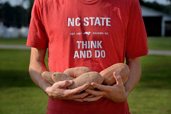
About half of the nation’s sweet potatoes are grown in North Carolina, and all growers in the state who cultivate one acre or more pay dues to the nonprofit North Carolina Sweet Potato Commission. At least, they usually do… The commission promotes the success of the crop and regularly sends agents afield to verify the acreage of growers. Needing a way to streamline their reporting and better identify potentially unregistered fields, they partnered with MGIST student Michael Chuang and ProStar Geocorp to help locate and verify fields of sweet potatoes grown in the state.
Knowing that sweet potato plants can be identified from satellite data based on the unique pattern of light they reflect, Michael used weekly satellite imagery of North Carolina to find sweet potato signatures that agents can then inspect on the ground. Michael examined data for 39 counties in the state and helped agents find almost 5,000 acres of unregistered sweet potato fields. To facilitate inspections, he developed a mobile application that “helps agents find unregistered fields more accurately and efficiently,” he says. Easy to use and “like Facebook with really powerful geospatial functions,” the app allows retired farmers working on behalf of the commission to draw field boundaries on digital maps where they find previously unknown sweet potato fields, upload photos, and see crew updates in real time to avoid duplicating effort.
Seeking equality for early voting

Early voting sites are meant to be convenient, one-stop shops for voters interested in casting their ballot before election day; making sure that they equitably serve all populations in a county is an important and complicated task. MGIST student Tony Fairfax partnered with the Southern Coalition for Social Justice to determine how well residents in North Carolina of different races/ethnicities are served by the locations of early voting sites. The model he developed uses census data to provide “metrics that can assist with strategic decisions,” he says, by looking at how far different population groups reside from the nearest early voting site, the hours of operation of those sites, amounts of population served per site, and how many people per hour can be served. “A county can actually view the impact of removing or [adding] early voting sites or changing hours, prior to implementation––which can actually save them a lot of time, energy and possibly resources that are involved,” Tony points out. “The metrics can assist with selection of a fair collection of early voting sites, which is of course the objective of what we’re trying to do.” Allison Riggs, a senior staff attorney with the coalition, and Tony’s contact for the project, commented, “We’re talking about revolutionizing how communities become part of this process. It’s really critically important, and Tony…did amazing work with this.”
Providing affordable housing in Wake County

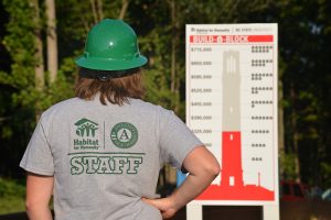
MGIST student Ashleigh Cline developed a web application that will help Habitat for Humanity of Wake County better understand their applicant pool and the low-income areas with greatest housing need. The project was coordinated by emeritus director of the Center for Geospatial Analytics Hugh Devine, who also mentored several NC State Caldwell Fellows working on a service learning project for Habitat for Humanity this semester. Habitat’s goal, Ashleigh points out, is “to build safe affordable homes for those in need of housing.” Using data that the group supplied, Ashleigh organized and made spatial all of the applicant info, allowing Habitat staff to now view, for example, how many applicants live within one mile of current and/or planned public transportation; they can also now use census data to examine household income by city or political district. All of these data are now accessible through interactive maps or user-customized graphs.
“This is just the beginning for Habitat,” Ashleigh explains. “This is the first time they’re seeing their data in a geographic context and [are] able to truly interact with it. Now they have the capability to really see where housing needs lie in Wake County and get a deeper understanding about who’s applying for housing––what are the commonalities of [the applicants], what are the differences, what do they have access to, what do they not have access to? It’s bringing a whole new dynamic to their service model.”
Serving the North Carolina National Guard

MGIST students Robert Toomey and Sean Houng worked to develop a system that would allow the National Guard Joint Operations Headquarters to automatically track the real-time locations of their field personnel during emergency responses and even quickly receive requests for help. Says their National Guard contact, Todd Preddy, “What we’re trying to do is track a user’s cell phone during an emergency event, like Hurricane Matthew that just came through, for the National Guard people on duty and our state partners”—partners such as the highway patrol, emergency management agencies, and firefighters. “We wanted something that would go across all platforms, because everybody has a different phone. And this is the first step down that path.” Reflecting on his experience in the MGIST program, Robert, who works at the National Severe Storms Laboratory in Norman, Oklahoma, commented, “GIS is so interesting to me because I can apply it to what I do. So, it’s a win-win…” Stephanie Wendel also collaborated with the North Carolina National Guard to create a web application that allows personnel to easily track progress and needs during the management of construction projects. Says Todd, “We have plenty of uses lined up for this technology.”
And more!

Chérie Southwick partnered with MGIST alum Kevin Dunlop, currently working for Prince William County, Virginia, to experiment with developing three-dimensional models for flooding scenarios using ArcGIS Pro. A pair of students, Jenna David and Laura Kay, partnered with the North Carolina Clean Energy Technology Center to create a web application that shows drivers where in North Carolina they might refuel their electric or compressed natural gas vehicle; users of the web application can also create routes with turn-by-turn directions, adding those refueling stations as stops. Pam Slater and Dana Hartley collaborated with the assistant curator of conservation and research at the North Carolina Zoo, mapping the habitats and movement patterns of critically endangered vultures in East Africa.
Some students even produced projects for the companies or agencies where they are currently employed. Seth Church works for the South Carolina Department of Health and Environmental Control; for his capstone project, he created a web application that students, reporters, and other community members can use to explore statewide public health statistics, even making their own customized reports and maps. John Burleson works for The Shopping Center Group, a retail-only real estate firm; he developed a web GIS platform that his company’s brokers can access to add or retrieve information about current or future retail locations, without having to consult the company’s GIS staff.

Several students also connected with partners at NC State’s College of Natural Resources or Center for Geospatial Analytics. Sudha Kumar worked with center research associate Okan Pala to develop a geospatial model for Jefferson County, KY, that could estimate demand on the county’s water treatment plant. Jamie Dunbar partnered with silviculturist Elizabeth Snider of the Department of Forestry and Environmental Resources to monitor potential environmental impacts of recreational use of G.W. Hill Forest during fox hunts. Andrew Jones worked with research associate Cari Furiness of the Department of Forestry and Environmental Resources and the North Carolina Atmospheric Chemistry Consortium to develop a web app useful for visualizing the chemical composition of rainfall, particularly the deposition of nitrogen and sulfur from rain across the state through time.
Congratulations to all our graduating MGIST students on their success!


