Future Fire Use and Wildland Urban Interface Communities in Western North Carolina
Editor’s note: Each semester, students in the Geospatial Analytics Ph.D. program can apply for a Geospatial Analytics Travel Award that supports research travel or presentations at conferences. The following is a guest post by travel award winner Kate Jones as part of the Student Travel series.
Media coverage of wildfires, particularly from the summer of 2020, catapulted fire-related articles, employment, news and policies into the limelight, ultimately expediting the uptick in fire legislation associated with the 2021 Infrastructure Investment and Jobs Act. Though the news mostly focuses on the catastrophic short- and long-term impacts of wildfires, there are numerous other critical aspects to “living with fire” and becoming a more fire-adapted society.
Prescribed fire is one of the most effective tools available for mitigating dangerous buildup of flammable materials (like leaves and shrubs in the forest understory known generally as “fuels”) on the landscape. Prescribed fires, also called controlled burns, not only reduce hazardous fuels but are critical for promoting ecosystem health and fire-dependent species. Both prescribed fires and wildfires can result in harmful smoke exposure for communities; however, the preemptive use of prescribed fire provides more control over when, where and how smoke travels downwind, while also reducing fuel loads to lessen the likelihood of future hazardous wildfire activity.
Practitioners and researchers alike support the benefits of prescribed fire––more control, reducing hazardous fuels, supporting fire-adapted ecosystems, etc.––but the positives of prescribed fire are not always communicated to the neighboring public in a clear and timely manner.
As communities in the wildland urban interface (WUI) continue to grow, more people will interact with smoke from prescribed fires. Unfortunately, when communication and public support is lacking, even a successful, safe prescribed fire can result in negative public opinion, which can then act as a barrier to future fire use. My dissertation research therefore focuses on the intersection of three key aspects of fire management: the desire to use more prescribed fire to reduce fuels around communities, growing WUI communities, and estimating the cumulative smoke emissions from different fire management strategies.
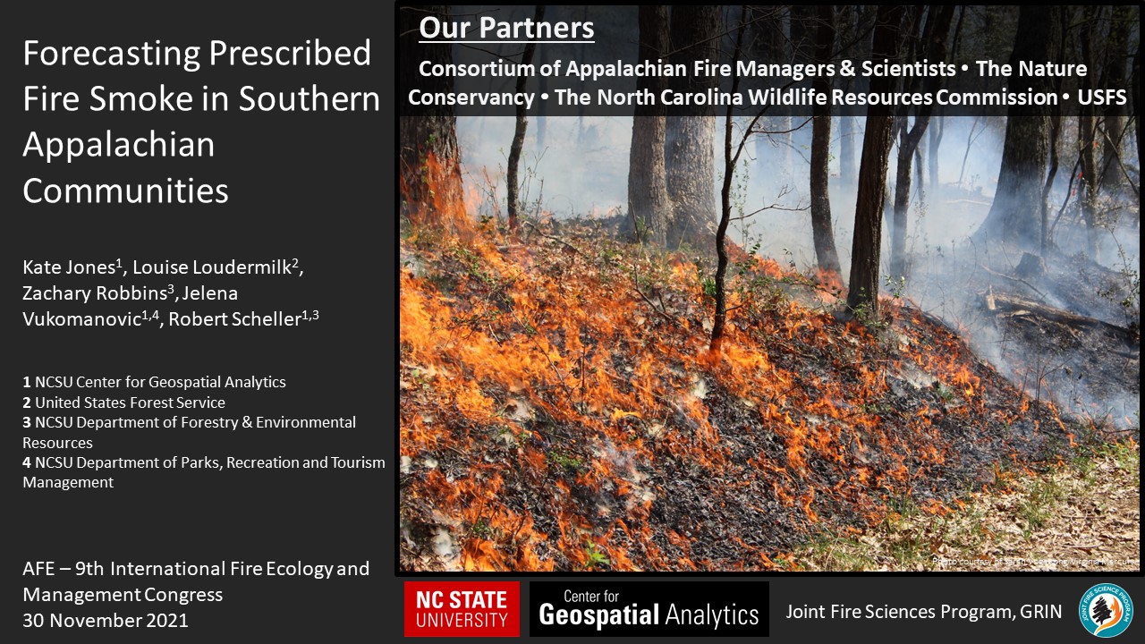
Thanks to the Center for Geospatial Analytics travel award, I participated in the 9th International Fire and Management Congress by giving an oral presentation titled “Forecasting Prescribed Fire Smoke in Southern Appalachian Communities“ in the special session “Fire in the Southern Appalachians: Past, Present and Future Resilience.” The conference, hosted by the Association for Fire Ecology, provides a welcome blend of research and practice and is a place to learn and discuss all things fire. Similar to many other recent events, the conference went virtual, but I was still able to receive valuable input and absorb new ideas through the conference’s online platform.
My presentation shared the initial steps and future roadmap of research funded by the Joint Fire Science Program to support co-producing future prescribed fire management scenarios with land managers in western North Carolina. The modeling of future management scenarios considers different prescribed fire management strategies, climate change and smoke exposure for existing and anticipated growth of local communities. We will work with managers to design various forest management and prescribed fire strategies (less vs. more time between prescribed burns) focused on their priority burn sites adjacent to growing communities in western North Carolina.
Importantly, these scenarios will allow us to compare “business as usual” strategies with more exploratory or experimental plans under different climate scenarios (hotter and wetter vs. hotter and drier, etc.). In every modeled scenario, prescribed fires will be virtually ignited in a computer simulation and a smoke dispersion model will track where smoke would be expected to flow downwind. When the modeling work is complete, we will have estimated smoke footprints and concentrations for each multi-decade prescribed fire management strategy. We can then overlay existing community data and projections of community growth to estimate where people may interact with prescribed fire smoke, now and in the future.
We hope this research will be used to facilitate communication with the public and foster a collective sense of community- and landscape-aware management strategies. This will allow managers to explore patterns of smoke dispersion in space and time and how these patterns are linked to managing land with different prescribed fire strategies. Our goal is to work alongside our management partners to deliver data products and analyses from this project in the most useful and accessible formats. Additionally, we hope to host a web map of model results to promote open data access and interactivity following the completion of the project.
Acknowledgements
Thank you to CGA’s Robert Scheller and Jelena Vukomanovic and our management partners at The Nature Conservancy, the North Carolina Wildlife Resources Commission, and the Center for Appalachian Fire Managers and Scientists. Thanks too to Zachary Robbins (Department of Forestry and Environmental Resources at NC State) for his significant contributions to this modeling work. Thanks to Louise Loudermilk (USDA Forest Service), the session convener and co-PI of this research; and thank you to the Joint Fire Sciences Program for funding this work.