GIS Service Learning to Support Public Lands, First Responders, City Planning and More

Before graduating, each student in the Center for Geospatial Analytics’ professional master’s program in Geospatial Information Science and Technology (MGIST) applies their knowledge and skills to a client-supplied problem in a service-learning capstone project.
Industry, academic, government and nonprofit partners work closely with our students to find a customized solution using GIS applications and geospatial analysis. This semester, our professional master’s students developed solutions for protecting landmarks, supporting first responders, advancing city planning, improving NC State’s campus and more!
Protecting Landmarks with the National Park Service
The National Park Service oversees protection and maintenance of landmarks and landscapes across the country with ecological, cultural and historical significance. This semester, two MGIST students worked to support the NPS’s mission in the Southeast.
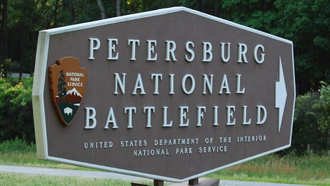
Brendan Simms partnered with NPS staff at Petersburg National Battlefield in Virginia to identify the potential locations of undiscovered Civil War artifacts and evaluate barriers to acquiring the lands that contain them. Petersburg National Battlefield has “recently been given an opportunity to expand their park,” Simms explained, “and so they need help identifying what lands would be helpful to their story to expand and preserve.” The web map he developed incorporates the locations and typical range of artillery used during a series of 1865 battles called the Picket Line Assault, as well as displays the locations of contemporary buildings and the current owners and values of land parcels.
Paige Yelen worked with the Western Carolina University Archaeology GIS Laboratory to support protection of the Trail of Tears National Historic Trail. “The Trail of Tears refers to routes taken during the forced removal of Native peoples from their homeland in the southeastern United States to Indian Territory in what is now known as Oklahoma during the early to mid-19th century,” Yelen explained. Portions of the trail are currently unknown due to a lack of historical maps and documents. To identify the likely route through Monroe County, Tennessee, Yelen performed a suitability analysis and least cost path analysis. “The results obtained from this tool can inform future geospatial analysis,” she said. “They can help researchers identify specific land records that might be useful and even help future field work.”
Supporting First Responders
Fire departments routinely undergo accreditation to ensure they meet the changing needs of communities they serve. Jill Robson partnered with the Hickory Fire Department to create a GIS-based system that could replace lengthy reports with data visualizations. “Overall, the project set out to create a risk assessment at the city and neighborhood levels by showcasing demographic and incident data for each,” Robson explained. “And this information would show that the fire department is staying up to date on any changes within their community as well as understanding the locations they may need to allocate more resources to.”
Ryan Shaffer worked with the City of New Bern Police Department to help them replace multiple softwares and the need for specialized GIS expertise with a user-friendly database and web mapping application for tracking incidents and analyzing crime data.
Advancing City Planning

One objective of the City of Raleigh’s Strategic Plan is to better understand the impacts of transportation projects on residents. Deirdre (Dee) An partnered with the City to determine which areas were likely burdened by past projects. “One of the main things they wanted to accomplish was to map the demographics and variables that could indicate, or be related to, a burden by a past transportation investment,” she explained. Combining demographic, health and road data, she developed “a suitability score showing where in Wake County would be the most and least burden on a scale from one to five”; she also created a story map to detail her findings.
To support future planning by Durham Public Schools as part of the Growing Together project, Randy Johnson developed a web mapping application that displays the demographics of neighborhoods served by the school system’s different facilities. Using a socioeconomic index he created, planners can also better understand which areas are disadvantaged versus advantaged.
With its “Tree City USA” designation, the Town of Matthews cares about maintaining its abundant tree cover. Jeremy Davis partnered with the Town’s Appearance/Tree Advisory Committee to develop tools for assessing canopy health and coverage over time, collecting new data about individual trees, and calculating needs for new plantings to compensate for trees unavoidably lost.
Infrastructure like pipes and cables buried underground can be vulnerable to damage by plant roots that grow deep enough to penetrate them. Michael Mirolli worked with the City of Winston-Salem to identify locations where vegetation growth may someday pose a problem for city infrastructure.
Improving NC State’s Campus
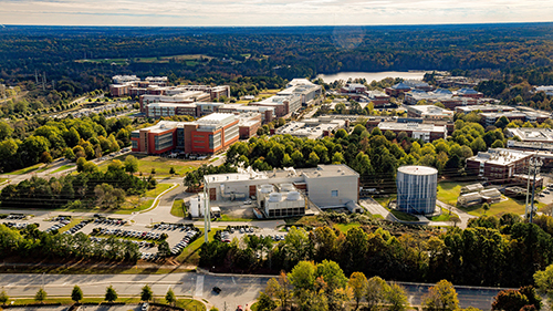
NC State’s Centennial Campus boasts a nine-hole disc golf course and is considering an expansion. Whether and how the site could include another nine holes, though, remained an open question. Working with NC State Real Estate and Development, Alexis (Lexi) Thomas gathered data about the course and its environs, as well as input from the Capital Area Disc League Facebook group, to perform a suitability analysis and draft a potential new design. “When you are doing a project for the people, you should talk to the people,” Thomas said. Based on disc golfer feedback and mapping buffer distances from features like streets, trails and marshy areas, she drafted a design capable of accommodating 18 disc golf holes, including four >400 feet from tee to basket.
Two other MGIST students worked with NC State University Facilities and its GIS Administrator, MGIST alum Laurel Krynock, to support the division’s mission of overseeing planning, construction and maintenance of the university’s physical infrastructure. Ashley Belwolff developed a web mapping application that will help staff inventory and maintain campus trees. “The purpose of this project was to expand and improve the database that was already existing from years ago, enable mobile field collection for groundskeepers, and create a proximity analysis tool to see the trees’ distance to high-traffic areas,” she explained. Patrick Williams developed a decision-support tool that can help decision-makers evaluate the best locations for future electric vehicle (EV) charging stations.
And More!

Ryan Held worked with the healthcare design firm BSA LifeStructures to identify and characterize the service areas of healthcare facilities operated by one of its clients, Bassett Healthcare Network.
Mary Hughes developed a workflow using open-source software to help the nonprofit National Tropical Botanical Garden maintain its tens of thousands of plant records for its research and conservation gardens in Hawaii and Florida.
Yajie Liu partnered with the US Geological Survey to support quality control of data generated by contractors for the new Elevation-Derived Hydrography dataset.
Hanna Swartz worked with North Carolina Emergency Management to spread the word about statewide LiDAR data that are available for use in a range of applications. The story map she created details how the data were collected and how to use them. Swartz is the winner of this semester’s MGIST poster competition.
Zach Tunstall developed a method using aerial imagery to help the USDA Agricultural Research Service monitor the health of citrus trees at the USDA Research Farm in Leesburg, Florida.
Thank you to all of our capstone partners, and congratulations to all of our graduating MGIST students on their success!