Ph.D. in Geospatial Analytics
Our groundbreaking Ph.D. program blends integrative thinking with hands-on experience, offering a unique, interdisciplinary approach to training the next generation of geospatial data scientists. If your research ambitions span geospatial problem-solving across any number of fields, you'll find an ideal environment to thrive and innovate with us here at NC State.
What makes the Ph.D. in Geospatial Analytics different?
- Collaborative, cross-disciplinary teamwork unites students and faculty from diverse research fields
- Guaranteed funding for four years includes a competitive minimum stipend of $30,000, health insurance, and tuition
- Professional seminar enhances student success through training in science communication, proposal writing and geospatial data ethics
- Travel funding supports student attendance at attend scientific conferences
- Program values emphasize student mental health and work/life balance, open data, and a strong commitment to community and collaboration
“I appreciate the program’s interdisciplinary nature and feel I have benefited from bouncing ideas off students from different research domains. CGA goes out of its way to promote a super welcoming and supportive culture.”
Katie McQuillan ’23
What kinds of research projects might I work on?
At the Center for Geospatial Analytics, we are dedicated to pushing the frontiers of spatial data science to drive discovery and inform real-world decision-making. Our interdisciplinary approach integrates expertise from diverse fields such as design, natural resources and the environment, computer science, social and behavioral sciences, engineering, and more. You can explore our student directory and Ph.D. student dissertations for a glimpse into the innovative research conducted here.
Each year, we seek talented students for graduate assistantships funded by external grants. Additionally, we admit a select number of students on internal program funding, who are matched with advisors and research projects during their first year.
Please be aware that not all faculty members are recruiting annually. We recommend focusing your inquiries on faculty with open positions, which will be updated on the assistantships page as funding is confirmed.
Applications for Fall 2026 are now closed. Information regarding the Fall 2027 admissions cycle will be shared in September. We will post positions on our assistantships page as funding is confirmed. We ask for your patience due to ongoing disruptions of federal funding. The application deadline is February 1.

What are the career possibilities with a Ph.D. in Geospatial Analytics?
Our doctoral program prepares students for careers across industry, academia, government agencies, and nonprofit research organizations. Graduates are well-prepared for roles such as Remote Sensing Analyst, Geospatial Modeler, Geospatial Software Engineer and Data Scientist.
Ph.D. Alumni Employers
- Arthur J. Gallagher & Co.
- Cary Institute of Ecosystem Studies
- Clark University
- Emory University
- Environmental Protection Agency (EPA)
- Fresno State University
- Harvard University
- John Hopkins University Applied Physics Laboratory
- Karen Clark & Company
- NASA Goddard Space Flight Center
- National Environmental Satellite, Data, and Information Service (NESDIS)
- National Oceanic and Atmospheric Administration (NOAA)
- NextEra Analytics
- Pacific Northwest National Laboratory
- Planet Labs
- RTI International
- SAS
- Spectrum Enterprise
- Stockholm University
- Syngenta
- UNC Chapel Hill
- University of Nevada Reno
- University of Toronto
- USDA Animal and Plant Health Inspection Service (APHIS)
- USGS National Climate Adaptation Science Center
- Virginia Tech
- Washington and Lee University
“I gained experience working with federal agencies and nonprofits on funded projects, teaching, mentoring undergraduate students, serving on CGA committees and interacting with other natural resource practitioners. I feel these experiences will translate well to future research and other opportunities.”
Kate Jones ’24
alumni spotlight


How do I apply for the Ph.D. in Geospatial Analytics?
Eight to ten fully funded Ph.D. graduate assistantships with $30,000 salary (minimum), benefits and tuition waiver are available each Fall through the Center for Geospatial Analytics.
We welcome applications with quantitative and computational backgrounds interested in pushing the boundaries of geospatial analytics and technology from a variety of perspectives, including natural resources and the environment, computer science, engineering, social and behavioral sciences, design and more.
While securing an advisor prior to admission is not required, we highly encourage applicants to reach out to potential supervisors for assistantship positions of interest. Please be aware that not all faculty members are recruiting each year, so we recommend focusing your inquiries on those with available positions. Although faculty may not be able to respond to every inquiry, each application receives careful review, and faculty will reach out to candidates selected for interviews. We’re grateful for the high level of interest in our program.
Competitive applicants are encouraged to apply even if they do not fit with one of the listed assistantships, as a select number of students will be admitted on internal program funding.
We also encourage students to explore external funding opportunities, such as the National Science Foundation Graduate Research Fellowship Program, GEM Fellowship Program, Department of Energy Computational Science Graduate Fellowship, Graduate Fellowships for Science, Technology, Engineering, and Mathematics Diversity, and the National Defense Science and Engineering Graduate Fellowship Program.
Applications for Fall 2026 are now closed. Information regarding the Fall 2027 admissions cycle will be shared in September. We will post positions on our assistantships page as funding is confirmed. The deadline for all applications is February 1; we do not have priority or rolling deadlines.
There are several opportunities for students to receive a stipend above the base rate of $30,000. These fellowships do not require an additional application:
- Goodnight Doctoral Fellowship. One to two incoming students with a track record of exceptional achievement in the sciences will earn a stipend of $40,000 per year + all student fees waived for four years
- University Graduate Fellowship. Five incoming students will receive an additional $4,000 in their first year
- Graduate Education Enhancement Fellowship. Two incoming students will receive an additional $2,000 in their first year
- Mansour Doctoral Fellowship. One incoming international student will be nominated to receive an additional $10,000 in their first year
Admission Requirements
Our most competitive applicants will have:
- Quantitative research experience outside of the classroom, beyond basic data collection or data entry
- Computational/quantitative background, including a combination of the following coursework or demonstrated skills: applied statistics and math, quantitative research methods, computer programming (for example, R and/or Python), use of GIS technologies
- Prior coursework, background and/or research interests in the area of geospatial analytics
- For international applicants: IBT TOEFL new score scale – total score of 4 (at least a 4 in each section, 5 in Speaking to be eligible for a TA appointment), IELTS score ≥ 6.5 on each section, Duolingo English ≥ 110 on each section. We will not consider applicants who do not meet these minimum scores. Scores are not required for citizens of these countries or who have completed at least one year of full time study at a U.S. college or university
Supporting Documents
- Official NC State Graduate School application.
- Unofficial transcripts from all colleges/universities attended (official transcripts are only required if admitted to the program).
- A personal statement, not to exceed 2 pages. We encourage you to include the following in your personal statement:
- Your academic and career goals as well as your motivation in pursuing a Ph.D.
- Research experiences and accomplishments that would make you a successful Ph.D. student in geospatial analytics, particularly emphasizing computational/quantitative skills
- Relevant research interests
- Your specific interest in the Ph.D. in Geospatial Analytics at NC State
- 3 letters of recommendation. Submit the names and contact information for your recommenders through the online application, and they will receive an email with instructions for submitting their letters online. Please select recommenders who can speak to your academic and/or research potential.
- Curriculum vitae/resume. We suggest using this resource in developing a CV.
- The GRE is not required.
If you have questions about the application process, please contact Rachel Kasten, Student Services Specialist (rachelkasten@ncsu.edu). Please note that there is a required application fee of $85 for domestic applicants and $95 for international applicants. We do not offer application fee waivers for international students.
More information for prospective international students can be found here.
What are the degree requirements? What courses will I take?
The Ph.D. program consists of:
- 72 credit hours beyond the Bachelor’s degree. The core required courses comprise 12 credit hours. The remaining 54 credit hours are devoted to an individually tailored selection of electives and research. You can find the requirements and descriptions of the core courses in the University Catalog.
- a comprehensive exam. Students will complete both written and oral exams by the end of their fifth semester in order to be admitted to candidacy.
- a written dissertation and final dissertation oral defense required to complete the degree.
Core Courses
All students are required to take GIS 710 in their first semester, as well as three additional core courses.
GIS 710: Geospatial Analytics for Grand Challenges
Students examine why sustainable solutions to grand societal challenges need geospatial analytics. Emphasis is placed on the roles that location, spatial interaction and multi-scale processes play in scientific discovery and communication. Discussion of seminal and leading-edge approaches to problem-solving is motivated by grand challenges such as controlling the spread of emerging infectious disease, providing access to clean water and creating smart and connected cities. Students also engage in several written and oral presentation activities focused on data science communication skills and professionalization. Required for all students in the first semester.
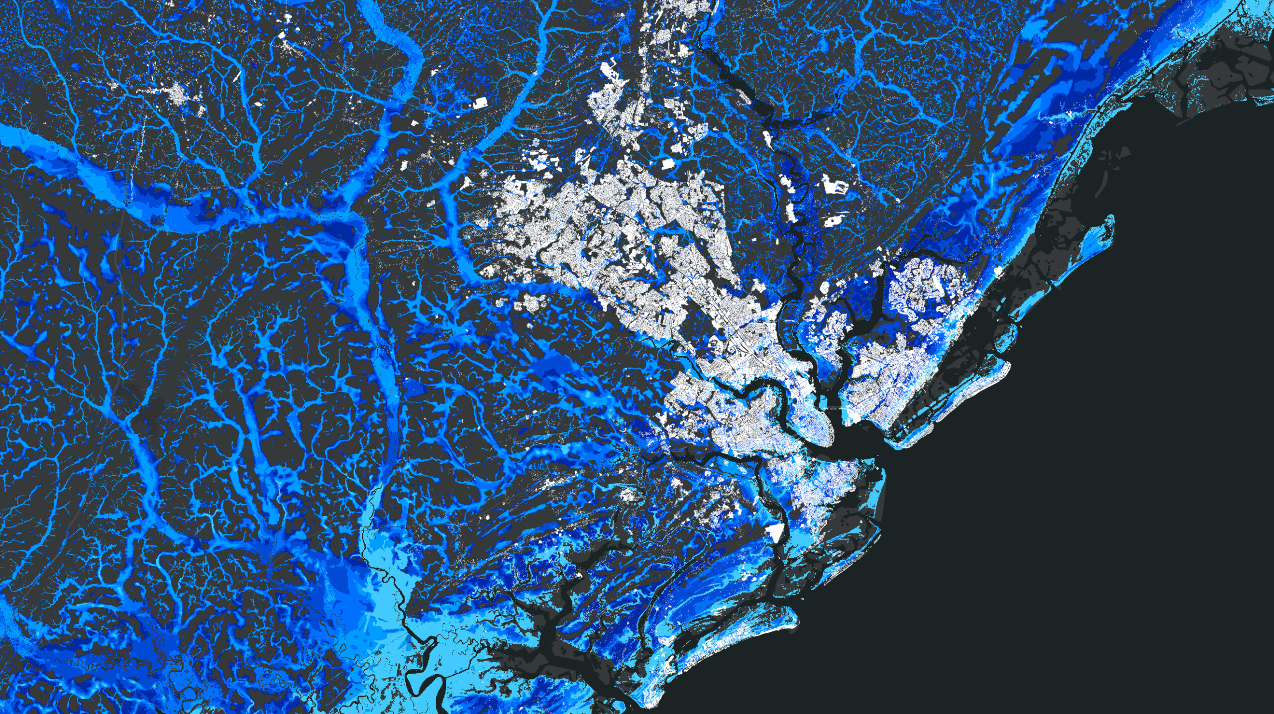
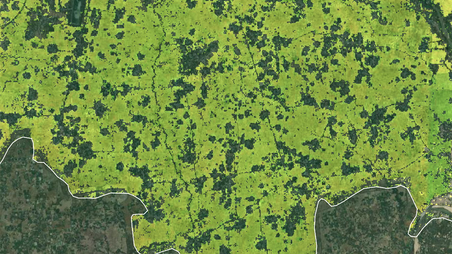
GIS 712: Environmental Earth Observation and Remote Sensing
Advanced understanding of physical principles of remote sensing, image processing and applications from earth observations. Awareness of tradeoffs between earth observing sensors, platforms and analysis techniques will help prepare the students to critically assess remote sensing products and devise solutions to environmental problems. Students will be able to communicate the complexities of image analysis and will be better prepared to integrate earth observations into their areas of expertise. Topics include electromagnetic energy and radiative transfer; US and international orbital and suborbital data acquisition platforms; passive and active imaging and scanning sensors; spatial, spectral, radiometric, and temporal resolutions; geometric corrections and radiometric calibrations; preprocessing of digital remotely sensed data; advanced image analysis including enhancement, enhancement, classification, geophysical variable retrieval, error and sensitivity analysis; data fusion; data assimilation; and integration of remotely sensed data with other data types in a geospatial modeling context.
GIS 713: Geospatial Data Mining and Analysis
Spatial data mining is the process of discovering interesting and previously unknown, but potentially useful, patterns from spatial and spatiotemporal data. However, explosive growth in the spatial and spatiotemporal data (~70% of all digital data), and the emergence of geosocial media and location sensing technologies has transformed the field in recent years. This course reviews the current state of the art in spatial, temporal and spatiotemporal data mining and looks at real-world applications ranging from geosocial networks to climate change impacts. Course introduces various spatial and temporal pattern families and teaches how to incorporate spatial relationships and constraints into data mining approaches like clustering, classification, anomalies and colocations.
GIS 714: Geospatial Computation and Simulation
Methods, algorithms and tools for geospatial modeling and predicting spatio-temporal dimensions of environmental systems. The course covers the physical, biological, and social processes that drive dynamics of landscape change. Deterministic, stochastic, and multi-agent simulations are explained, with emphasis on coupling empirical and process based models, techniques for model calibration and validation and sensitivity analysis. Applications to real-world problems are explored, such as modeling multi-scale flow and mass transport, spread of wildfire, biological invasions and urbanization.
GIS 715: Geovisualization
Principles of visualization design and scripting for geospatial visualization. This course provides a systematic framework of visualization design principles based on the human visual system and explores open-source geospatial data visualization tools. Topics include challenges and techniques for visualizing large multivariate dataset, spatio-temporal data and landscape changes over time. Students have the opportunity to work with broad range of visualization technologies, including frontiers in immersive visualization, tangible interaction with geospatial data and eye tracking.
GIS 790: Geospatial Artificial Intelligence
Several decades of research have led to current advances in AI (specifically machine-learning (ML) and deep learning (DL)) which is poised to solve major challenges to human society – from mitigating climate change to increasing food production, and designing smart cities to optimizing scarce resources – the problems that are inherently rooted in space and time. This course explores recent advances in artificial intelligence and deep learning as they apply to the analysis of large-scale geospatial and spatiotemporal data. Emphasis will be placed on both theory and practice. Students learn the conceptual underpinnings and principles behind AI techniques and how they can be adopted via modeling unique characteristics, relationships, and dependencies in spatial and spatiotemporal data. Students will learn to apply these techniques, and evaluate and compare these models on various benchmark datasets.
What professional development opportunities can I participate in?
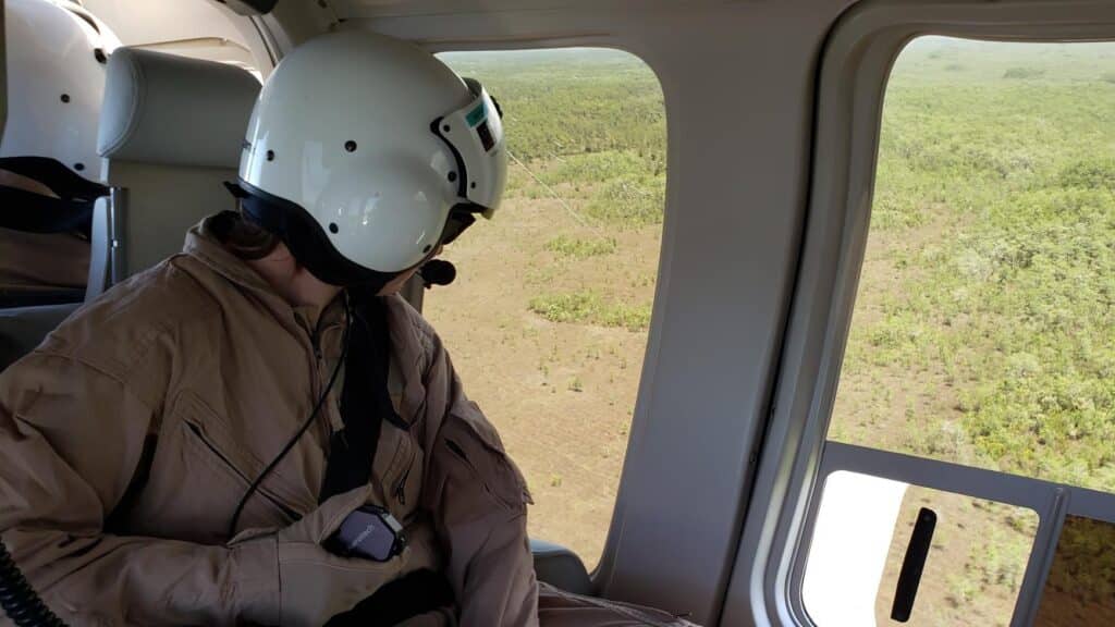
Students are encouraged to engage in an External Professional Experience (EPE) that immerses them in the geospatial field through opportunities with government agencies, industry leaders, private firms, academic research institutions, and other relevant organizations. Students have participated in internships, fellowships, external workshops, and other professional development activities, providing valuable real-world exposure and networking opportunities.
Internship Spotlight
The Center’s Geospatial Forum series provides students with the chance to engage with and learn from prominent leaders in the geospatial data sciences. Additionally, the Geospatial Graduate Student Organization hosts Lunch & Learns, study halls, and GIS Week events, fostering a collaborative and enriching environment for academic and professional growth.
The Geospatial Analytics Travel Award offers substantial funding each year to support students presenting their research at scientific conferences. Read our Student Travel series to learn more.
In addition, N.C. State’s Graduate School offers an extensive suite of professional development opportunities, including Accelerate to Industry, a Teaching Certificate, writing workshops and much more. Students with an interest in teaching are given the opportunity to become instructor of record for one of the Center’s undergraduate or Master’s courses.
Previous External Professional Experiences
- AGU Community Science Fellows
- Data4Justice Accelerator Program
- Earth Surface Processes Institute
- Environmental Protection Agency
- I-GUIDE Summer School
- The Nature Conservancy
- National Audobon Society
- NASA
- NOAA Great Lakes Environmental Research Laboratory
- Oak Ridge National Laboratory
- Pacific Northwest National Laboratory
- Planet Labs
- Rachel Carson Council Fellowship
- Rocky Mountain Biological Laboratory
- USDA
- US Olympic & Paralympic Committee
- Weyerhauser
- Yale Environmental Fellows
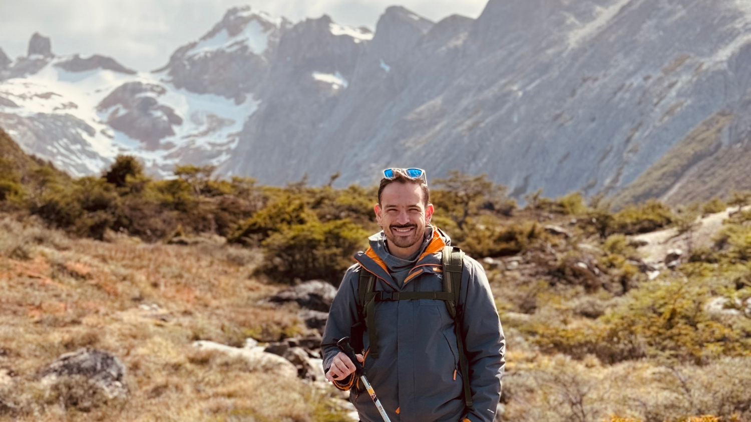
The program provided the skill development, classes and research at the intersection of my interests in data science/computational modeling and earth science. I learned a ton, which is a result of the mentorship I received, classes I took, grants I was encouraged to apply to, and research and publications I completed.
Elyssa Collins ’23
Frequently Asked Questions
Below are some of the most frequently asked questions we have received about the Ph.D. program in Geospatial Analytics.
Can the program be completed online or part-time?
No, the Ph.D. in Geospatial Analytics is a traditional full-time on-campus program.
I am currently in a master’s degree program and will complete my degree in the spring. Can I still apply now to start the Ph.D. program in the fall?
Yes. We accept unofficial transcripts with your application. Official transcripts will be requested if you are admitted to the program.
Do I need to have been a geography major to apply?
No, we welcome applications from students with strong computational skills from diverse backgrounds, including mathematics, data science, environmental science, biology, engineering, and more.
Do I need a master’s degree to apply?
No, we accept outstanding students without a master’s degree. Successful applicants, however, will have had significant previous academic research experience.
Do you offer application fee waivers?
Application fee waivers are offered only for domestic students who have participated in specific national research programs (i.e. McNair Scholars). International students are not eligible for application fee waivers.
Is financial assistance available? Do you accept students without funding?
We offer full funding to our admitted students, with a minimum $30,000 stipend, tuition waiver, and insurance, renewable for up to four years. Students are responsible for paying their own student fees (currently $1,252.25 per semester).
Do I need to secure an advisor before applying?
While we do not require students to secure an advisor prior to admission, we strongly encourage applicants to contact with the supervisors of assistantship positions that would be of interest to them. Please note that not all of our faculty are recruiting each year, so we suggest restricting your inquiries to those with open positions. We also offer admission to a limited number of students on internal program funding who are matched to an advisor and a research project during their first year.
Do I need to take the GRE?
No, the GRE is not required.
What are the English proficiency requirements for international students?
IBT TOEFL new score scale – total score of 4 (at least a 4 in each section, 5 in Speaking to be eligible for a TA appointment), IELTS score ≥ 6.5 on each section, Duolingo English ≥ 110 on each section. We will not consider applicants who do not meet these minimum scores. Please do not submit an application if you have not met this minimum. Scores are not required for citizens of these countries or who have completed at least one year of full time study at U.S. college or university