Helena Mitasova
Professor and CGA Distinguished Fellow
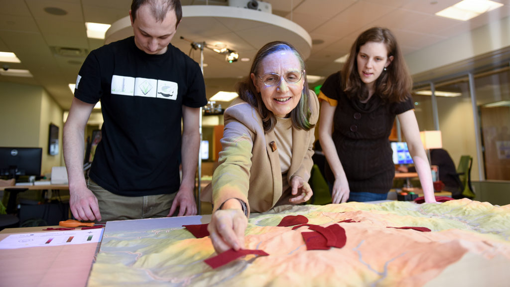
Exploring Models through Tangible Interaction, Modeling of Landscape Processes
Marine, Earth and Atmospheric Sciences
Jordan Hall 2127
919-513-1327 [email protected] WebsiteBio
Helena develops geospatial analytics to investigate coastal evolution, soil erosion control, natural hazards, and sustainable land management. Tangible geospatial modeling environments (Tangible Landscape), dynamic simulations of landscape processes, and analyses of LiDAR time series data are some of the research frontiers she is advancing. Her interests also include Unmanned Aerial Systems (UAS) remote sensing and open source software development. Helena is a member of the OSGeo Foundation and the Open Source GRASS GIS Project Steering Committee, and is co-author of the first book on Open Source GRASS GIS.
Publications
- A geospatial analysis comparing wastewater-monitored sewershed and statewide populations for 32 states participating in CDC’s National Wastewater Surveillance System, 2021-2024 , PLOS Global Public Health (2026)
- GRASS , Zenodo (CERN European Organization for Nuclear Research) (2026)
- Technologies and Applications of Geocomputational Tangible User Interfaces , ISPRS International Journal of Geo-Information (2026)
- Carbon estimation of old-growth bald cypress knees using mobile LiDAR , Frontiers in Forests and Global Change (2025)
- Splines and Radial Basis Functions Interpolation , Geographic Information Science & Technology Body of Knowledge (2025)
- Active Remote Sensing Assessment of Biomass Productivity and Canopy Structure of Short-Rotation Coppice American Sycamore (Platanus occidentalis L.) , Remote Sensing (2024)
- Estimating Rates of Change to Interpret Quantitative Wastewater Surveillance of Disease Trends , medRxiv (2024)
- Estimating rates of change to interpret quantitative wastewater surveillance of disease trends , The Science of The Total Environment (2024)
- An open-source platform for geospatial participatory modeling in the cloud , Environmental Modelling & Software (2023)
-
Integrating
GRASS GIS and Jupyter Notebooks to facilitate advanced geospatial modeling education , Transactions in GIS (2023)